Turn on suggestions
Auto-suggest helps you quickly narrow down your search results by suggesting possible matches as you type.
Cancel
- Home
- :
- All Communities
- :
- Developers
- :
- Python
- :
- Python Questions
- :
- Script for GO TO XY TOOL Python for ArcGIS 10
Options
- Subscribe to RSS Feed
- Mark Topic as New
- Mark Topic as Read
- Float this Topic for Current User
- Bookmark
- Subscribe
- Mute
- Printer Friendly Page
Script for GO TO XY TOOL Python for ArcGIS 10
Subscribe
4679
2
01-03-2011 05:02 AM
01-03-2011
05:02 AM
- Mark as New
- Bookmark
- Subscribe
- Mute
- Subscribe to RSS Feed
- Permalink
I'm looking to build or find a script that works like the GO to XY tool to use in a model. If anyone has any ideas or information that would be great.
Thanks
Thanks
2 Replies
01-04-2011
09:46 AM
- Mark as New
- Bookmark
- Subscribe
- Mute
- Subscribe to RSS Feed
- Permalink
I don't have a script, but I imagine you would just take the coordinate and then set the data frame extent corners based on a distance of your choice. Something like:
dfList[0].extent.lowerLeft.X = X1
dfList[0].extent.lowerLeft.Y = Y1
dfList[0].extent.upperRight.X = X2
dfList[0].extent.upperRight.Y = Y2
dfList[0].extent.lowerLeft.X = X1
dfList[0].extent.lowerLeft.Y = Y1
dfList[0].extent.upperRight.X = X2
dfList[0].extent.upperRight.Y = Y2
03-30-2013
12:02 PM
- Mark as New
- Bookmark
- Subscribe
- Mute
- Subscribe to RSS Feed
- Permalink
I don't have a script, but I imagine you would just take the coordinate and then set the data frame extent corners based on a distance of your choice. Something like:
dfList[0].extent.lowerLeft.X = X1
dfList[0].extent.lowerLeft.Y = Y1
dfList[0].extent.upperRight.X = X2
dfList[0].extent.upperRight.Y = Y2
I have the same problem.
I wanted to publish the �??go to xy�?� tool but sound it is not in the toolbox
It would be perfect if this tool is developed as geoprocessing tool (model or script tool) such that it can be published easily.
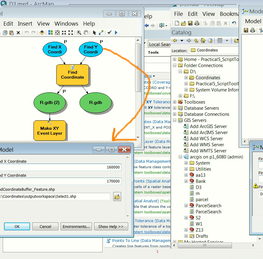
[ATTACH=CONFIG]23098[/ATTACH]
I got help with this issue but sound not to work with me.
http://forums.arcgis.com/threads/78352-Displaying-more-than-one-
Thank you
Best
Jamal
----------------------------------------
Jamal Numan
Geomolg Geoportal for Spatial Information
Ramallah, West Bank, Palestine
Jamal Numan
Geomolg Geoportal for Spatial Information
Ramallah, West Bank, Palestine