- Home
- :
- All Communities
- :
- Products
- :
- ArcGIS Enterprise
- :
- ArcGIS Enterprise Questions
- :
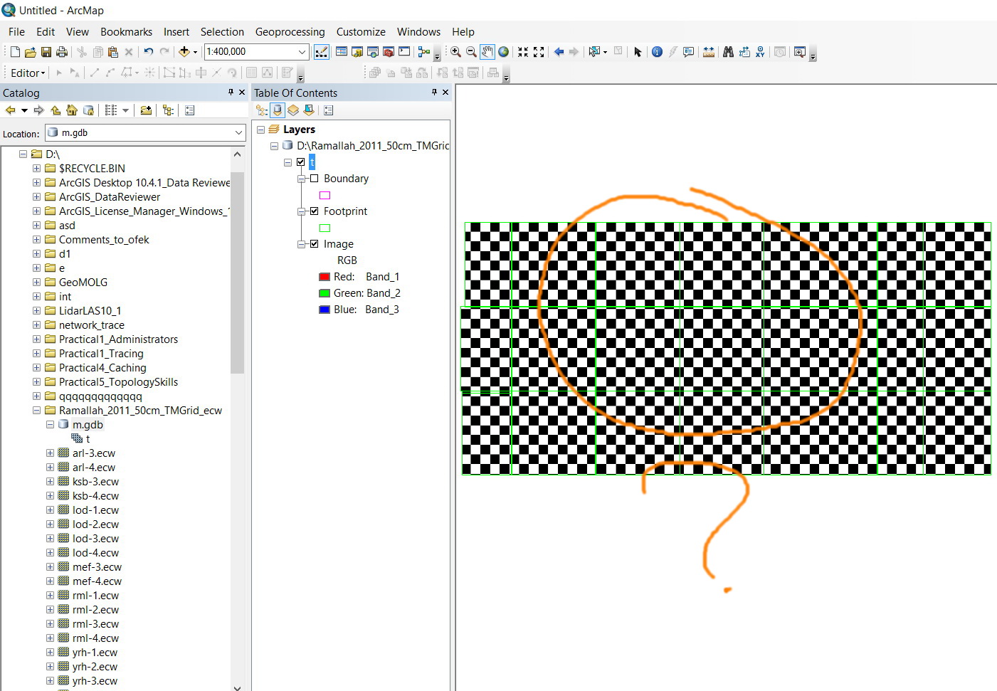
- “build overviews” for a mosaic generates black\whi...
- Subscribe to RSS Feed
- Mark Topic as New
- Mark Topic as Read
- Float this Topic for Current User
- Bookmark
- Subscribe
- Mute
- Printer Friendly Page
“build overviews” for a mosaic generates black\while tiles
- Mark as New
- Bookmark
- Subscribe
- Mute
- Subscribe to RSS Feed
- Permalink
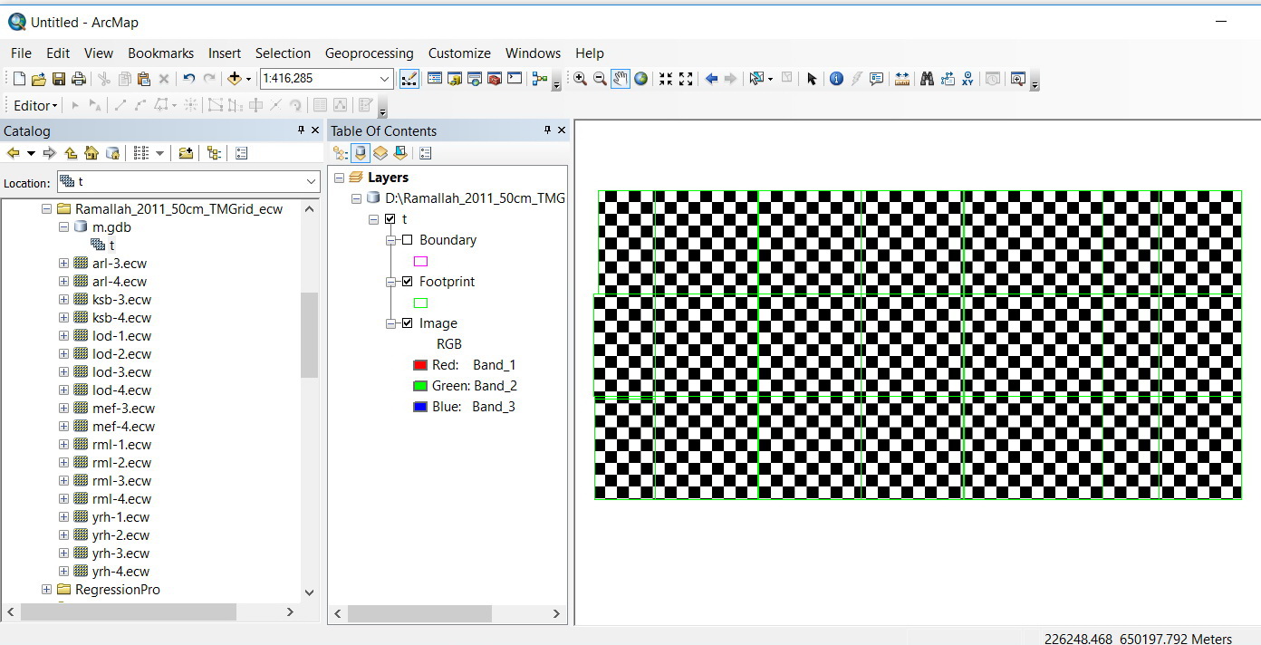
Applying “build overviews” for a mosaic generates black\while tiles,
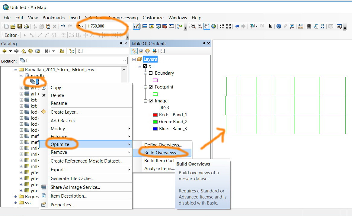
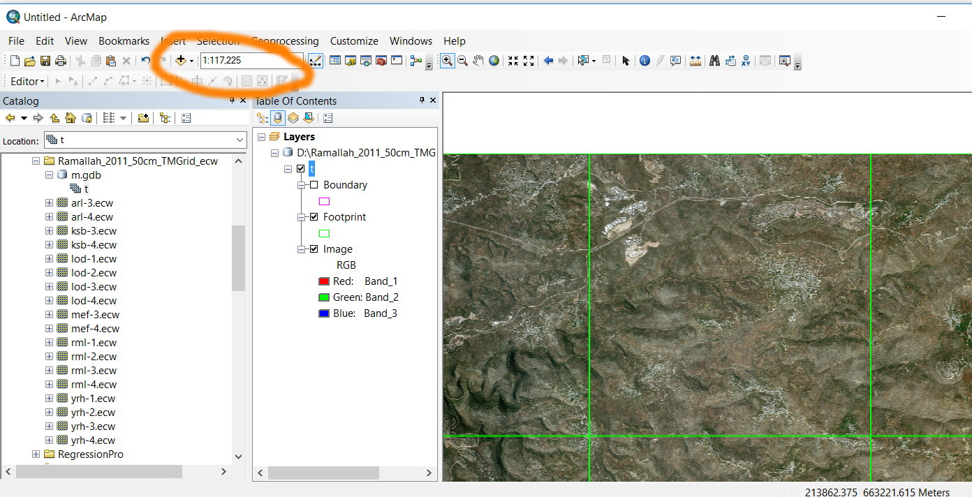
For example, in the screenshots below, in order to let the mosaic appear in all scales, the “build overviews” is applied. However, this generates black\while tiles.
How this might be resolved?
Thank you
Best
Jamal
Jamal Numan
Geomolg Geoportal for Spatial Information
Ramallah, West Bank, Palestine
Solved! Go to Solution.
Accepted Solutions
- Mark as New
- Bookmark
- Subscribe
- Mute
- Subscribe to RSS Feed
- Permalink
Hi
No you really dot need a server license, try to go to geoprocessing menu > Environments then go to Parallel processing set the parallel processing factor to 1. Then try to build the overviews again.
.png)
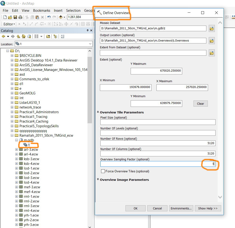
please be aware that you need to build the mosaic overviews when you change the overview sampling factor from 3 to 5, this is related for my previous answer and has nothing to do with the server license issue.
Thanks
- Mark as New
- Bookmark
- Subscribe
- Mute
- Subscribe to RSS Feed
- Permalink
Jamal,
check out the links in Mosaic dataset looks like a checkerboard which has a similar issue.
it also has a link to a blog Does your mosaic dataset look like a checkerboard? | ArcGIS Blog
- Mark as New
- Bookmark
- Subscribe
- Mute
- Subscribe to RSS Feed
- Permalink
Thank you Rebecca for the help.
I went through the links you have already provided but it appears that they don’t provide root solution for the issue. I got no tools that that can fix it.
Jamal Numan
Geomolg Geoportal for Spatial Information
Ramallah, West Bank, Palestine
- Mark as New
- Bookmark
- Subscribe
- Mute
- Subscribe to RSS Feed
- Permalink
did you go through the comments
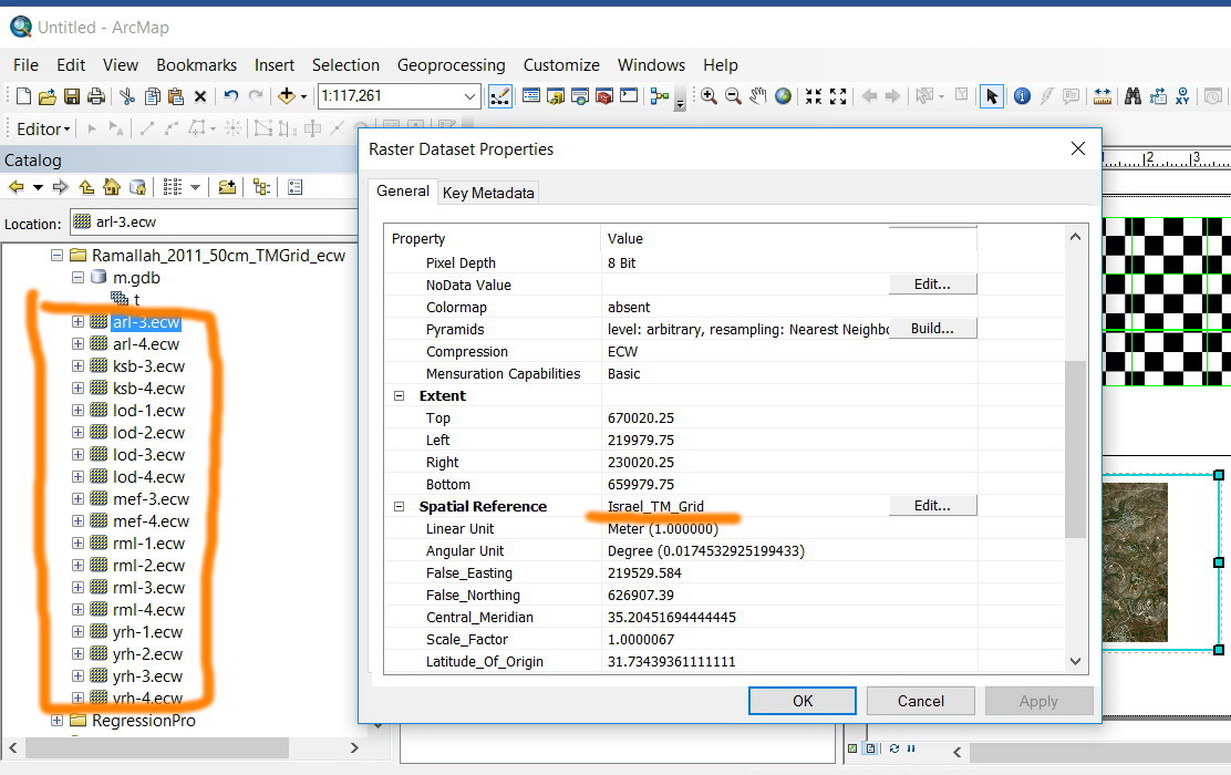
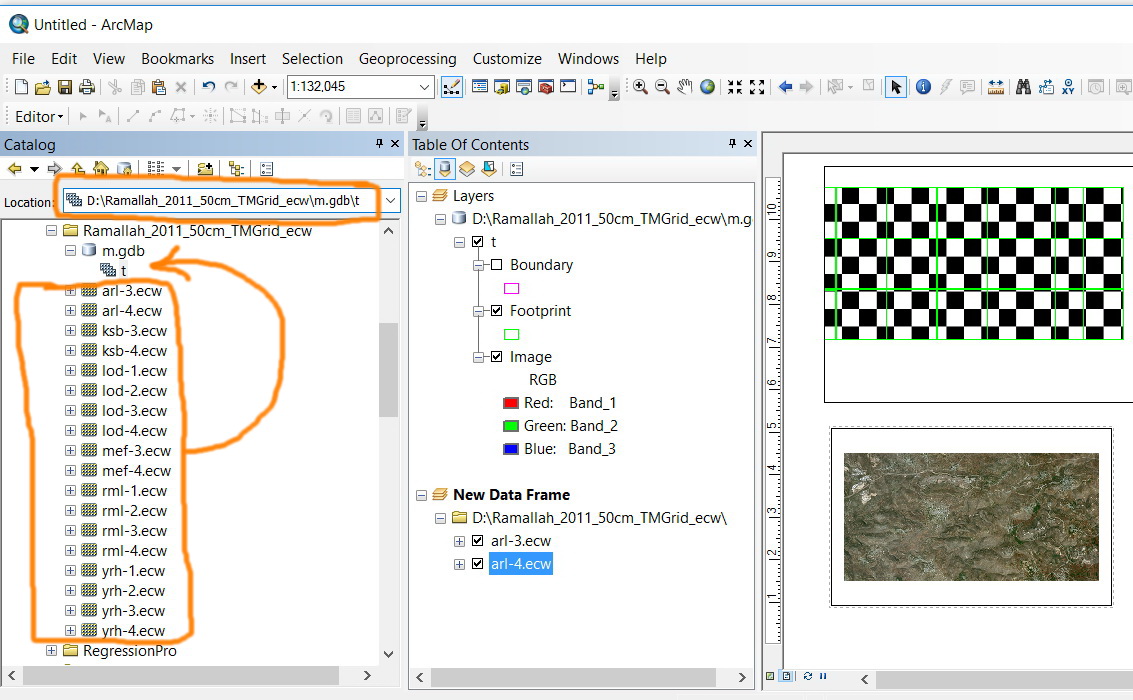
- make sure they have defined coordinate system
- they view individually fine
- make a new mosaic data set
- a consolidate link which suggests using UNC paths rather than absolute paths
- what have you ruled out?
- Mark as New
- Bookmark
- Subscribe
- Mute
- Subscribe to RSS Feed
- Permalink
Thanks Dan for the help
Thanks Dan for the help
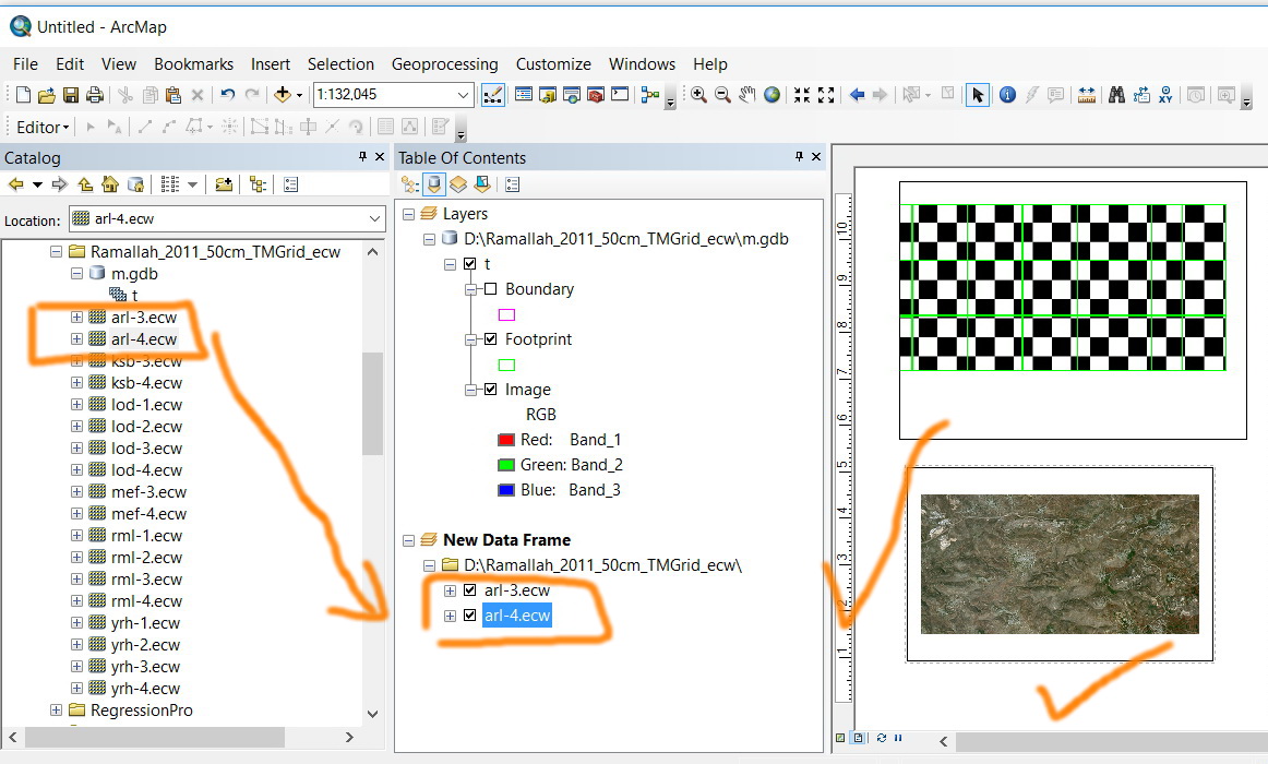
-make sure they have defined coordinate system (screenshot below)
-they view individually fine (screenshot below)
-make a new mosaic data set (the same issue is repeated in the new mosaic)
-a consolidate link which suggests using UNC paths rather than absolute paths (screenshot below)
-Room in mosaic data appear checkerboard pattern (no solutions are here)
Jamal Numan
Geomolg Geoportal for Spatial Information
Ramallah, West Bank, Palestine
- Mark as New
- Bookmark
- Subscribe
- Mute
- Subscribe to RSS Feed
- Permalink
well that leaves the data type... (ecw)... perhaps passing this on to tech support might be worthwhile
- Mark as New
- Bookmark
- Subscribe
- Mute
- Subscribe to RSS Feed
- Permalink
Yes,
my guess would be the problem is the ecw format. This has its own in-build pyramid structure.
Where are the overviews created? Is there anything funny in that path. Have a look in there to see if the tif / jpg overviews are actually there.
Pro-tip : use the Data management / Mosaic dataset / Define overviews tool to specify that the overviews are created inside the fgdb where the mosaic resides. If you don't do this, the overviews are created in a sub-dir next to the fgdb, which is a bit dumb imho.
- Mark as New
- Bookmark
- Subscribe
- Mute
- Subscribe to RSS Feed
- Permalink
Hi Jamal,
From the define overviews try to increase the overview sampling factor from 3 to 5

Thanks
- Mark as New
- Bookmark
- Subscribe
- Mute
- Subscribe to RSS Feed
- Permalink
Thanks Ahmad. Not working
Jamal Numan
Geomolg Geoportal for Spatial Information
Ramallah, West Bank, Palestine