- Home
- :
- All Communities
- :
- Developers
- :
- Python
- :
- Python Questions
- :
- matplotlib.pyplot.show() crashes ArcGIS
- Subscribe to RSS Feed
- Mark Topic as New
- Mark Topic as Read
- Float this Topic for Current User
- Bookmark
- Subscribe
- Mute
- Printer Friendly Page
- Mark as New
- Bookmark
- Subscribe
- Mute
- Subscribe to RSS Feed
- Permalink
Hello everyone!
I'm creating a customizing tools in arcgis. I want to show some diagrams in arcgis, which made by matplotlib.
Everything works fine, the diagram kann even be saved in the right way, except when I show the plot through plt.show(), ArcGIS hangs and I have to force it to close with Task Manager.
Changing plt.show() to plt.show(block=False) should make the plot non-blocking, but this crashes ArcMap either, with a Runtime Error.
I am working with Windows 7 and ArcGIS 10.1.
The codes are something like:
import ConversionUtils
import arcpy
from arcpy import env
import matplotlib.pyplot as plt
xLabelName = ConversionUtils.gp.GetParameterAsText(0)
yLabelName = ConversionUtils.gp.GetParameterAsText(1)
Titel = ConversionUtils.gp.GetParameterAsText(2)
fig = plt.figure()
plt.plot(range(10), range(10))
plt.xlabel(xLabelName, fontsize = 14)
plt.ylabel(yLabelName, fontsize = 14)
plt.title(str(Titel), fontsize = 16)
plt.grid()
plt.savefig('abc.png')
plt.show()
Because matplotlib uses TKinter by default, so the window pop up from plt.show() crashes ArcGIS.
The problem has been bothering me for days. I will greatly appreciate any ideas on how can I solve this Problem.
Thank you.
Solved! Go to Solution.
Accepted Solutions
- Mark as New
- Bookmark
- Subscribe
- Mute
- Subscribe to RSS Feed
- Permalink
As an alternative, why not just let the default image viewer open the plot?
import os
import matplotlib.pyplot as plt

def plotthegraph():

    xLabelName = "x label"
    yLabelName = "y_label"
    title = "Title"
    fig = plt.figure()
    plt.plot(range(10), range(10))
    plt.xlabel(xLabelName, fontsize = 14)
    plt.ylabel(yLabelName, fontsize = 14)
    plt.title(str(title), fontsize = 16)
    plt.grid()
    plt.savefig(r'H:\abc.png')
    plt.close()
    os.system(r'H:\abc.png') #this should allow the installed image viewer to open the png
- Mark as New
- Bookmark
- Subscribe
- Mute
- Subscribe to RSS Feed
- Permalink
It will probably remain so, since no one can replicate the problem with only partial code.
- Mark as New
- Bookmark
- Subscribe
- Mute
- Subscribe to RSS Feed
- Permalink
I have complemented the code.
- Mark as New
- Bookmark
- Subscribe
- Mute
- Subscribe to RSS Feed
- Permalink
So the trick is to track down the source of the error. I edited the code to simplify it.
import ConversionUtils
import arcpy
from arcpy import env
import matplotlib.pyplot as plt
xLabelName = "x label"
yLabelName = "y_label"
title = "Title"
fig = plt.figure()
plt.plot(range(10), range(10))
plt.xlabel(xLabelName, fontsize = 14)
plt.ylabel(yLabelName, fontsize = 14)
plt.title(str(title), fontsize = 16)
plt.grid()
plt.savefig("f:/test/abc.png")
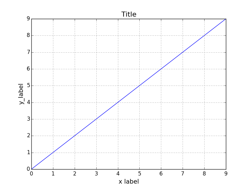
plt.show()Basically I got rid of all that conversion stuff and tried to get output as a graph (see image) and as a file (see file).
It works...ergo...your problem is with your inputs using that ConversionUtils stuff. At least your have a start point.

- Mark as New
- Bookmark
- Subscribe
- Mute
- Subscribe to RSS Feed
- Permalink
Yes, as you've tried, it works also fine only with python IDLE.
Because I use the code as the source of a customizing tool, so I need using that ConversionUtils). The problem is : the matplotlib utilizes Tkinter in it's backend. I've had problems running Tkinter windows from within ArcMap.
- Mark as New
- Bookmark
- Subscribe
- Mute
- Subscribe to RSS Feed
- Permalink
Yes, Tkinter will cause crashes, just google " tkinter arcmap crash " for some examples.
There are also posts for alternatives, for example python addins
python addin - Creating Tkinter dialog box in arcpy? - Geographic Information Systems Stack Exchange
But practically, you would be better off, using a conventional or python toolbox to get your input parameters rather than reinventing the wheel in a different dialog, if you intend to use this in arcmap
- Mark as New
- Bookmark
- Subscribe
- Mute
- Subscribe to RSS Feed
- Permalink
My input parameters are using a conventional GUI through ConversionUtils.gp.GetParameterAsText.
The Tkinter window is a output window, which pop up through plt.show().
After I run the tool/script, it shows an extra window with the plot diagram. Just like the output in IDLE.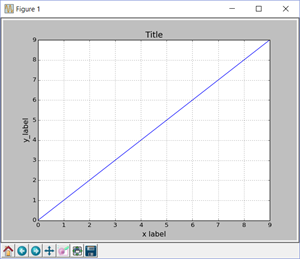
Then I want to use this output window. After I usethe Pan/Zoom button, then click the save button in this window, it crashes arcgis. The diagram cannot be saved with this button, but I want to...
- Mark as New
- Bookmark
- Subscribe
- Mute
- Subscribe to RSS Feed
- Permalink
Sorry...the window I showed works for me, don't know why yours doesn't. Using Windows 10, ArcMap 10.3.1, tested in python 3.4.x and 2.7.x
- Mark as New
- Bookmark
- Subscribe
- Mute
- Subscribe to RSS Feed
- Permalink
It doesn't work by me..I have to force it to close arcgis with Task Manager.
but thank you all the way.
- Mark as New
- Bookmark
- Subscribe
- Mute
- Subscribe to RSS Feed
- Permalink
you might want to try it without the ConversionUtils module and either develop your app so that arcmap doesn't need to be open