- Home
- :
- All Communities
- :
- Products
- :
- Mapping
- :
- Mapping Questions
- :
- Spatial points pattern
- Subscribe to RSS Feed
- Mark Topic as New
- Mark Topic as Read
- Float this Topic for Current User
- Bookmark
- Subscribe
- Mute
- Printer Friendly Page
Spatial points pattern
- Mark as New
- Bookmark
- Subscribe
- Mute
- Subscribe to RSS Feed
- Permalink
Hi all
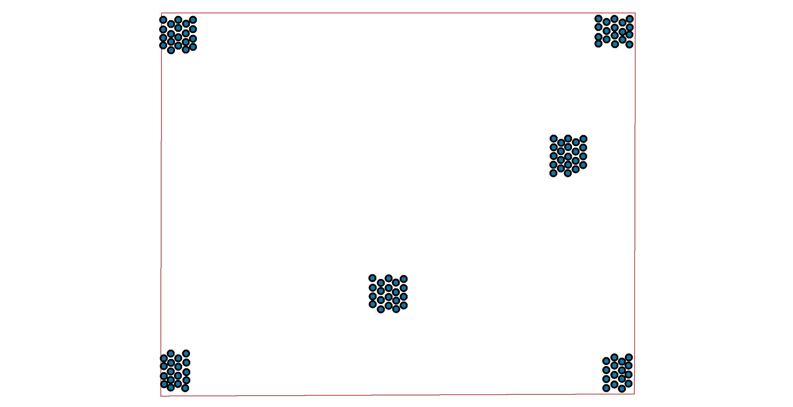
I have points data which represent infected palms in block plantation. I want to analyze whether the infected palms are random, dispersed, or dispersed distribution.
I thought the extension of spatial statistic in ArcInfo could help me to measure the distribution. But I doubt the result, when I creating dummy data (clearly clustered distribution) and I execute with Average Nearest Neighbor tools, the result is at dispersed distribution!
I attach my dummy data here.
If anyone could give me suggestion, it would be appreciated.
Thanks
-anggi
- Mark as New
- Bookmark
- Subscribe
- Mute
- Subscribe to RSS Feed
- Permalink
from the average nearest neighbour how it works section,
you observed average nearest neighbours is going to be small relative to the expected
ANN = Do/De < 1 clustering, > 1 dispersed
De depends upon area... what is your area? you have a bounding rectangle but was it used as the extent for the analysis?
- Mark as New
- Bookmark
- Subscribe
- Mute
- Subscribe to RSS Feed
- Permalink
Hi Don
Thanks for your suggestion. I have tried to execute once and in environment work, I put my extent area. It works. The result is at clustered distribution.
I thought why my first trial failed was because i didn't put my extent, I only fill the area (optional) with my hectare area.
-anggi