- Home
- :
- All Communities
- :
- Products
- :
- ArcGIS Online
- :
- ArcGIS Online Questions
- :
- Allow unlimeted zoom on ArcGIS online map with a c...
- Subscribe to RSS Feed
- Mark Topic as New
- Mark Topic as Read
- Float this Topic for Current User
- Bookmark
- Subscribe
- Mute
- Printer Friendly Page
Allow unlimeted zoom on ArcGIS online map with a cached layer
- Mark as New
- Bookmark
- Subscribe
- Mute
- Subscribe to RSS Feed
- Permalink
- Report Inappropriate Content
I would like to create a map on ArcGIS online account where one of the layer is cached (aerial image). However, I have experienced that when I add a cached service to the map, a user can only zoom in to the last level created in cached layer.
However, I would like for a user to zoom in without setting any limits. Is this possible?
- Mark as New
- Bookmark
- Subscribe
- Mute
- Subscribe to RSS Feed
- Permalink
- Report Inappropriate Content
Hi Martin,
You are limited to the cached scales when zooming for a tiled service. You would either need to cache larger scales, or add the service as a dynamic map/image service.
- Mark as New
- Bookmark
- Subscribe
- Mute
- Subscribe to RSS Feed
- Permalink
- Report Inappropriate Content
Is there no workaround for this? Or are there any plans to change this.
It would be great I do not have to create cache for very large scales, and when user zooms closer in than the cache level, the image would disappear, or would just zoom digitally,even though there would not be more detail shown on the map.
- Mark as New
- Bookmark
- Subscribe
- Mute
- Subscribe to RSS Feed
- Permalink
- Report Inappropriate Content
When you create your cache, you can add larger scales, and then choose the option to build the cache manually. When you build the cache, do not check to build the larger scales. The user can still zoom to this scale level, but the image will disappear. There is also the option to create tiles on demand, but I was having difficulty getting the tiles to generate using an ArcGIS.com web map.
- Mark as New
- Bookmark
- Subscribe
- Mute
- Subscribe to RSS Feed
- Permalink
- Report Inappropriate Content
Martin,
There is a workaround you could try.
The amount you can zoom into a map is controlled by the scale levels in the service you use for your basemap.
Use a Dynamic (non-cached) map service as your basemap. it doesn't have any scales, so the zoom will be unlimited.
This shows using a service.. I used one from http://sampleserver1.arcgisonline.com/ArcGIS/rest/services/Demographics/ESRI_Census_USA/MapServer/
Use one that has the least amount of data as possible.
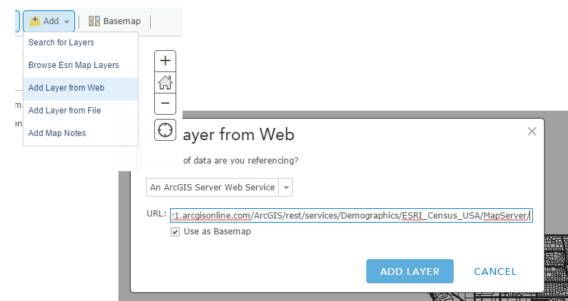
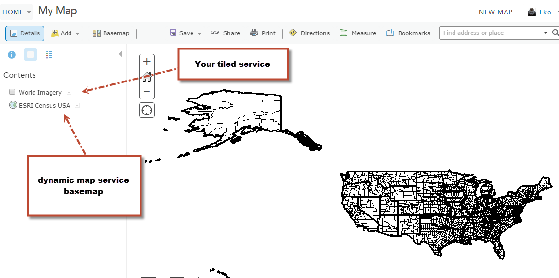
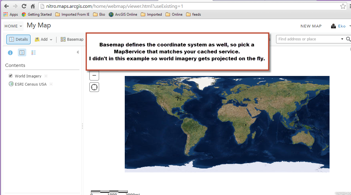
Then add your cached service to the map.. I just used world imagery. Make sure the Coordinate systems are the same so that your cached service isn't re-projecting to match the basemap, which is a display performance drag.
then zoom in...
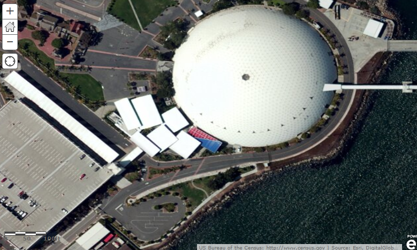
When you go past the last level you will see the underlining map service.
Mark