- Home
- :
- All Communities
- :
- User Groups
- :
- Web AppBuilder Custom Widgets
- :
- Questions
- :
- Assistance Building First Widget : Buffer Points?
- Subscribe to RSS Feed
- Mark Topic as New
- Mark Topic as Read
- Float this Topic for Current User
- Bookmark
- Subscribe
- Mute
- Printer Friendly Page
Assistance Building First Widget : Buffer Points?
- Mark as New
- Bookmark
- Subscribe
- Mute
- Subscribe to RSS Feed
- Permalink
Would anyone be willing to help me walk through the steps necessary to develop my first widget?
I believe it would be a simple one. I want to take the following JSAPI functionality and make it into a widget.
Buffer a point | ArcGIS API for JavaScript 3.18
I'm envisioning a CREATE BUFFER POINTS button. You click it, then click on the map, then I want the user to be able to print the map with the buffers created.
That is all I want... I'm an experienced JS developer, just out of practice and unfamiliar with Dojo. I really just need to know where and what calls and callbacks and function naming conventions to use as well as packaging guidance.
Thanks in advance
Solved! Go to Solution.
- Mark as New
- Bookmark
- Subscribe
- Mute
- Subscribe to RSS Feed
- Permalink
The NLS file was possibly a problem... There was a comma after the only entry in the list...
But the thing that fixed it was adjusting the manifest.json. All of those parameters were switched off to false and voila!
Thank you again sir...
- Mark as New
- Bookmark
- Subscribe
- Mute
- Subscribe to RSS Feed
- Permalink
Robert,
I downloaded the cotBuffer.zip and added it to my web appbuilder and it works. My problem is the buffer distances don't match the map distances. I put the buffer distance as 10 miles and it draws a circle with 8 mile radius. What do i need to change to get the distances all the same?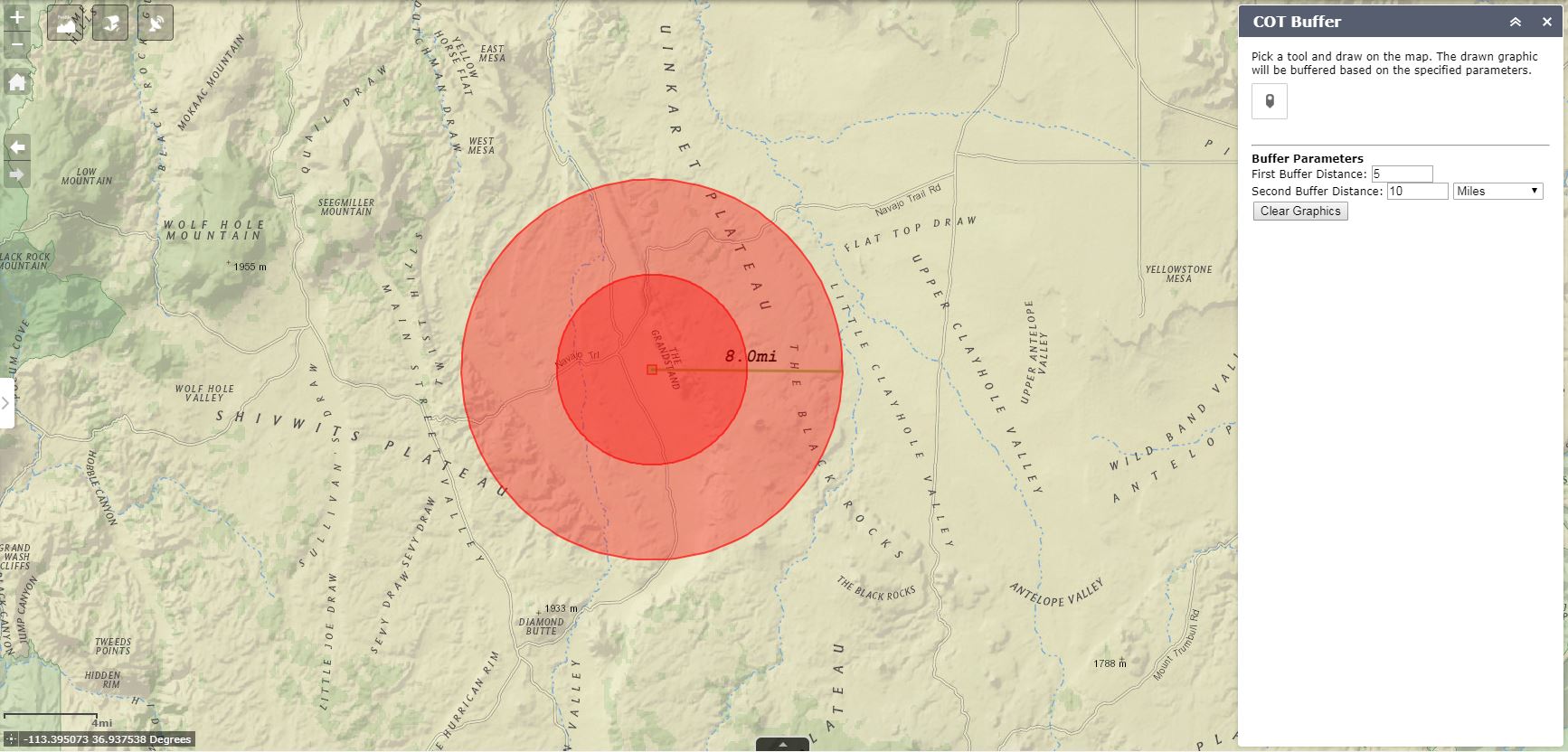
- Mark as New
- Bookmark
- Subscribe
- Mute
- Subscribe to RSS Feed
- Permalink
Chad,
It looks like you are using a standard esri basemap and thus need to use a geodesic buffer.
params.geodesic = true;
- Mark as New
- Bookmark
- Subscribe
- Mute
- Subscribe to RSS Feed
- Permalink
Yep. After trying different things for hours playing with WKIDs and spatial references, I came to that answer right after I posted the question. Thanks Robert!
- « Previous
-
- 1
- 2
- Next »
- « Previous
-
- 1
- 2
- Next »