- Home
- :
- All Communities
- :
- Industries
- :
- Water Utilities
- :
- Water Utilities Questions
- :
- Domain decode inconsistency
- Subscribe to RSS Feed
- Mark Topic as New
- Mark Topic as Read
- Float this Topic for Current User
- Bookmark
- Subscribe
- Mute
- Printer Friendly Page
Domain decode inconsistency
- Mark as New
- Bookmark
- Subscribe
- Mute
- Subscribe to RSS Feed
- Permalink
I’m Using ArcGIS Pro 2.2 to Publish a web layer to both a map service and a feature service to an onsite Portal (10.6.1). The data source is Postgres 10.3. The popup is configured in ArcGIS Pro and some of the values are decoded and others are not (highlighted are not decoded):
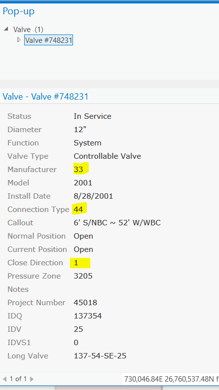
When I access the popup in the map service layer in the Portal default map viewer the decodes are correct:

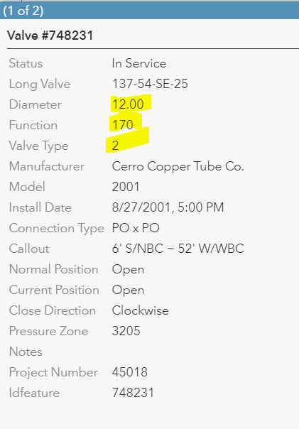
Then when I access the popup in the feature service layer in the Portal default map viewer those decodes are correct but other ones are no longer decoded:
I’m concerned about the inconsistency if there is a problem with the way the domains are defined I would expect that we would see the same issues. Any suggestions on how to fix this or is this a bug?
Solved! Go to Solution.
- Mark as New
- Bookmark
- Subscribe
- Mute
- Subscribe to RSS Feed
- Permalink
Michael,
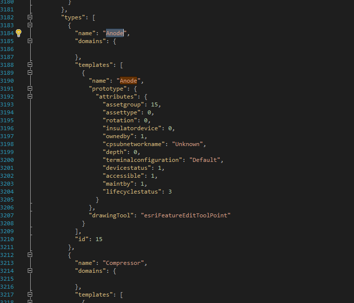
I just revisited this and @ 10.6.1 with ArcGIS Pro 2.2.1 I lose domains and subtype descriptions in my map document definition in a shared web map even if I symbolize using only the subtype field. If I look at the map definition I can see that the domains element is blank (even though the field has domains) and even though the type has an id its still unrecognized as a subtype by the map (I wouldn't the order would matter, but the id is typically at the beginning of the json element but for a pro web map its located at the end).
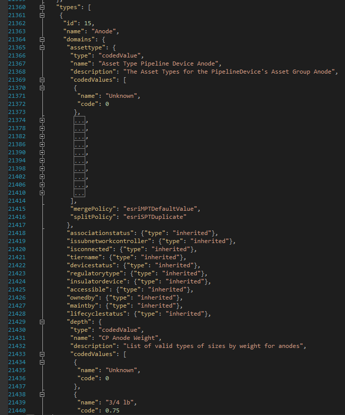
"types": [ { "name": "Anode", "domains": { }, "templates": [ { "name": "Anode", "prototype": { "attributes": { "assetgroup": 15, "assettype": 0, "rotation": 0, "insulatordevice": 0, "ownedby": 1, "cpsubnetworkname": "Unknown", "depth": 0, "terminalconfiguration": "Default", "devicestatus": 1, "accessible": 1, "maintby": 1, "lifecyclestatus": 3 } }, "drawingTool": "esriFeatureEditToolPoint" } ], "id": 15 },
- Mark as New
- Bookmark
- Subscribe
- Mute
- Subscribe to RSS Feed
- Permalink
I am not sure, can you zip up the entire rest def so I can look at it?
- Mark as New
- Bookmark
- Subscribe
- Mute
- Subscribe to RSS Feed
- Permalink
The service def looks correct. You can see the definition in the types. The layer definition in the webmap from ArcGIS Pro looks wrong. Looks like a legit bug. I would suggest logging it.
Service Def
Layer Def in webmap from pro
- « Previous
-
- 1
- 2
- Next »
- « Previous
-
- 1
- 2
- Next »