- Home
- :
- All Communities
- :
- Industries
- :
- Water Resources
- :
- Water Resources Questions
- :
- Problem with DEM mosaic in watershed delineation p...
- Subscribe to RSS Feed
- Mark Topic as New
- Mark Topic as Read
- Float this Topic for Current User
- Bookmark
- Subscribe
- Mute
- Printer Friendly Page
Problem with DEM mosaic in watershed delineation project
- Mark as New
- Bookmark
- Subscribe
- Mute
- Subscribe to RSS Feed
- Permalink
I am trying to delineate nearly 700 watersheds from Stormwater outflow points on relatively small order streams. I have found that 1-meter and 30-meter DEMs are either too fine or too coarse of a scale for this work. I was given multiple 10-meter .tif files to use for the DEM.
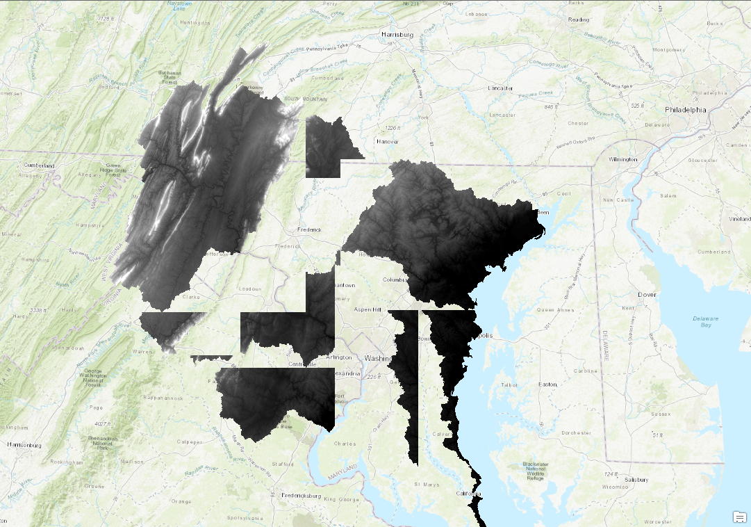
-I've used the 'Mosaic to New Raster' tool which has an overlapping effect on the raster imagery that makes it unusable (image 1). My best guess is that the mosaic tool is taking the "black" areas, which should have a null value, and giving them a very low numeric value. When the mosaic tool is used, it addresses the top most layer and uses it's value over the layers below it.
- To get around this, I tried the 'Raster Catelog To Raster Dataset' tool to see if it would behave differently and it appears to do about the same as above.
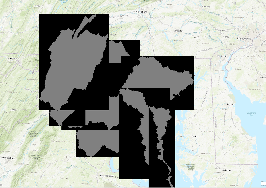
-Images 1 and 2 show the overlapping effects and the "black areas" that have extremely low values
I'm not quite sure how to overcome this issue. Is there a tool like 'Mosaic to New Raster' that will ignore those low values? Or is there a way to edit those values in each Raster layer?
- Mark as New
- Bookmark
- Subscribe
- Mute
- Subscribe to RSS Feed
- Permalink
I would use the raster calculator's Con and IsNull statements, as shown here: https://support.esri.com/en/technical-article/000010059. If that doesn't work, I would experiment with different environment settings that would impact the raster processing.
- Mark as New
- Bookmark
- Subscribe
- Mute
- Subscribe to RSS Feed
- Permalink
What Jacom Helfan said is a good approach.
One issue is the different extents of each of the rasters. The suggestion of mine below might be the long way around, but should work.
- You should make all the rasters for each watershed with the same cell size and grid basis (starting x, y).
- For each raster, run Con and IsNull to make all the Null cells 0.
- Create a raster from that one polygon based on the grid size and grid basis of the other rasters and making the value zero.
- Do raster math and add them all up with the new big raster with zero value as the starting point. This will make sure the extent is right.
- A key is getting any Null values to 0 because I think in raster math if one of the values is null, the answer will be null. If there is any overlap of the rasters you could get large numbers.
- There should be an option to use the value of the last raster as the final answer, but that might be mosic (and the problem you are having.
Again, I have not tested this and it is "the long way around" but it seems that it would work.
HTH,
Mark