- Home
- :
- All Communities
- :
- Industries
- :
- Water Resources
- :
- Water Resources Questions
- :
- Level DEM: Spatial reference does not have z unit
- Subscribe to RSS Feed
- Mark Topic as New
- Mark Topic as Read
- Float this Topic for Current User
- Bookmark
- Subscribe
- Mute
- Printer Friendly Page
Level DEM: Spatial reference does not have z unit
- Mark as New
- Bookmark
- Subscribe
- Mute
- Subscribe to RSS Feed
- Permalink
Thank you very much in advance.
- Mark as New
- Bookmark
- Subscribe
- Mute
- Subscribe to RSS Feed
- Permalink
- Open the prj file associated to the grid (prj.adf) in a text editor.
- Set the parameters Units to the desired value (e.g. FEET, METERS) for the ground unit if not set.
- Set the parameters Zunits to the desired value for the z-unit. This parameter is set to NO if the z-unit is not explicitly defined: in that case the z-unit is assumed to be the same as the ground unit.
The zunits parameter may be set using a unit name (e.g. METERS, FEET) or a number in the projection file: this number represents the number of zunits that are needed to equal one meter (not one ground unit). For example, for a ground unit in meters, a z-unit in centimeter is defined as:
Units METERS
Zunits 100
as there are 100 cm in 1m.
For a ground unit in feet, a z-unit in centimeter is defined as:
Units FEET
Zunits 100
as there are 100 cm in 1m.
Christine Dartiguenave
Esri Water Resources Team
- Mark as New
- Bookmark
- Subscribe
- Mute
- Subscribe to RSS Feed
- Permalink
The WTK describes these parameters. Looks they are not exposed in arcpy.SpatialReference, at least as of 10.2.2.
I was trying to get at them with setZFalseOriginAndUnits (false_z, z_units) using values [0, 100] but that doesn't seem to change the WTK text when exported.
PROJCS['NAD_1983_Albers',
GEOGCS['GCS_North_American_1983',
DATUM['D_North_American_1983',SPHEROID['GRS_1980',6378137.0,298.257222101]],
PRIMEM['Greenwich',0.0],
UNIT['Degree',0.0174532925199433]],
PROJECTION['Albers'],
PARAMETER['False_Easting',0.0],
PARAMETER['False_Northing',0.0],
PARAMETER['central_meridian',-96.0],
PARAMETER['Standard_Parallel_1',29.5],
PARAMETER['Standard_Parallel_2',45.5],
PARAMETER['latitude_of_origin',23.0],
UNIT['Meter',1.0]],
VERTCS['Unknown VCS',VDATUM['Unknown'],
PARAMETER['Vertical_Shift',0.0],
PARAMETER['Direction',1.0],
UNIT['User_Defined_Unit',0.01]];
-16901100 -6972200 266467840.990852;-100000 100;-100000 10000;0.001;0.1;0.001;IsHighPrecision
- Mark as New
- Bookmark
- Subscribe
- Mute
- Subscribe to RSS Feed
- Permalink
The spatial reference is now read from the auxiliary file (*.aux.xml) associated to the raster. This file contains information on the raster that cannot be stored in the raster itself (e.g. spatial reference in the SRS section).
The old projection file is overwritten based on the content of the auxiliary file – this is why ArcMap will not recognize the changes to the projection file.
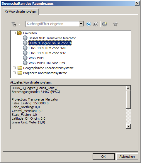
You can modify the spatial reference properties and set the z unit in the Z Coordinate System tab in the Spatial Reference Properties window.
You can select an existing Z Coordinate System or create a custom one by right-clicking and existing one and selecting Copy and Modify.
Christine Dartiguenave
Esri Water Resources Team
- Mark as New
- Bookmark
- Subscribe
- Mute
- Subscribe to RSS Feed
- Permalink
Christine,
I am having the same trouble: any modifications in the adf.prj-file are not recognized by ArcHydro. My raster coordinate system is a national reference system without a Z coordinate system. Consequently the Spatial Reference Properties window does only show a XY Coordinate System tab - there are no existing Z-coordinate systems to modify according to your post. How do I add a new one?
Thank you very much in advance!
Axel
- Mark as New
- Bookmark
- Subscribe
- Mute
- Subscribe to RSS Feed
- Permalink
Christine, is there a way to do this from Python? This is why I was dismayed it apparently isn't supported in the SpatialReference object even though it seemed like it should be.
- Mark as New
- Bookmark
- Subscribe
- Mute
- Subscribe to RSS Feed
- Permalink
Any way to modify the Z-coordinate system values would be ok for me: manually, Python, ArcObjects - we only need the information how to do it...
Cheers,
Axel
- Mark as New
- Bookmark
- Subscribe
- Mute
- Subscribe to RSS Feed
- Permalink
I got a question about this today and looked into it again. The Define Projection tool does the trick. That tool exposes the Z coordinate tab so you can set the values. When I set the Z values to NAVD88 and units to centimeters, it runs successfully and it seems to "take" - at least when i describe it I can see it has been set.
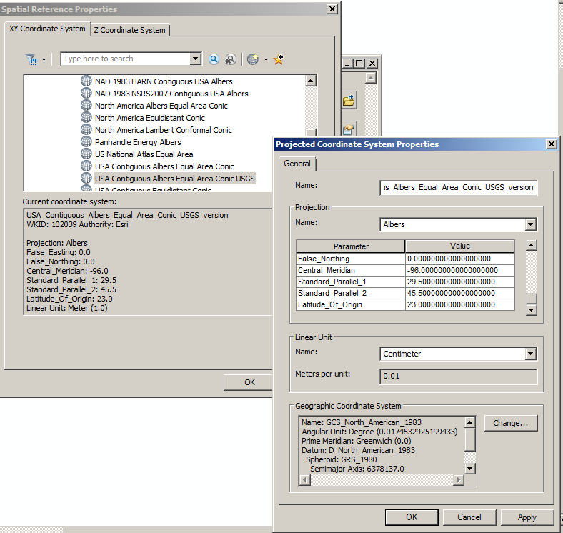
Check of results in Python window:
>>> arcpy.Describe("elev_cm.tif").spatialReference.exportToString()
u"PROJCS['USA_Contiguous_Albers_Equal_Area_Conic_USGS_version',GEOGCS['GCS_North_American_1983',DATUM['D_North_American_1983',SPHEROID['GRS_1980',6378137.0,298.257222101]],PRIMEM['Greenwich',0.0],UNIT['Degree',0.0174532925199433]],PROJECTION['Albers'],PARAMETER['false_easting',0.0],PARAMETER['false_northing',0.0],PARAMETER['central_meridian',-96.0],PARAMETER['standard_parallel_1',29.5],PARAMETER['standard_parallel_2',45.5],PARAMETER['latitude_of_origin',23.0],UNIT['Meter',1.0]],VERTCS['NAVD_1988',VDATUM['North_American_Vertical_Datum_1988'],PARAMETER['Vertical_Shift',0.0],PARAMETER['Direction',1.0],UNIT['Centimeter',0.01]];-16901100 -6972200 266467840.990852;-100000 100;-100000 10000;0.001;0.1;0.001;IsHighPrecision"
- Mark as New
- Bookmark
- Subscribe
- Mute
- Subscribe to RSS Feed
- Permalink
I have an update on this, 10.5 has improved Z support on the SpatialReference object, which now has a vcs property.
Still don't see an easy way to change the Z units, but you can define canned xy and z systems with codes:
SR = arcpy.SpatialReference(102039, 5703)