Nashville Tornado Resources

802
3
03-04-2020 05:10 AM
TariMartin1
Occasional Contributor III
1 3 802

Crowdsourced Photo App - Nashville Tornado (03/20/20)

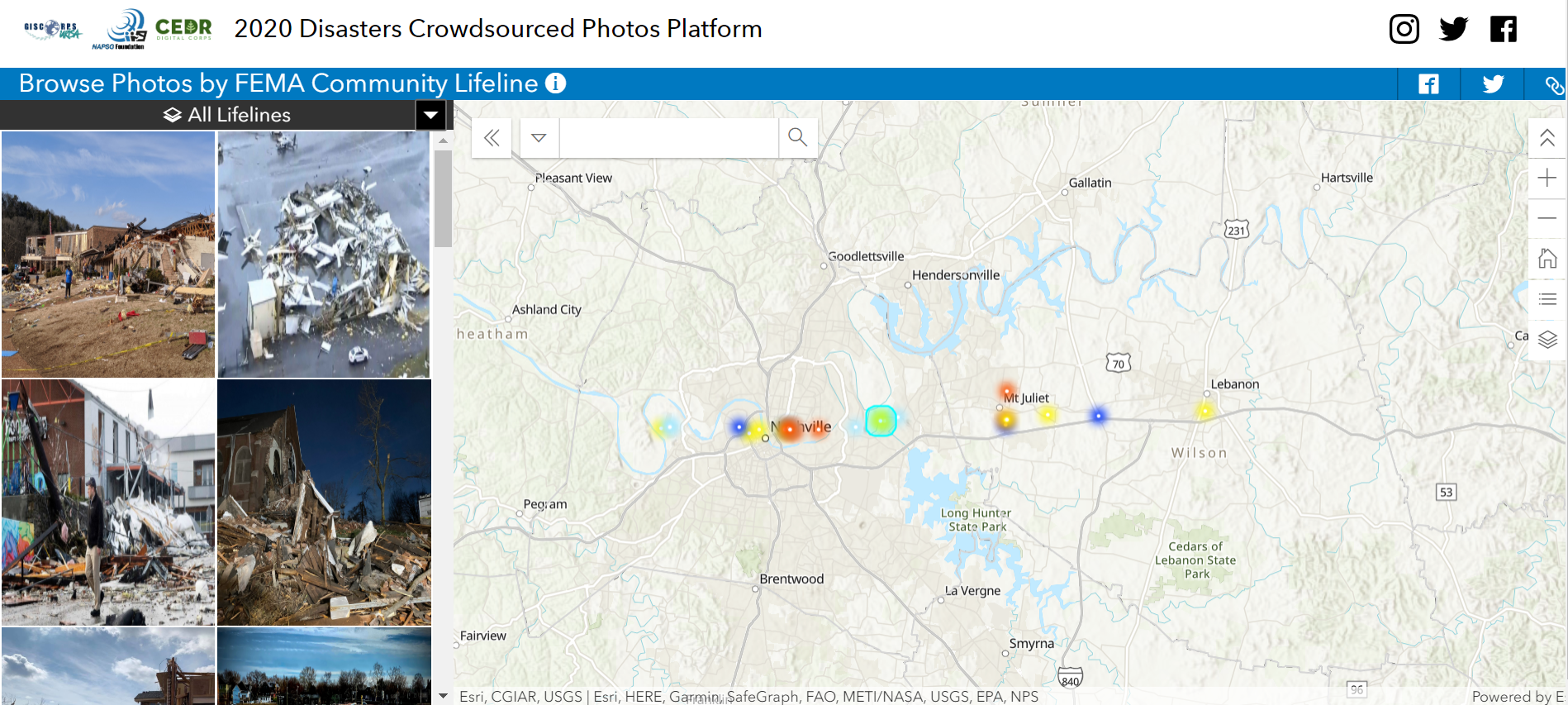
To view full resources for the Crowdsourced Photo App and/or contribute, visit 

https://2020-crowdsourced-disaster-photos-napsg.hub.arcgis.com/

Unofficial track based on social media posts - https://www.arcgis.com/home/item.html?id=cd2cd33ee7124066aeb81770466e1a72

Nashville Tornado 3/3/2020 SW (Direct Relief) - https://arcg.is/1aqqKv 

Nashville‌ tornado‌

3 Comments
TariMartin1
Occasional Contributor III

Civil Air Patrol 3D imagery for Nashville – Imagery Viewer https://cloud.skylineglobe.com/SG/terraexplorerweb/terraexplorer.html?catalogid=TEMA_WEB&site=tema3D imagery viewer application


Tennessee Tornado Building Exposure - Application is used for visualization and analysis of buildings (ORNL building footprints) potentially impacted by Tennessee Tornados 3/2/2020. (FEMA) https://arcg.is/m0XCK

FEMA  Web Mapping Application of Potential Building Damage

Nashville‌ Tornado‌ CAP FEMA #american red cross

TariMartin1
Occasional Contributor III

More Imagery related to the Nashville Tornadoes available.

NOAA Nashville Tornado Imagery 7 March 2020 - This imagery was acquired by the NOAA Remote Sensing Division to support NOAA homeland security and emergency response requirements. In addition, it will be used for ongoing research efforts for testing and developing standards for airborne digital imagery. Individual images have been combined into a larger mosaic and tiled for distribution. The approximate ground sample distance (GSD) for each pixel is ~25 cm / zoom level 19. Source: https://storms.ngs.noaa.gov/storms/nashville/index.html  

NOAA Imagery for the Nashville Tornado Response

NOAA Imagery has also been uploaded to the USGS Hazards Data Distribution System (HDDS) Explorer for download. https://hddsexplorer.usgs.gov/criteria?event=202003_Tornado_US&ordered=202003_Tornado_US_NOAA_AERIAL...

USGS Imagery Viewer link to NOAA Imagery for view and download

Interactive Map: 2020 Nashville Tornado Outbreak damage https://www.wkrn.com/news/nashville-tornado/interactive-map-2020-nashville-tornado-outbreak-damage/

Interactive map with photos showing damage produced by WKRN.com

TariMartin1
Occasional Contributor III

GIC imagery for Tennessee tornadoes

GIC flew on March 3rd and 4th for parts of Davidson county, March 4th for parts of Putnam Co, and Wilson on March 5th . These images are available via ArcGIS REST service for governmental agencies and public safety stakeholders. For more information, please see https://geointel.org/free-disaster-imagery or email graysky@geointel.org.

Geospatial Intelligence Center (GIC) post-disaster imagery

The GIC is a not-for-profit initiative as a partnership between Vexcel, National Insurance Crime Bureau, and the insurance industry. GIC collects high-resolution aerial photographs after disasters to provide to our member insurers as well as public safety stakeholders.Website of post-disaster geospatial imagery available for free to first responders and government agencies.

Data Use Guidelines: Imagery collected is for access and use by GIC Members, credentialed public safety stakeholders, and government agencies. For those members and stakeholders, this imagery may be used with any online mapping website and/or enterprise GIS provided secured to that member or stakeholder organization. Members or stakeholders may use this imagery with printed and/or digital maps shared with customers and/or the public. Please credit the source of the imagery to "GIC/Vexcel". This imagery is not to be available to the public via unsecured online mapping websites.

Nashville tornado imagery #disaster