- Home
- :
- All Communities
- :
- Industries
- :
- Telecommunications
- :
- Telecommunications Blog
- :
- ArcGIS Field Apps - GeoConX 2017
ArcGIS Field Apps - GeoConX 2017
- Subscribe to RSS Feed
- Mark as New
- Mark as Read
- Bookmark
- Subscribe
- Printer Friendly Page
At this years GeoConX we showed how the suite of ArcGIS Fields Apps could improve the cost accuracy and decrease the response time for new service connections. This was done by streamlining the data collection of pole locations and other sites to attach telecom network to, then using that data to automatically optimize a network route with spatial analysis. Lets recap all the apps shown.
Serviceability using Web AppBuilder
The Serviceability app allows direct sales reps or sales engineers to instantly generate a cost estimate for a new service connection by calling upon a Network Analyst service that generates a route based on pre-defined business rules. Those business rules can optimize the route based on shortest path, highest ROI, or even least cost path which looks for routes with existing infrastructure or the highest amount of aerial build potential (poles we can attach to). The serviceability app was configured using Web AppBuilder and the Service Qualification solution template.

Required Esri Technology | Recommended Experience |
|---|---|
|
|
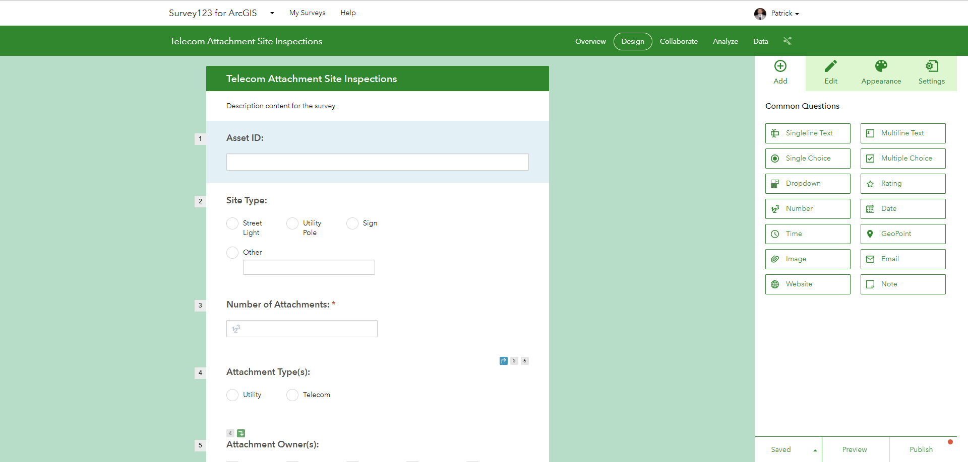
Telecom Attachment Site Inspection Survey using Survey123
The Telecom Attachment Site Inspection Survey allows field engineers to quickly collect information on locations to attach telecom network to. The locations and information collected from the field can be made instantly available for the Network Analyst service to optimize network routes, or to help engineers manually cost out routes. The site inspection survey was built using Survey123.
Ninja Pro Tip: What is New in Survey123 for ArcGIS v 2.4 (September 2017)
Required Esri Technology | Recommended Experience |
|---|---|
|
|
Work Order Management using Workforce
Workforce for ArcGIS allow management teams to quickly assign field work based on a survey grid within a web map, and allows field personnel to view their work orders and keep their management teams informed of their status and progress. Workforce for ArcGIS also integrates with Navigator, Survey123, and Collector to help streamline workflows in the field.

Required Esri Technology | Recommended Experience |
|---|---|
|
|
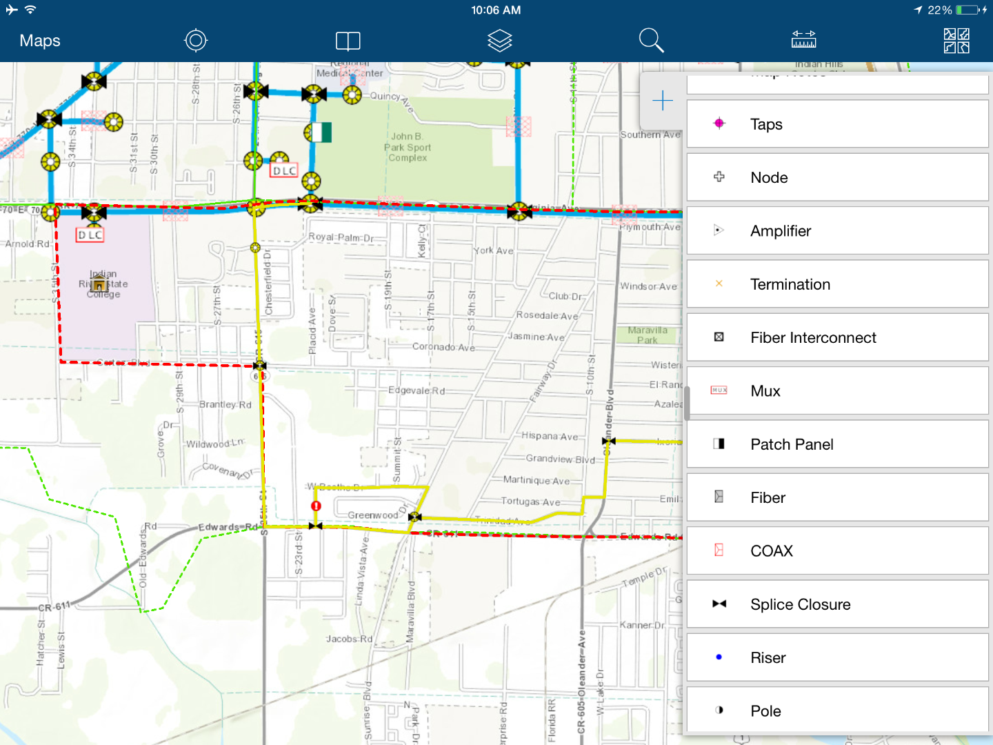
Map Notes & Redlining using Collector
Collector for ArcGIS allows field personnel to collect field data via a map and their GPS location. The example data collection workflow using Collector that was shown at GeoConX was focused on map notes & redlining to alert engineering teams in the back office of updates to an outside plant facility map or construction as-built's. The Collector based map notes & redlining workflow was configured using the Map Notes solution template.
Required Esri Technology | Recommended Experience |
|---|---|
|
|
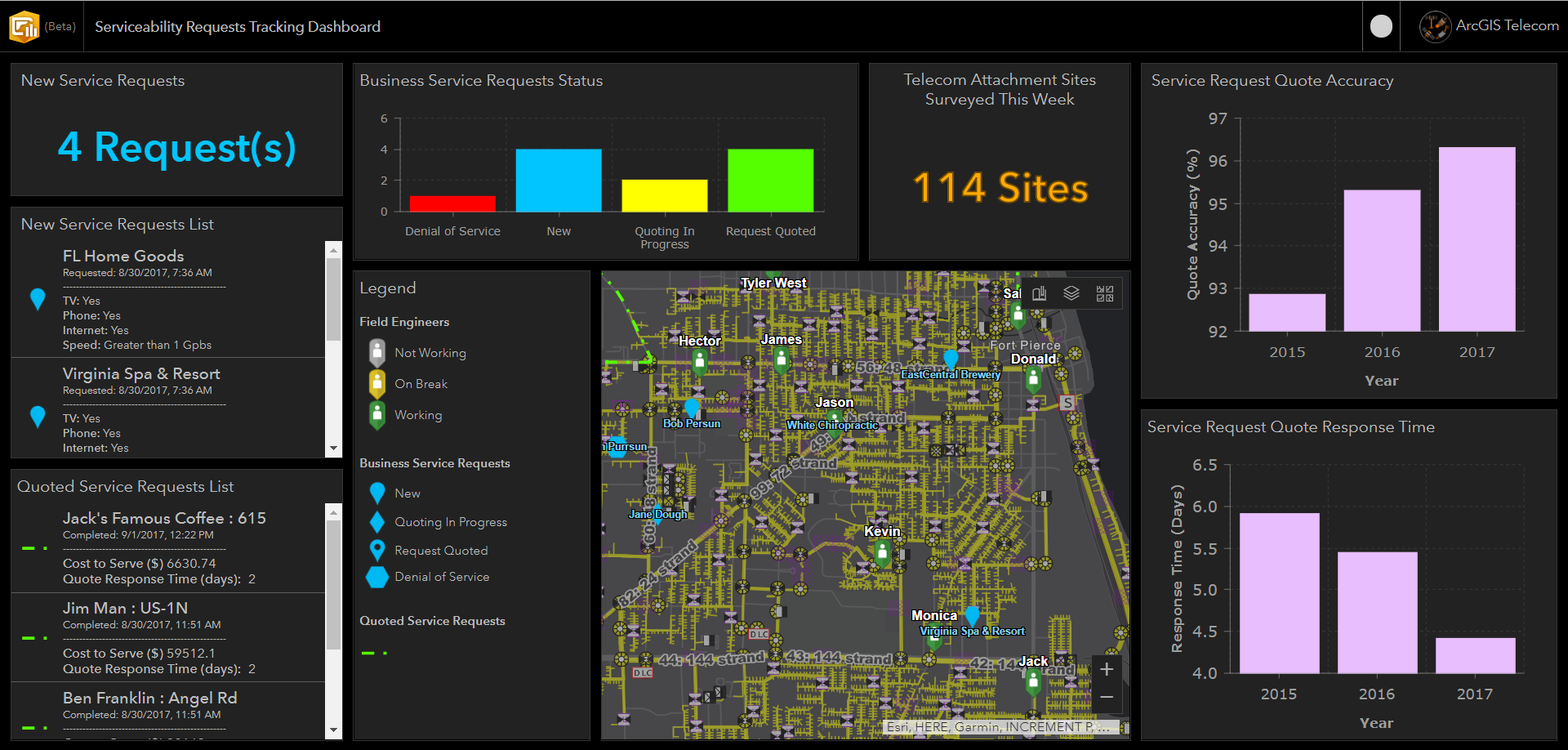
Service Request Tracking using Operations Dashboard
The Service Request Tracking Dashboard allows management to view the real-time status of all requests for new service connections, and the locations of their field engineers or direct sales reps. The dashboard can also pull in the performance metrics of your service quotes, like quote accuracy (initial quote vs. actual project cost) and quote response time (time to provide the customer with a cost estimation). The dashboard was configured using Operations Dashboard for the web.
Required Esri Technology | Recommended Experience |
|---|---|
|
|
To view the demonstration again, check out the video below.
Feel free to reach out with any questions or for more information on how to configure any of the ArcGIS Field Apps.
Patrick Huls
Technical Evangelist - Utilities and Communications
LinkedIn: Patrick Huls| Twitter: @SpatialNinja| GeoNet:Phuls-esristaff
You must be a registered user to add a comment. If you've already registered, sign in. Otherwise, register and sign in.