- Home
- :
- All Communities
- :
- Industries
- :
- State & Local Government
- :
- State & Local Government Questions
- :
- Re: Spatial Analysis....measuring ditch sediment
- Subscribe to RSS Feed
- Mark Topic as New
- Mark Topic as Read
- Float this Topic for Current User
- Bookmark
- Subscribe
- Mute
- Printer Friendly Page
- Mark as New
- Bookmark
- Subscribe
- Mute
- Subscribe to RSS Feed
- Permalink
Hey all! I have a technical question regarding some spatial analysis. It may be easy asnwer but for whatever reason I can't think of a solution. So I have a ditch system (water canal that drains from fields). I need to be able to measure the depth of ditch, depth of water, and volume of sediment underneath. Basically they are going to redo the entire ditch and construction needs to know if I can estimate the volume of dirt and sediment that will need to be moved.
Any answers, short or long would be much appreciated. Thank you.
Solved! Go to Solution.
Accepted Solutions
- Mark as New
- Bookmark
- Subscribe
- Mute
- Subscribe to RSS Feed
- Permalink
So Map Algebra (see: A quick tour of using Map Algebra—ArcGIS Help | ArcGIS Desktop ) con be used to mimic the behavior of the Cut/fill tool.
If you have a DEM that represents the situation without the dirt sediment and another one that includes the sediment, calculating the difference between the two (and mask them for the ditch area) can be used to sum the data and calculate the volume. This will require enough your DEMs to have sufficient precision in order to get a good estimate.
What is the spatial resolution of you DEM? How wide are the ditches? Can the "rough construction measurements" be used to create a 3D representation of the ditch without sediment? Is your DEM (with sediment) based on recent data (situation might have changed if data is not recent)?
Can you share a part of your data to see what you have and if it is possible to get the results you're after?
- Mark as New
- Bookmark
- Subscribe
- Mute
- Subscribe to RSS Feed
- Permalink
Assuming you have field data that represents the current conditions of the ditches, one way to do this would be to use the 3D Analyst extension, specifically the Cut/Fill tool. Essentially one would create a surface of the existing condition and a surface of the desired (or previous) condition, then use Cut/Fill to find the change between the two.
With the Cut Fill tool, you can do the following:
- Identify regions of sediment erosion and deposition in a river valley.
- Calculate the volumes and areas of surface material to be removed and areas to be filled to level a site for building construction.
- Identify areas that become frequently inundated with surface material during a mudslide in a study to locate safe areas of stable land for building homes.
Cut Fill—Help | ArcGIS for Desktop
How Cut Fill works—Help | ArcGIS for Desktop
Chris Donohue, GISP
- Mark as New
- Bookmark
- Subscribe
- Mute
- Subscribe to RSS Feed
- Permalink
I unfortunately do not have 3D analyst on my current setup, although I do wish I did! I know this process would be much easier to visual with ability to express my data 3D.
Is there any other way to even get estimates for this sort of calculation?
- Mark as New
- Bookmark
- Subscribe
- Mute
- Subscribe to RSS Feed
- Permalink
Do you have Spatial Analyst? This could be used to obtain the same using some Map Algebra. Maybe you can elaborate a little more on the data that you have (and in what format) and what software (and versions) you have available.
- Mark as New
- Bookmark
- Subscribe
- Mute
- Subscribe to RSS Feed
- Permalink
I am using ArcMap 10.5 and have data that includes aerial imagery, DEMs, rough construction measurements, and a variety of other data layers that I can use. And yes I have the Spatial Analyst extension.
- Mark as New
- Bookmark
- Subscribe
- Mute
- Subscribe to RSS Feed
- Permalink
So Map Algebra (see: A quick tour of using Map Algebra—ArcGIS Help | ArcGIS Desktop ) con be used to mimic the behavior of the Cut/fill tool.
If you have a DEM that represents the situation without the dirt sediment and another one that includes the sediment, calculating the difference between the two (and mask them for the ditch area) can be used to sum the data and calculate the volume. This will require enough your DEMs to have sufficient precision in order to get a good estimate.
What is the spatial resolution of you DEM? How wide are the ditches? Can the "rough construction measurements" be used to create a 3D representation of the ditch without sediment? Is your DEM (with sediment) based on recent data (situation might have changed if data is not recent)?
Can you share a part of your data to see what you have and if it is possible to get the results you're after?
- Mark as New
- Bookmark
- Subscribe
- Mute
- Subscribe to RSS Feed
- Permalink
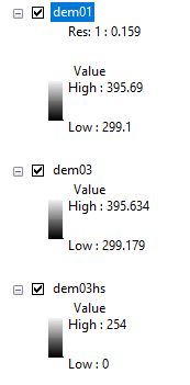
I found three DEM's for this area, but I am not sure for spatial resolution of each. The ditch is about 25 feet across at the water and about 65 feet wide up on the top of banks. I unfortunately don't have data for the ditch with and without fill so it will be difficult to calculate the difference using the method you are suggesting. 
- Mark as New
- Bookmark
- Subscribe
- Mute
- Subscribe to RSS Feed
- Permalink
25 feet!? I wouldn't call that a ditch....that's more like a canal. I'm perplex in how you can estimate the depth of a stream bed that is submerged under water.
If I was in your situation I think it MAY be possible to perform a very rough estimation as it involves some assumptions. So if you know the Ordinary High Water Mark (OHWM) elevation when the "ditch" was first constructed and at it's current date you can assume the elevation change is due to silt build up. Factor in the slops of the ditch (assuming that didn't erode away) you can do some simple math to get an estimated fill quantity. Now here lies the problem. OHWMs are not typically viewable form an aerial image. In fact sometimes they are hard to find when you are in the field! Unfortunately you can't just assume where the water meets the bank is the OHWM or represents the same flow from one aerial image to another. Streams/ditches/canals typically fluctuate a good bit so you don't want to end up thinking it's sediment causing the water rise when really you were comparing a low flow day to a high flow day. I hope that makes sense.
I still don't know how you can get your sediment quantity without some form of field survey.
- Mark as New
- Bookmark
- Subscribe
- Mute
- Subscribe to RSS Feed
- Permalink
Would be interesting to see the actual data you have for a small area to be able to determine what the possibilities are.