- Home
- :
- All Communities
- :
- Industries
- :
- State & Local Government
- :
- State & Local Government Questions
- :
- Re: Fillet Tool in Parcel Editor
- Subscribe to RSS Feed
- Mark Topic as New
- Mark Topic as Read
- Float this Topic for Current User
- Bookmark
- Subscribe
- Mute
- Printer Friendly Page
Fillet Tool in Parcel Editor
- Mark as New
- Bookmark
- Subscribe
- Mute
- Subscribe to RSS Feed
- Permalink
- Report Inappropriate Content
- Mark as New
- Bookmark
- Subscribe
- Mute
- Subscribe to RSS Feed
- Permalink
- Report Inappropriate Content
Thanks
Chris
- Mark as New
- Bookmark
- Subscribe
- Mute
- Subscribe to RSS Feed
- Permalink
- Report Inappropriate Content
I have created an idea for this on http://ideas.arcgis.com/. I have listed a few examples where this tool might be useful. Please vote on this if you feel it might be helpful in your edit tasks at your organization.
- Mark as New
- Bookmark
- Subscribe
- Mute
- Subscribe to RSS Feed
- Permalink
- Report Inappropriate Content
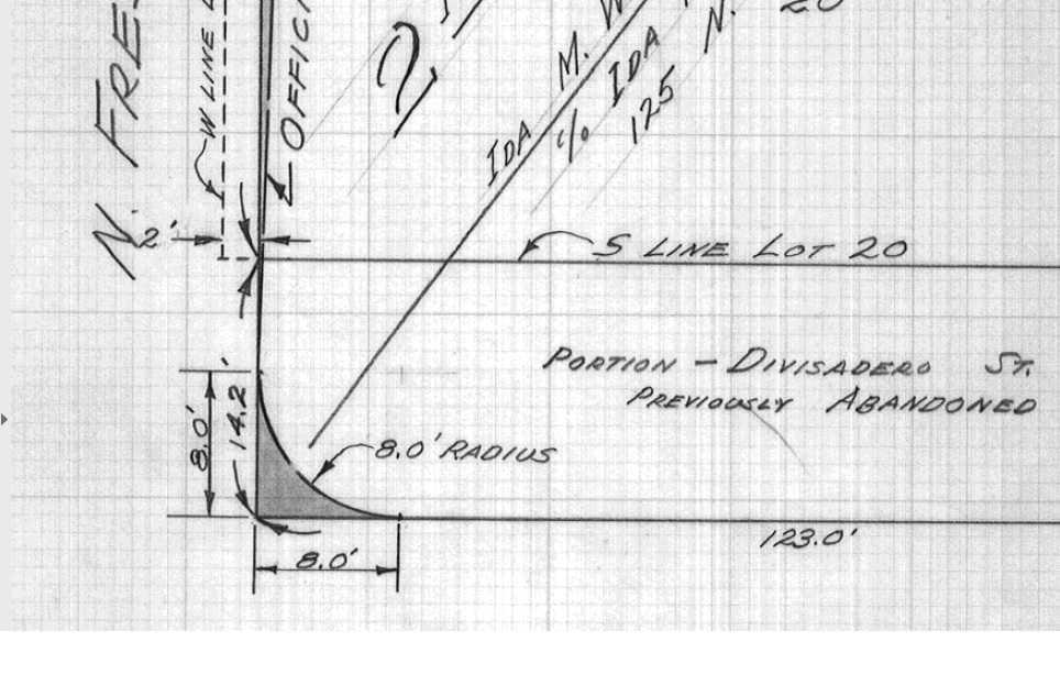
This would be useful when you need to construct a corner cut using a specific radius along two boundaries with no noted bearing. Typically, these types of right-of-way takes assume the two boundaries are perpendicular to each other. I'm having trouble in this too because there's no way to draw these properly without me using a 'construction' layer where I use the fillet tool to modify polylines, then note the COGO dimensions and traverse them in fabric. Trying to do this in fabric results in misclosures when they should be 0.000 in these instances.

- Mark as New
- Bookmark
- Subscribe
- Mute
- Subscribe to RSS Feed
- Permalink
- Report Inappropriate Content
Walid -
For this operation, road cut or dedication:
1. Using a 'construct from parent' operation, create breaklines at 8ft along the easterly boundary and southern boundary respectively, add a chord by digitizing between the two breakpoints and entering a 8ft. radius into the grid for the new line.
2. Build and mark historic.
Chris
- Mark as New
- Bookmark
- Subscribe
- Mute
- Subscribe to RSS Feed
- Permalink
- Report Inappropriate Content
- Mark as New
- Bookmark
- Subscribe
- Mute
- Subscribe to RSS Feed
- Permalink
- Report Inappropriate Content
Walid - the mis-close may be a result of the original survey, typo, or the calculated (remainder) distances of the lines that you broke with the breakline tool. Please check these dimensions in relation to the original lines.