- Home
- :
- All Communities
- :
- Products
- :
- Spatial Statistics
- :
- Spatial Statistics Questions
- :
- Re: Statistic Analyse How many Points (Point Datas...
- Subscribe to RSS Feed
- Mark Topic as New
- Mark Topic as Read
- Float this Topic for Current User
- Bookmark
- Subscribe
- Mute
- Printer Friendly Page
Statistic Analyse How many Points (Point Dataset) are in each Raster (Rasta Dataset)
- Mark as New
- Bookmark
- Subscribe
- Mute
- Subscribe to RSS Feed
- Permalink
Hey,
i have an Point Dataset (landslides) (mastershape_pt...) and a raster (rainfall) (Kostra_pkt_final...) . Now i want to do some Statistical Analyse. May you can help me 
I want to know how many points are located in the raster with the value from e.G 35.3000..1 till 37,2
so that i can say at the end i have 200 points with an value from blabla till blabla 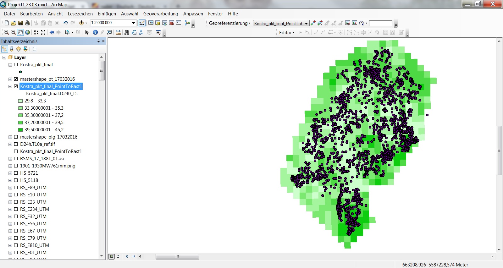
Thanks for your help! Cheers
Solved! Go to Solution.
Accepted Solutions
- Mark as New
- Bookmark
- Subscribe
- Mute
- Subscribe to RSS Feed
- Permalink
Extract Values to Points—Help | ArcGIS for Desktop
I am sure you must have missed this one
- Mark as New
- Bookmark
- Subscribe
- Mute
- Subscribe to RSS Feed
- Permalink
Extract Values to Points—Help | ArcGIS for Desktop
I am sure you must have missed this one
- Mark as New
- Bookmark
- Subscribe
- Mute
- Subscribe to RSS Feed
- Permalink
@Dan Patterson
thank you it was exact the help i search for. and it works pretty good i know everything is written in the "Help", but sometimes its not easy to find when you don't know what to search for.
Now i want to do the same with one difference. The Raster is now a point Dataset.
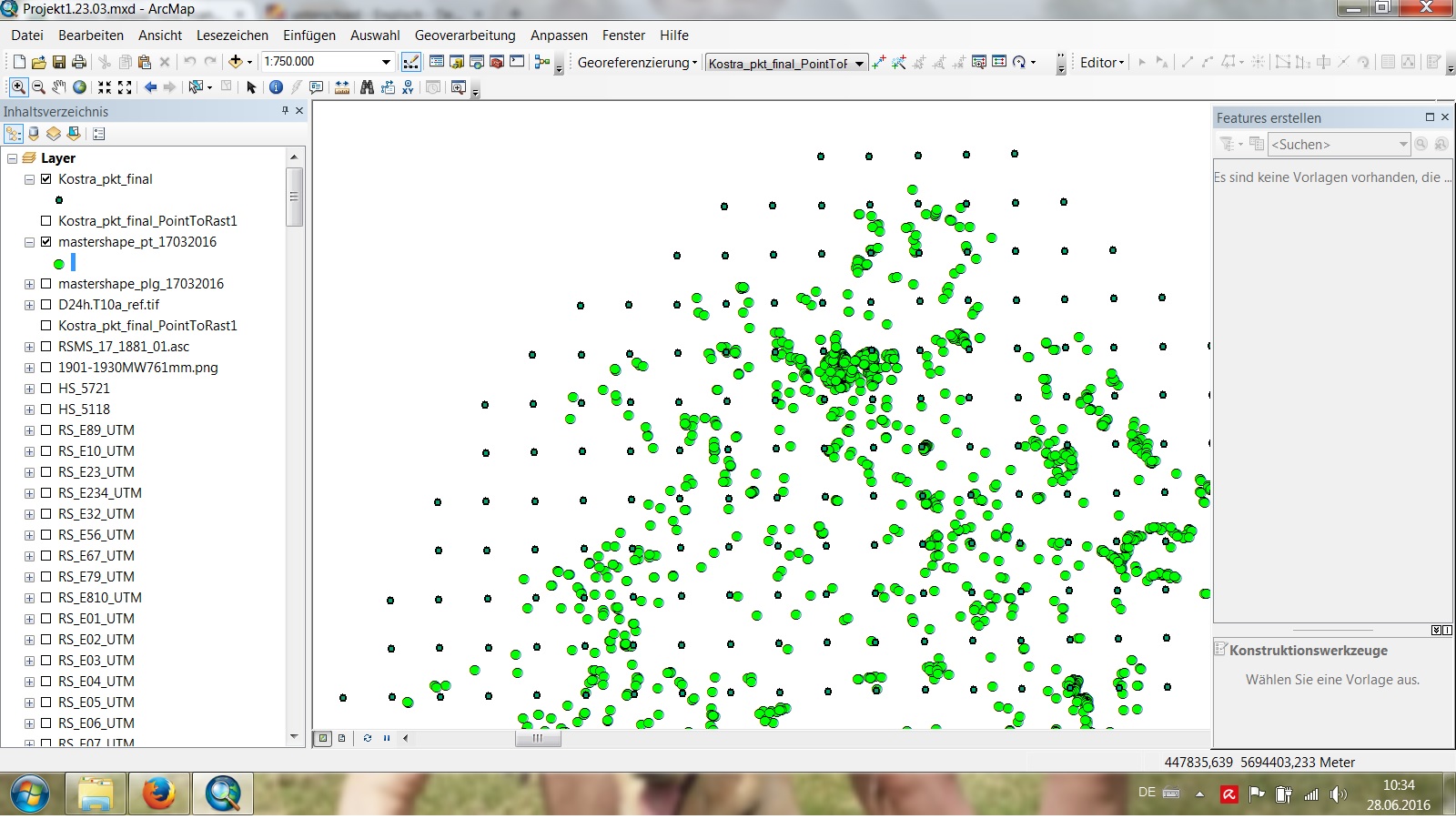
So i have two point datasets: green (Landslides) and the smaller ones (blue) are the Rainfall...
is there any possibillity to add a value to the green points attribute table which point of the blue points is the nearest? Or reverse? that the blue points get a entry which green points are nearest.
- Mark as New
- Bookmark
- Subscribe
- Mute
- Subscribe to RSS Feed
- Permalink
Near or spatial join would probably work depending on the result you want and your license level