- Home
- :
- All Communities
- :
- Products
- :
- Spatial Statistics
- :
- Spatial Statistics Questions
- :
- How to group points into optimal clusters: Proximi...
- Subscribe to RSS Feed
- Mark Topic as New
- Mark Topic as Read
- Float this Topic for Current User
- Bookmark
- Subscribe
- Mute
- Printer Friendly Page
How to group points into optimal clusters: Proximity and Timeframe?
- Mark as New
- Bookmark
- Subscribe
- Mute
- Subscribe to RSS Feed
- Permalink
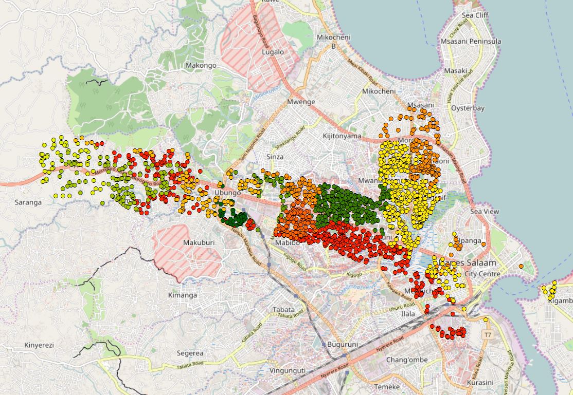
I' have extracted 2000 random building footprints within my study area and need to group the following points into optimal clusters to divide the study area for the 24 surveyors (x24 Tablets). We have 8 days to complete the survey and have roughly determined that it would take 45 minutes to survey a house, including walking from the previous house. The house locations are spread over the study area and have high and low clusters, which need to be taken into account. Any suggestions or methodologies that I could use to generate the clusters to group the points to split the study area up for the surveyors will be appreciated. I've tried used the Group Analysis tool within ArcGIS with little to no success as I have no attributes to use for any commonality between the points.
Solved! Go to Solution.
Accepted Solutions
- Mark as New
- Bookmark
- Subscribe
- Mute
- Subscribe to RSS Feed
- Permalink
That's great!
The spatial sort does sometimes give you weird results, especially when your data are clumpy. But it usually does give you a good first cut.
Please mark my response correct so it will come up in search results for others.
- Mark as New
- Bookmark
- Subscribe
- Mute
- Subscribe to RSS Feed
- Permalink
The Sort tool may do what you want, see this thread:
- Mark as New
- Bookmark
- Subscribe
- Mute
- Subscribe to RSS Feed
- Permalink
Hi Curtis
The following has worked perfectly, with a few minor manual adjustments to the clusters.
Thanks so much for the following.
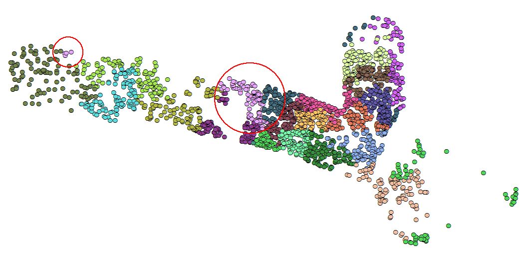
Same group for some reason, not sure why.
- Mark as New
- Bookmark
- Subscribe
- Mute
- Subscribe to RSS Feed
- Permalink
That's great!
The spatial sort does sometimes give you weird results, especially when your data are clumpy. But it usually does give you a good first cut.
Please mark my response correct so it will come up in search results for others.