- Home
- :
- All Communities
- :
- Products
- :
- Spatial Data Science
- :
- Spatial Data Science Questions
- :
- Removing polygon boundaries permanently
- Subscribe to RSS Feed
- Mark Topic as New
- Mark Topic as Read
- Float this Topic for Current User
- Bookmark
- Subscribe
- Mute
- Printer Friendly Page
- Mark as New
- Bookmark
- Subscribe
- Mute
- Subscribe to RSS Feed
- Permalink
Hi all,
I'm currently using a Fishnet grid to create a model and am joining environmental data layers to the grid using a spatial join in order to assign data to 500x500m2 grids.
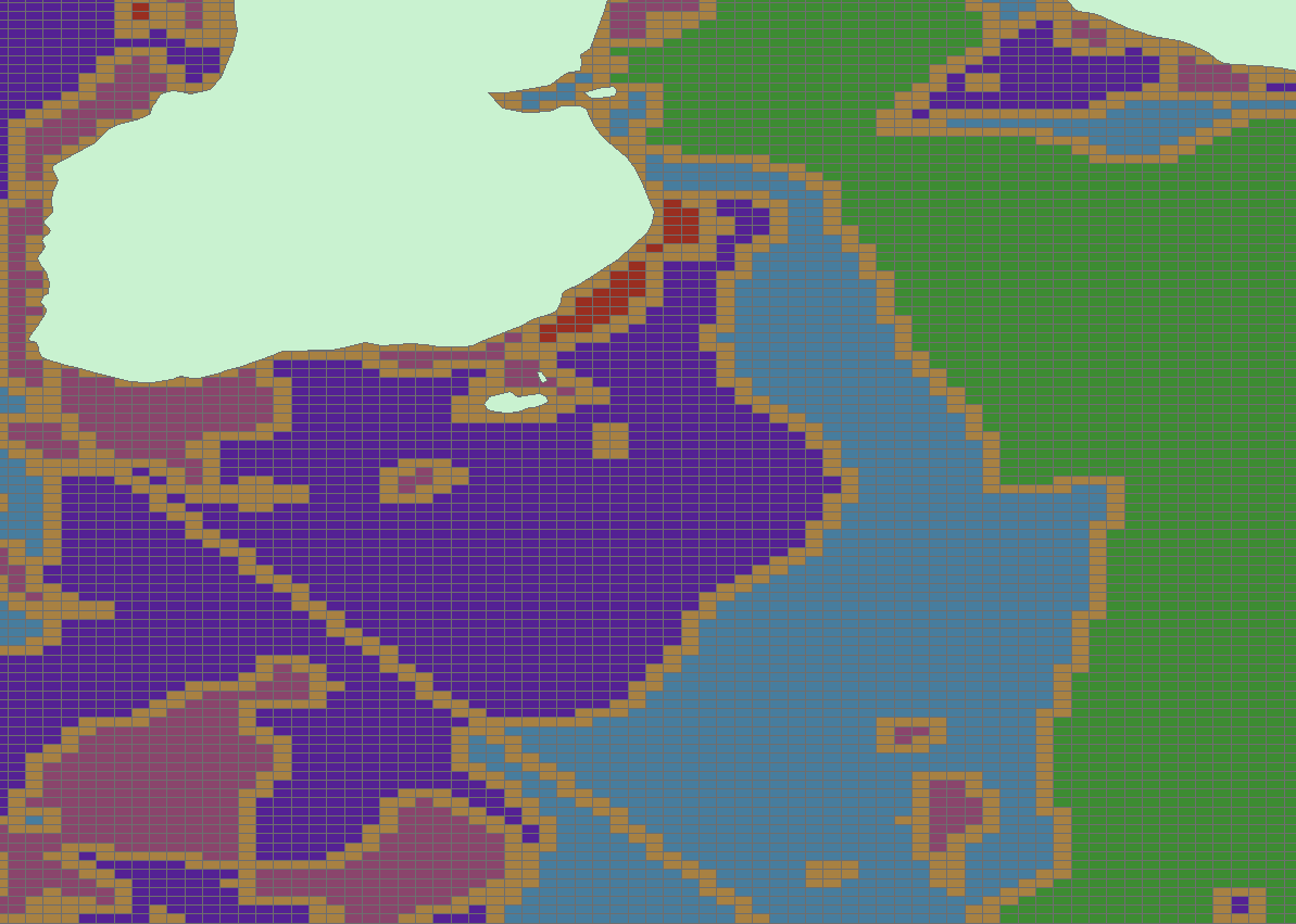
I'm having difficulty with with some polygon layers as the data isn't being added to the gird but the polygon boundaries are. You can see this below with a sample of a sediment layer- the yellow symbolises polygon boundaries.
Does anyone know how I can permanently remove boundaries so that I don't continue to have this problem?
Any suggestions would be most welcome.
Thanks,
Ruth
Solved! Go to Solution.
Accepted Solutions
- Mark as New
- Bookmark
- Subscribe
- Mute
- Subscribe to RSS Feed
- Permalink
When you convert the fishnet to a raster, set the fishnet's symbology so that there is no outline, it will just be a filled color so that when it is converted to a grid, the cell boundaries will acquire the values of the cell itself. To do this simply double-click on the colour in the symbol, and set its border to 0 width
- Mark as New
- Bookmark
- Subscribe
- Mute
- Subscribe to RSS Feed
- Permalink
Not sure how you have arrived at the picture you have presented.
But if you are converting various polygon datasets to a raster representation for some sort of SA based overlay analysis or something, why not use the Polygon to Raster tool :
http://resources.arcgis.com/en/help/main/10.2/index.html#//001200000030000000
Use the environment settings, extent and cell size to get the grid you want.
Good luck,
- Mark as New
- Bookmark
- Subscribe
- Mute
- Subscribe to RSS Feed
- Permalink
When you convert the fishnet to a raster, set the fishnet's symbology so that there is no outline, it will just be a filled color so that when it is converted to a grid, the cell boundaries will acquire the values of the cell itself. To do this simply double-click on the colour in the symbol, and set its border to 0 width
- Mark as New
- Bookmark
- Subscribe
- Mute
- Subscribe to RSS Feed
- Permalink
It looks you you were rasterizing fishnet line (not polygon) features.