- Home
- :
- All Communities
- :
- Products
- :
- Spatial Data Science
- :
- Spatial Data Science Questions
- :
- How to deal with 'No Data' Values in Topographic W...
- Subscribe to RSS Feed
- Mark Topic as New
- Mark Topic as Read
- Float this Topic for Current User
- Bookmark
- Subscribe
- Mute
- Printer Friendly Page
How to deal with 'No Data' Values in Topographic Wetness Index
- Mark as New
- Bookmark
- Subscribe
- Mute
- Subscribe to RSS Feed
- Permalink
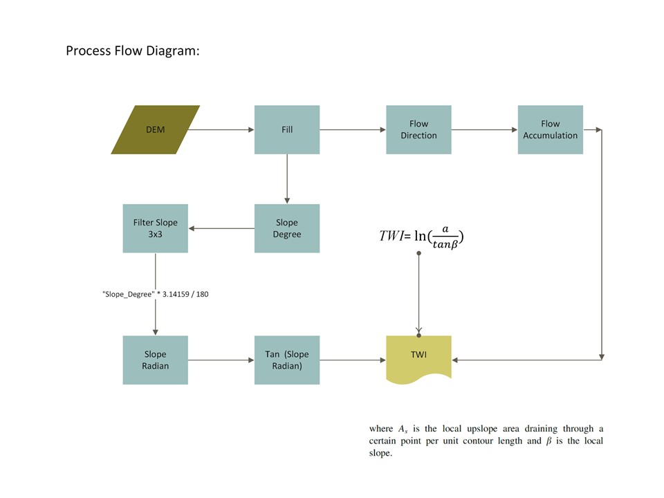
I have derived Topographic Wetness Index (TWI)/CTI with ArcGIS 10.3 using 30m DEM resolution. Earlier, it was propagating negative values which were mainly confined to ridges. I have restructured the 'Raster Calculator' expression as below and got rid of negative values.
Ln(("Flow_acc"+ 1 ) * 900/"Tan_SlopeRad")
The below process diagram would acquaint you about steps I have taken to arrive at the positive integer values.
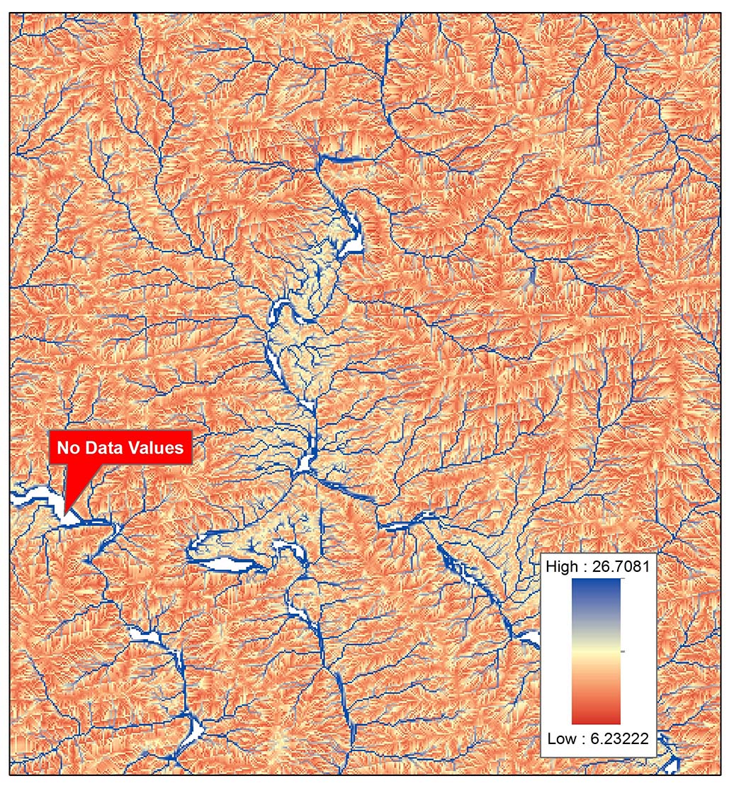
and the resultant image clearly indicates values having 'No Data'. These values are mainly confined to Zero Degree Slope within River.
Earlier, I uploaded this query on the following link but no response has been made so far:-
arcgis desktop - No Data Values in TWI Raster - Geographic Information Systems Stack Exchange
Now, How would I deal with values having ''No Data'???
- Mark as New
- Bookmark
- Subscribe
- Mute
- Subscribe to RSS Feed
- Permalink
Looks good!
- Mark as New
- Bookmark
- Subscribe
- Mute
- Subscribe to RSS Feed
- Permalink
Hello,
I am running into this same problem. I have tried your new formula but I still have so many areas with no data. This new version barely improved the original (multicolored).
My location is mossy, low lying tundra. A lot of the terrain is wet. But I want to use TWI to create a layer signifying the relationship between slope and wetness. The area that are missing would either be very wet (rivers and lakes) or dry (upland). But these values are missing.


- « Previous
-
- 1
- 2
- Next »
- « Previous
-
- 1
- 2
- Next »