- Home
- :
- All Communities
- :
- Products
- :
- Spatial Data Science
- :
- Spatial Data Science Questions
- :
- Re: centerlines from polygon canal network
- Subscribe to RSS Feed
- Mark Topic as New
- Mark Topic as Read
- Float this Topic for Current User
- Bookmark
- Subscribe
- Mute
- Printer Friendly Page
centerlines from polygon canal network
- Mark as New
- Bookmark
- Subscribe
- Mute
- Subscribe to RSS Feed
- Permalink
Hello,
I was wondering if anybody has recently converted a complex polygon or raster canal network to centerlines? ESRI toolboxes or third party tools are moving targets so some of the old threads are hard to apply. The canal polygon network that I have was created by cutting out nearly 20,000 mounds and agricultural beds from a shallow lake system (archaeological example). The remaining canal polygon network is one large complex polygon. I converted it to a raster and tried the raster to polyline tool but ended up with a polyline feature class that filled in the canal cells with 800 million lines after running for a couple days. Obviously, not what I was looking. I didn't try the ArcScan vectorization since my raster was 1 or no data and ArcScan requires a 2 value raster. I can convert my raster and give that a try. Not sure if there is a method to convert my complex polygon directly to lines (centerlines). I'll attribute the resulting lines after the fact so I just need to create the skeleton or centerline features. Any ideas are welcome.
Thanks, Greg
- Mark as New
- Bookmark
- Subscribe
- Mute
- Subscribe to RSS Feed
- Permalink

- Mark as New
- Bookmark
- Subscribe
- Mute
- Subscribe to RSS Feed
- Permalink
Thanks. The open pools seem to be the biggest challenge. I'll play with the max width setting.
- Mark as New
- Bookmark
- Subscribe
- Mute
- Subscribe to RSS Feed
- Permalink
A picture of what you are dealing with good do wonders...
From this thread: How to create a centerline from polygon in Arcgis 10 - Geographic Information Systems Stack Exchange
If you have the ArcInfo licence you can use Collapse Dual Lines To Centerline tool (Cartography) tool. This is in the Cartography Toolbox.
Alternatively, if you have Data Interoperability Suite, then you will have FME. There is also a tool in FME to get centerlines from polygons.
If you don't have access to an Advanced license or Data Interop, you may want to check out ET GeoWizards for ArcGIS. It has some features for finding center lines. createCenterlines
but you may give it a try in ArcScan too...
- Mark as New
- Bookmark
- Subscribe
- Mute
- Subscribe to RSS Feed
- Permalink
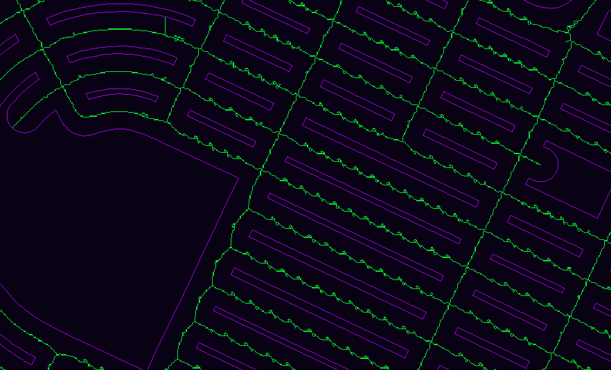
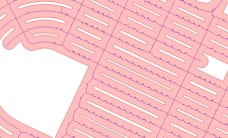
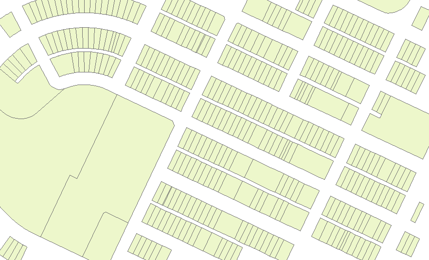
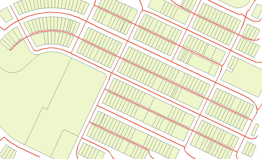
Thanks, Here is a small area of the canal system. The white areas are raised agricultural fields or residential mounds. Trying to turn the canals into polylines for network analysis of movement through the canal system. There are some open pools and non-linear canal areas to add to the challenge. Greg
- Mark as New
- Bookmark
- Subscribe
- Mute
- Subscribe to RSS Feed
- Permalink
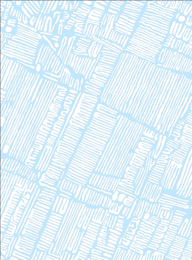
The ET GeoWizards example Xander linked to seems to give good results, which should work for your canals:
- Mark as New
- Bookmark
- Subscribe
- Mute
- Subscribe to RSS Feed
- Permalink
Thanks. Looks like I may have to make the investment. I don't see it among ET Geowizards free functions. I'm guessing that it will correctly create lines for my "cul-de-sacs". Greg
- Mark as New
- Bookmark
- Subscribe
- Mute
- Subscribe to RSS Feed
- Permalink
The network analysis you are planning, is a vector analysis? If not, you may be able to some "network" (accessibility) analysis in raster format...
- Mark as New
- Bookmark
- Subscribe
- Mute
- Subscribe to RSS Feed
- Permalink
I was planning on vector analysis. I could manually rank the primary canals (some are very wide and could accommodate large transport canoes). Secondary and tertiary canals could also be attributed with the remainder assigned to the thin canals separating individual beds. The idea being that I can identify which fields/mounds were associated with larger village/wharves I have identified based on travel costs.
- Mark as New
- Bookmark
- Subscribe
- Mute
- Subscribe to RSS Feed
- Permalink
Can you explain this a bit more please, the network accessibility in a raster?