- Home
- :
- All Communities
- :
- Industries
- :
- Science
- :
- Science Questions
- :
- How to manipulate the raster after polygon to rast...
- Subscribe to RSS Feed
- Mark Topic as New
- Mark Topic as Read
- Float this Topic for Current User
- Bookmark
- Subscribe
- Mute
- Printer Friendly Page
How to manipulate the raster after polygon to raster?
- Mark as New
- Bookmark
- Subscribe
- Mute
- Subscribe to RSS Feed
- Permalink
Hi all,
I am trying to create a soil dataset of the whole of Indonesia, and then clipping it to the extents of certain areas of Interest and resampling them to different resolutions.
So far, I have managed to create a soil dataset of the whole of Indonesia in a raster format. This is, however, where it gets tricky, and where I get confused.
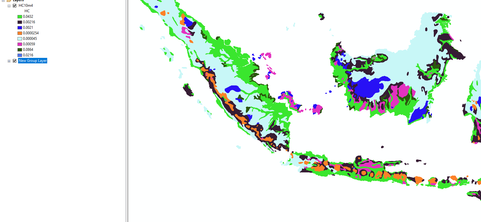
The first image details the soil dataset for the whole of Indonesia - that is what I want so no problem.
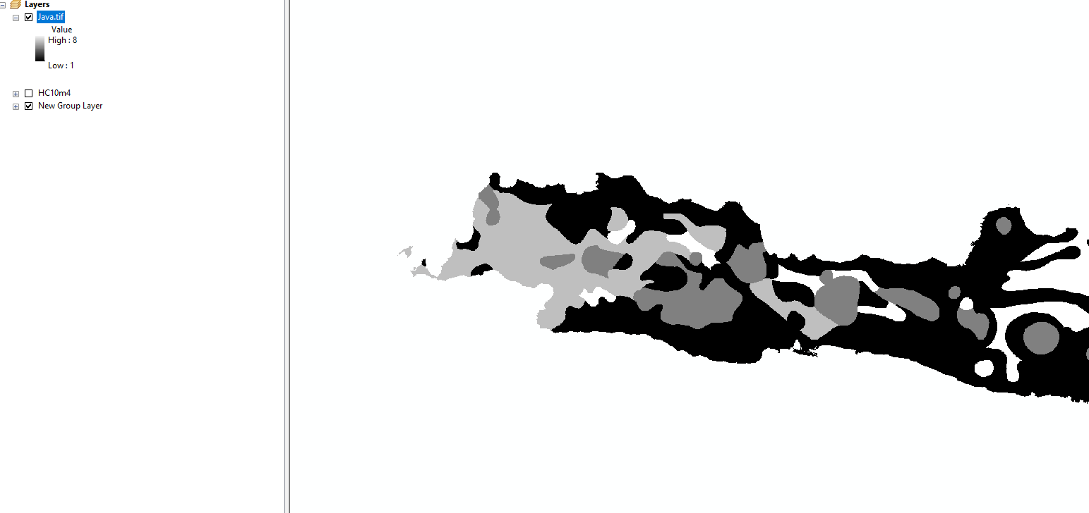
The second image shows the dataset after I have clipped it to each Island. For some reason, the values change from the original ones to integers from 1 to 7. I am sure it has something to do with the way clip acts on the data and would appreciate any methods, that I am simply overlooking, that could resolve this.
Thanks all so much in advance!!
- Mark as New
- Bookmark
- Subscribe
- Mute
- Subscribe to RSS Feed
- Permalink
Matthew,
Try using Extract by Mask instead of Clip Raster. Another approach to try to is use the Extent Environment in your Resample to avoid the need to clip.