- Home
- :
- All Communities
- :
- Developers
- :
- Native Maps SDKs
- :
- Qt Maps SDK Questions
- :
- divergence between map and Route plan
- Subscribe to RSS Feed
- Mark Topic as New
- Mark Topic as Read
- Float this Topic for Current User
- Bookmark
- Subscribe
- Mute
- Printer Friendly Page
divergence between map and Route plan
- Mark as New
- Bookmark
- Subscribe
- Mute
- Subscribe to RSS Feed
- Permalink
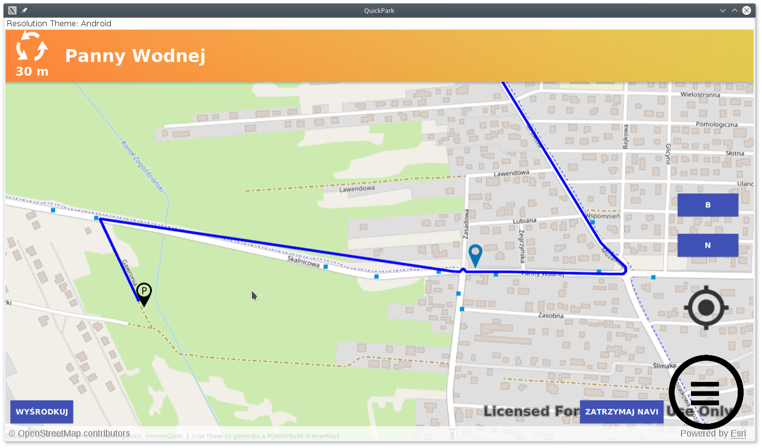
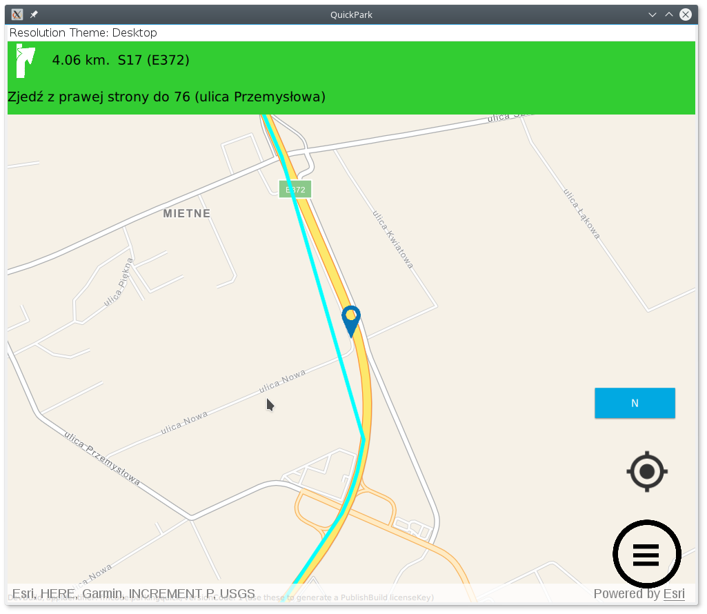
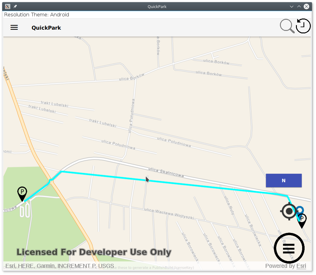
Hi
I'm working on a navigation app. I have noticed that sometimes there is a divergence between the map and Route plan. Clearly, you can see this in attached pictures, can someone shed some light why this is happening?
My QML code:
RouteTask {
id: routeTaskOnline
url: "http://route.arcgis.com/arcgis/rest/services/World/Route/NAServer/Route_World"
Credential {
oAuthClientInfo:oAuth
}
onLoadStatusChanged: {
if (loadStatus === Enums.LoadStatusLoaded) {
console.log("Route task ready");
routeTaskOnline.createDefaultParameters();
}
}
onCreateDefaultParametersStatusChanged: {
if (createDefaultParametersStatus === Enums.TaskStatusCompleted) {
routeParameters = createDefaultParametersResult;
routeParameters.returnRoutes = true;
routeParameters.returnDirections = true;
routeParameters.directionsDistanceUnits=Enums.UnitSystemMetric;
routeParameters.directionsLanguage="PL"
routeParameters.travelMode.outputGeometryPrecision=1;
routeParameters.outputSpatialReference = SpatialReference.createWebMercator();
}
}
onErrorChanged: {
console.log("Route Error:", JSON.stringify(routeTaskOnline.error));
}
onSolveRouteStatusChanged: {
if (solveRouteStatus === Enums.TaskStatusCompleted && solveRouteResult) {
for (var index = 0; index < solveRouteResult.routes.length; index++) {
console.log("add route graphics idx:"+index)
route = solveRouteResult.routes[index];
routeGraph = ArcGISRuntimeEnvironment.createObject("Graphic", {geometry: route.routeGeometry});
routeGraph.attributes.insertAttribute("route",1);
graphicsOverlay.graphics.append(routeGraph);
directionListModel = route.directionManeuvers;
}
}
else if (solveRouteStatus === Enums.TaskStatusErrored) {
console.log("Route error");
}
}
Component.onCompleted: {
routeTaskOnline.load();
}
}Pictures:
Best Regards
Marek
- Mark as New
- Bookmark
- Subscribe
- Mute
- Subscribe to RSS Feed
- Permalink
Can you please contact Esri Support with your repro app? I think they will be able to help troubleshoot different scenarios further and hopefully come to a resolution. One thing I am suspicious of is if there is some issue with separator , vs . as those differ between U.S. and Polish/other locales on the various operating systems. Somehow your geometry precision is going from 1 to 1000000, and that is the cause of the generalized lines - I am just not sure how the number is changing.
- Mark as New
- Bookmark
- Subscribe
- Mute
- Subscribe to RSS Feed
- Permalink
Hi
Yes I had an issue with this separator myself, functions needs to be Locale Aware.
On the other hand I have switched default application locale to en_EN - didn't help.
What Esri Support do you have in mind ? Support in my country ?
Not good  only for ArcGIS desktop applications.
This issue is not critical for me, I'm developing on Linux but endproduct with navigation will run on Android and iOS, so as long as these works fine I can sleep peacefully.
Best,
Marek
- « Previous
-
- 1
- 2
- Next »
- « Previous
-
- 1
- 2
- Next »