- Home
- :
- All Communities
- :
- Developers
- :
- Python
- :
- Python Questions
- :
- Tool to add triangular polygon
- Subscribe to RSS Feed
- Mark Topic as New
- Mark Topic as Read
- Float this Topic for Current User
- Bookmark
- Subscribe
- Mute
- Printer Friendly Page
Tool to add triangular polygon
- Mark as New
- Bookmark
- Subscribe
- Mute
- Subscribe to RSS Feed
- Permalink
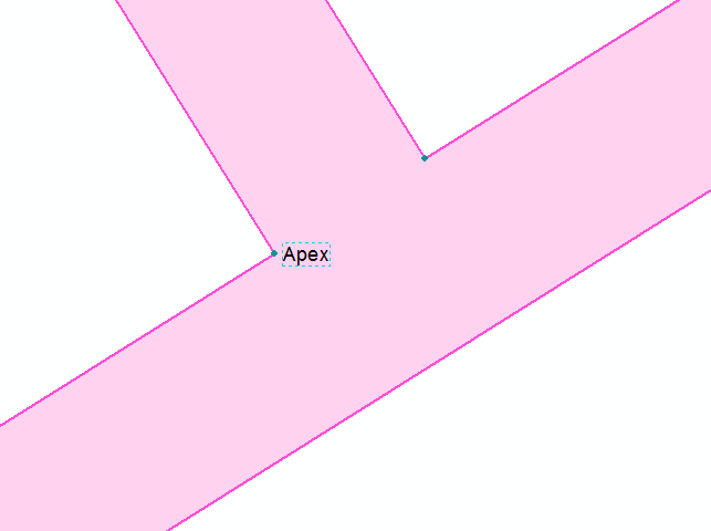
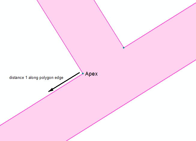
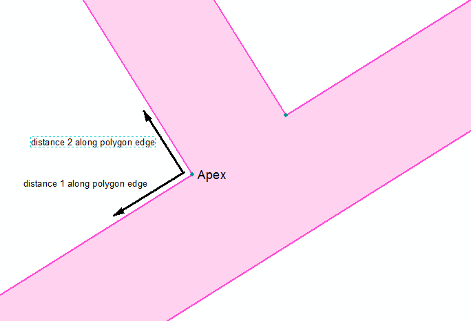
I have a road layout and at the road intersections I need to create what are termed "splays" in the Survey world. This is usually done by choosing the apex point and then creating a vertex a defined distance down each polygon edge running away from the apex point. The triangle is then created by joining the two new vertices with the apex vertex. I then need to merge this new triangular polygon with the adjoining polygon. See below:
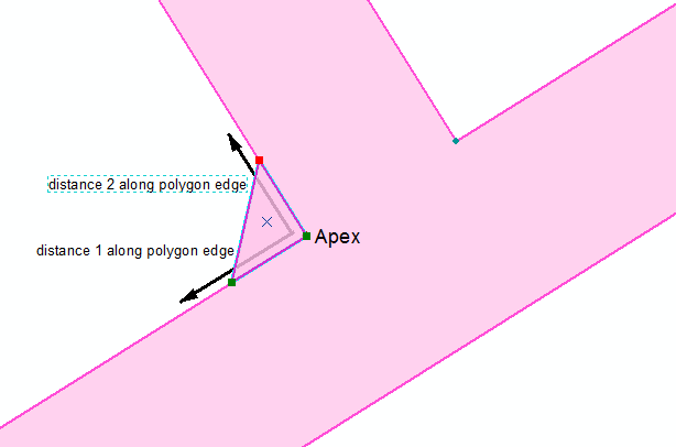
And the end result being:

Is there a way to create a tool in ArcMap to achieve the above easily? Currently the method I am using is very cumbersome. Or has anyone already created such a tool?
Thanks in advance!
- Mark as New
- Bookmark
- Subscribe
- Mute
- Subscribe to RSS Feed
- Permalink
Reshape polygon seems appropriate. See http://desktop.arcgis.com/en/arcmap/10.3/manage-data/editing-existing-features/reshaping-polygons.ht...
- Mark as New
- Bookmark
- Subscribe
- Mute
- Subscribe to RSS Feed
- Permalink
I know I can use the Reshape Polygon tool but I'm looking for something that will speed the process up significantly as I have a lot of these "chamfer" type triangles to add at these road intersections. In the interim I have decided to use a point layer as a construction layer and have used the "Point at end of line" construction tool to create the points at my specified distances down each polygon edge away from the apex point. I then just edit the vertices of the polygon to include my constructed points. I was ideally looking for a way that I could create a simple tool to automate my series of clicks and typing distances in.
- Mark as New
- Bookmark
- Subscribe
- Mute
- Subscribe to RSS Feed
- Permalink
I would say yes this is very doable (but can't help right now). I would do a search on either "arcpy split along line" or split line at point, or some of the other terms similar. Questions that would help others...
- Do you already know the apex (i.e. maybe separate point layer)
- are the distances the same for 1) each apex, 2) each line/direction
You should look at Geometry—Help | ArcGIS for Desktop You can do just about anything in a python script with this, that is breaking any feature down to it's smallest part, basically an x/y coordinate. But someone may have already written something to I would look around on the web.
The "official" code sharing page from esri now is here: ArcGIS Code Sharing