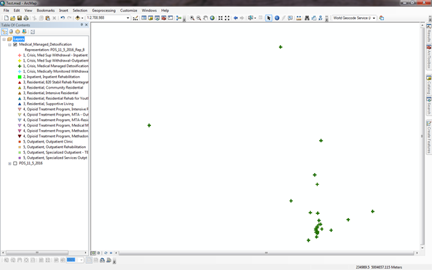
I am trying to automate a process that I do weekly via model builder and python to upload a file to ArcGIS Online. I have a file that I geocode (about 1,000 points) and then symbolize based on a specific column, there are roughly 20 different symbols, using the Add Representation tool. I then want each symbol type to be it's own layer so it can be turned on and off in ArcGIS Online. To make each symbol type it's own layer I use the Split by Attribute tool. The problem is that when I add the split file to the map the Table of Contents in ArcMap it shows the symbols (representation) for all of the other symbols that were split-off. How to I remove the excess symbols (using a tool or python code) for each split symbol without having to do 20 separate representations? I don't want to manually delete each symbol in the Symbology tab and I will not have a legend (because this is going into ArcGIS Online) so 'Only show classes that are visible in the current map extent' check box (in the Legend Properties) will not work. Thanks in advance!