- Home
- :
- All Communities
- :
- Developers
- :
- Python
- :
- Python Questions
- :
- Python Topo To Raster: Tiled Processing
- Subscribe to RSS Feed
- Mark Topic as New
- Mark Topic as Read
- Float this Topic for Current User
- Bookmark
- Subscribe
- Mute
- Printer Friendly Page
Python Topo To Raster: Tiled Processing
- Mark as New
- Bookmark
- Subscribe
- Mute
- Subscribe to RSS Feed
- Permalink
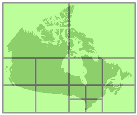
I'm looking for a reasonable workflow to generate DEM's from contours for multiple study areas without having to clip my contours into tiles in order to generate a DEM. I'm looking for suggestions from the community in being able to process large datasets (contours) by processing the study area into usable tiled areas such as the Tiled processing that ESRI has developed for certain geoprocessing tools:

I'd like to generate a tiled index on the fly based on the extent of my study area and output cellsize, in order to process my study area in tiles and then stitch the tiles together to generate a single DEM.
Topo to Raster is written in Fortran and doesn't take advantage of multiple processors or cores. Its limited in the amount of memory that is allocated to the single geoprocessing tool, so I'm trying to develop a Python workflow of splitting the study area into small enough areas that can be run simultanously and then stitched back together afterwards.
My current study area is made up of nine local municipalities and from my calculations based on a 10m cellsize each local municipality will have the following amount of cells for each DEM:
- Baviaans 226 791 600
- Blue Crane Route 209 397 384
- Camdeboo 250 726 124
- Ikwezi 86 625 374
- Kouga 50 539 474
- KouKamma 73 776 259
- Makana 40 357 026
- Ndlambe 40 357 026
- Nelson Mandela Bay 34 654 290
- Sunday's River Valley 114 374 190
Nine Local Municipalities
- Mark as New
- Bookmark
- Subscribe
- Mute
- Subscribe to RSS Feed
- Permalink
Peter... and you still have the added limitation of using python 2.7 and ArcMap correct?
suggestions from the help (for others in case they haven't seen it
There are insufficient system resources available. The algorithms used in Topo to Raster hold as much information as possible in memory during processing. This allows point, contour, sink, stream, and lake data to be accessed simultaneously.
To facilitate processing of large datasets, it is recommended that unnecessary applications be closed before running the tool to free up physical RAM. It is also important to have sufficient amounts of system swap space on disk. The contour or point input may be too dense for the output cell size specified. If one output cell covers several input contours or points, the algorithm may not be able to ascertain a value for that cell. To resolve this, try any of the following:Decrease the cell size, then resample back to the larger cell size after Topo to Raster.
Rasterize smaller sections of the input data using the Output extent and Margin in cells. Assemble the resulting component rasters with the Mosaic tool. Clip the input data into overlapping sections, and run Topo to Raster separately on each section. Assemble the resulting component rasters with the Mosaic tool.
Use Dice then try Topo To Raster by File since in theory, you should be able to slice and dice, copy and paste the inputs with making minimal changes then run it.
Of course you are still going to be limited by the memory that ArcMap allows
- Mark as New
- Bookmark
- Subscribe
- Mute
- Subscribe to RSS Feed
- Permalink
Hi Dan
Thanks for the following ![]() Is this still true if you are using 64 bit background processing and running the python script as a standalone process?
Is this still true if you are using 64 bit background processing and running the python script as a standalone process?
- Mark as New
- Bookmark
- Subscribe
- Mute
- Subscribe to RSS Feed
- Permalink
Peter... I have just never found the need for the background stuff... perhaps it is the leisurely lifestyle I lead... give it shot on a small sample and time it. (Besides there is also the fact that I have anywhere up to 50 computers I can commandeer should the need arise ![]() and I haven't used python 2.7 in quite some time).
and I haven't used python 2.7 in quite some time).
So I will leave that for others to comment on
- Mark as New
- Bookmark
- Subscribe
- Mute
- Subscribe to RSS Feed
- Permalink
If only I was so lucky ![]() , thanks Dan.
, thanks Dan.
- Mark as New
- Bookmark
- Subscribe
- Mute
- Subscribe to RSS Feed
- Permalink
Interesting problem, given that the typical workflow is to create contours from DEMs.
Did you try using the 'Create Tin' tool? And then make the raster from a TIN?
- Mark as New
- Bookmark
- Subscribe
- Mute
- Subscribe to RSS Feed
- Permalink
The algorithm behind topo to raster does a pretty good job (anudem) of generating the dem when approaches like you propose fail. There is quite extensive literature and testing behind the implementation and it is generally the preferred method.