- Home
- :
- All Communities
- :
- Developers
- :
- Python
- :
- Python Questions
- :
- Convert lat-long to WKT spatial reference?
- Subscribe to RSS Feed
- Mark Topic as New
- Mark Topic as Read
- Float this Topic for Current User
- Bookmark
- Subscribe
- Mute
- Printer Friendly Page
- Mark as New
- Bookmark
- Subscribe
- Mute
- Subscribe to RSS Feed
- Permalink
Hello, arcpy newbie here... sorry if I am asking a basic question. I am looking for help on transforming lat/long decimal degrees to a different spatial reference, specifically a well-known-text (WKT) custom reference that we are using.
I have sent a street address to an address locator (findAddressCandidates) and it returns JSON back to me. If the candidate score is near 100, then I parse the JSON to grab the lat/long. That all works fine. But, now I would like to use an insertCursor to add this point to my feature class. I am unclear how I would convert a lat long to the custom spatial ref., WKT?
I have been trying many different things in the past few days but nothing works for me. I have tried passing the WKT in the URL for the address locator. It seems like the locator does not recognize the WKT and converts it to the default 4326 spatial reference (not what I want).
FYI.. this is the custom spatial reference that I am using:
PROJCS["NAD_1983_Lambert_Conformal_Conic",GEOGCS["GCS_North_American_1983",DATUM["D_North_American_1983",SPHEROID["GRS_1980",6378137.0,298.257222101]],PRIMEM["Greenwich",0.0],UNIT["Degree",0.0174532925199433]],PROJECTION["Lambert_Conformal_Conic"],PARAMETER["False_Easting",1840330.965],PARAMETER["False_Northing",527997.6316666666],PARAMETER["Central_Meridian",-92.0],PARAMETER["Standard_Parallel_1",41.15],PARAMETER["Standard_Parallel_2",45.0],PARAMETER["Latitude_Of_Origin",40.15],UNIT["Foot_US",0.3048006096012192]]
Thanks, --Rick
Solved! Go to Solution.
- Mark as New
- Bookmark
- Subscribe
- Mute
- Subscribe to RSS Feed
- Permalink
If you know the reference numbers, you can use this instead:
# WGS 1984 : (4326) Lat/Lon
# WGS 1984 Web Mercator (auxiliary sphere) : (102100) or (3857)
ptGeometry = arcpy.PointGeometry(arcpy.Point(x,y),arcpy.SpatialReference(4326)).projectAs(arcpy.SpatialReference(3857))
- Mark as New
- Bookmark
- Subscribe
- Mute
- Subscribe to RSS Feed
- Permalink
Thanks Randy! That's exactly what I was looking for!
Nice touch using the Wisconsin Capitol.  Rebecca's lat/long examples were SO confusing to me! Haha. I mean, -147.707779, 63.680584, what is that??? Sara Palin's house?
Take care everybody! Thanks again! -_Rick
- Mark as New
- Bookmark
- Subscribe
- Mute
- Subscribe to RSS Feed
- Permalink
hi Randy, how can I take x,y coordinates from featureclass? Because I don`t have xy values in code.
- Mark as New
- Bookmark
- Subscribe
- Mute
- Subscribe to RSS Feed
- Permalink
Using a search cursor, you can loop through the points in a feature class, read the geometry and convert to longitude/latitude. Something like this:
for row in arcpy.da.SearchCursor("MyPointLayer",["OID@","SHAPE@XY"]):
print("Feature {}:".format(row[0])),
px, py = row[1]
print("{}, {}".format(px, py)),
# WGS 1984 : (4326) Lat/Lon
# WGS 1984 Web Mercator (auxiliary sphere) : (102100) or (3857)
ptGeometry = arcpy.PointGeometry(arcpy.Point(px,py),arcpy.SpatialReference(3857)).projectAs(arcpy.SpatialReference(4326))
print ptGeometry.firstPoint.X, ptGeometry.firstPoint.YThis code may be helpful in getting the spatial reference information for the point feature:
SR = arcpy.Describe("MyPointLayer").spatialReference
print SR.name
print SR.factoryCode- Mark as New
- Bookmark
- Subscribe
- Mute
- Subscribe to RSS Feed
- Permalink
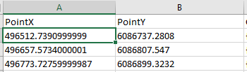
Could you explain, how to separate coordinates in different columns ? Now I have coordinates like this(photo). I want 4 different columns Point X Point Y in WGS1984 and POINT X POINT Y in WGS 1984 Web Mercator..

- Mark as New
- Bookmark
- Subscribe
- Mute
- Subscribe to RSS Feed
- Permalink
Here's a version of the previous script that puts the x and y coordinates into a comma delimited format.
# print a header row - comma delimited
print "{}, {}, {}, {}, {}".format(
'"OBJECTID"',
'"X_WebM"',
'"Y_WebM"',
'"X_Lon"',
'"Y_Lat"'
)
# we will assume the feature is in web mercator
for row in arcpy.da.SearchCursor("MyPointLayer",["OID@","SHAPE@XY"]):
# SHAPE@XY contains both x and y coordinates
px, py = row[1]
# convert px and py to longitude and latitude
# WGS 1984 : (4326) Lat/Lon
# WGS 1984 Web Mercator (auxiliary sphere) : (102100) or (3857)
ptGeometry = arcpy.PointGeometry(arcpy.Point(px,py),
arcpy.SpatialReference(3857)).projectAs(arcpy.SpatialReference(4326))
print "{}, {}, {}, {}, {}".format(
row[0], # OBJECTID
px, # X_WebM
py, # Y_WebM
ptGeometry.firstPoint.X, # X_Lon
ptGeometry.firstPoint.Y # Y_Lat
)
This should make it easier to see how to separate the geometry into columns. You can add other attribute fields to the list in the Search Cursor:
for row in arcpy.da.SearchCursor("MyPointLayer",["OID@","SHAPE@XY","FieldName"]):
....
row[2] # FieldName- Mark as New
- Bookmark
- Subscribe
- Mute
- Subscribe to RSS Feed
- Permalink
Rick ...
if you want to weigh in here anytime... the suggestions are piling up... I will whip in a numpy solution if this isn't closed soon 
- Mark as New
- Bookmark
- Subscribe
- Mute
- Subscribe to RSS Feed
- Permalink
Randy's solution was great for me (I do use the SR #'s) except since they were just one points I used .centroid instead of .startpoint. this saved two projections/addXY/AlterField on 3 different files for me. This is why I really like geonet.
If anyone has a simple solution using the geometry for converting the long, lat values to DDM and DMS (into new fields) other than using the Convert Coordinate Notation—Help | ArcGIS for Desktop which works great and adds the new fields, but to a new FC each time (3 times x 3 files in my case), I would love to see it. I may just do the conversion/formatting in a and add the values to my [ ].
Dan....simple Numpy suggestion perhaps? DD (negative long in my case) -> DDM and DMS? I can fire this off to a new question if needed, but I know there are already thread on the conversion (and I have snippets already)
- Mark as New
- Bookmark
- Subscribe
- Mute
- Subscribe to RSS Feed
- Permalink
Getting off topic a little... Rebecca, you could write a function. For DD to DMS, something like:
def dd2dms(dd,xy):
    is_positive = dd >= 0
    dd = abs(dd)
    m,s = divmod(dd*3600,60)
    d,m = divmod(m,60)
    if is_positive:
        if xy == 'lat' : nsew = ' N'
        else : nsew = ' E'
    else:
        if xy == 'lat' : nsew = ' S'
        else : nsew = ' W'
    return str(int(d))+' '+str(int(m))+' '+str(round(s,1))+ nsew

print 61.217176, -149.889006
print dd2dms(61.217176,'lat'), dd2dms(-149.889006,'lon')
# 61 13 1.8 N 149 53 20.4 W
- Mark as New
- Bookmark
- Subscribe
- Mute
- Subscribe to RSS Feed
- Permalink
Rebecca, you probably haven't had time to scroll around the Numpy Repository, but I have this in there
Converting Decimal Degrees to DMS format (there is a zip as well)