- Home
- :
- All Communities
- :
- Developers
- :
- Python
- :
- Python Questions
- :
- Calculate Z values of 3D Polyline for new vertices
- Subscribe to RSS Feed
- Mark Topic as New
- Mark Topic as Read
- Float this Topic for Current User
- Bookmark
- Subscribe
- Mute
- Printer Friendly Page
Calculate Z values of 3D Polyline for new vertices
- Mark as New
- Bookmark
- Subscribe
- Mute
- Subscribe to RSS Feed
- Permalink
I've created a 3D polyline from a 3D point feature class and then reshaped the polyline feature class to follow the meandering of the river thawleg (centreline). I would like to calculate the Z values for the new vertices that are added to the 3D polyline based on the existing vertices that already have Z values and the distance along the polyline as a linear proportion of the elevation drop. Is there a way that I can achieve the following in python.
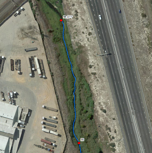
Points (Red) were used to create the 3D polyline
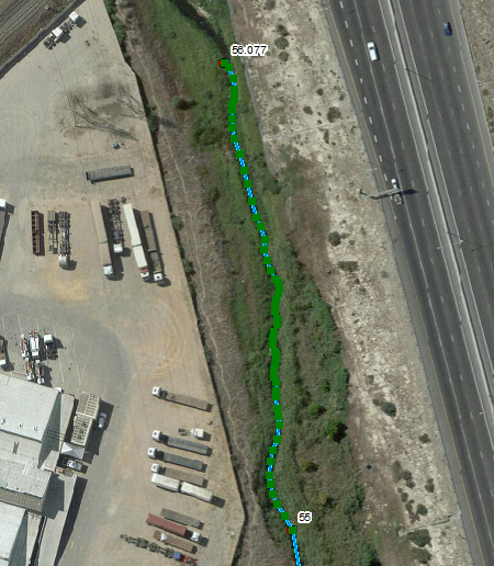
New vertices added through reshaping 3D Polyline
- Mark as New
- Bookmark
- Subscribe
- Mute
- Subscribe to RSS Feed
- Permalink
Not to nitpick, but a thalweg is often not the same as a centerline. A thalweg is the lowest point in a waterbody and in a moving waterbody that meanders it will be found on the outside of the curve (not in the center). Depending upon what your goal is of this analysis, that can throw things a bit if centerline data is used instead of thalweg location data.
Thalweg - Wikipedia, the free encyclopedia
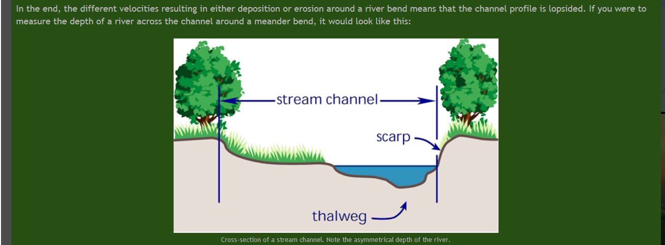
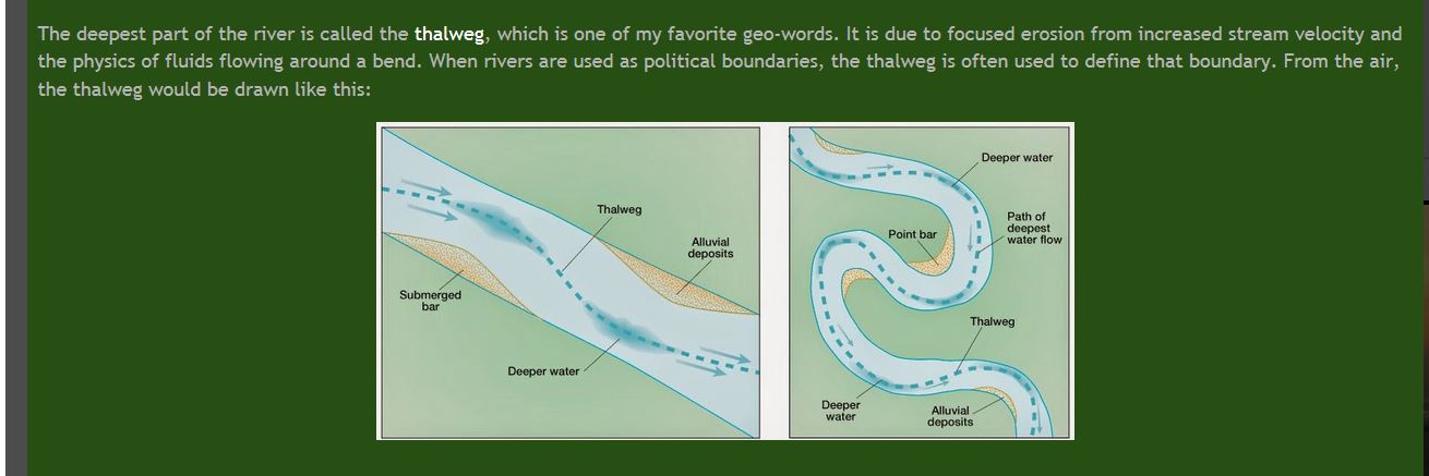
images source: Aerial Geologist: Thawing Thalweg
EDIT - added images from the link to help folks better visualize the spatial location of a thalweg.
Chris Donohue, GISP
- Mark as New
- Bookmark
- Subscribe
- Mute
- Subscribe to RSS Feed
- Permalink
Well, once you have moved or inserted vertices, the only way is to re-interpolate the elevation from the dem using interpolate shape. To calculate an elevation from the vertex before and after would be a mistake surely? What if you have reshaped a small segment of line to better follow the stream bottom (which is what you appear to be doing).
So without the original dem, where are the elevations coming from?
The line segment geom object could be fed into Interpolate shape to create an in_memory fc, then update the original from that.
- Mark as New
- Bookmark
- Subscribe
- Mute
- Subscribe to RSS Feed
- Permalink
There is a Python Code sample in the help section for Interpolate Shape that may be use. Note that it requires access to the 3D Analyst extension.
Interpolate Shape—Help | ArcGIS for Desktop
Chris Donohue, GISP