- Home
- :
- All Communities
- :
- Developers
- :
- Python
- :
- Python Questions
- :
- Re: ArcPy - How to create a perpendicular line to ...
- Subscribe to RSS Feed
- Mark Topic as New
- Mark Topic as Read
- Float this Topic for Current User
- Bookmark
- Subscribe
- Mute
- Printer Friendly Page
ArcPy - How to create a perpendicular line to an existing line since one especific point in ArcGIS
- Mark as New
- Bookmark
- Subscribe
- Mute
- Subscribe to RSS Feed
- Permalink
Hello! I am currently generating a layer parallel to a layer of existing lines , from a point layer lines . Can someone please help me to resolve this situation ? Thank you very much.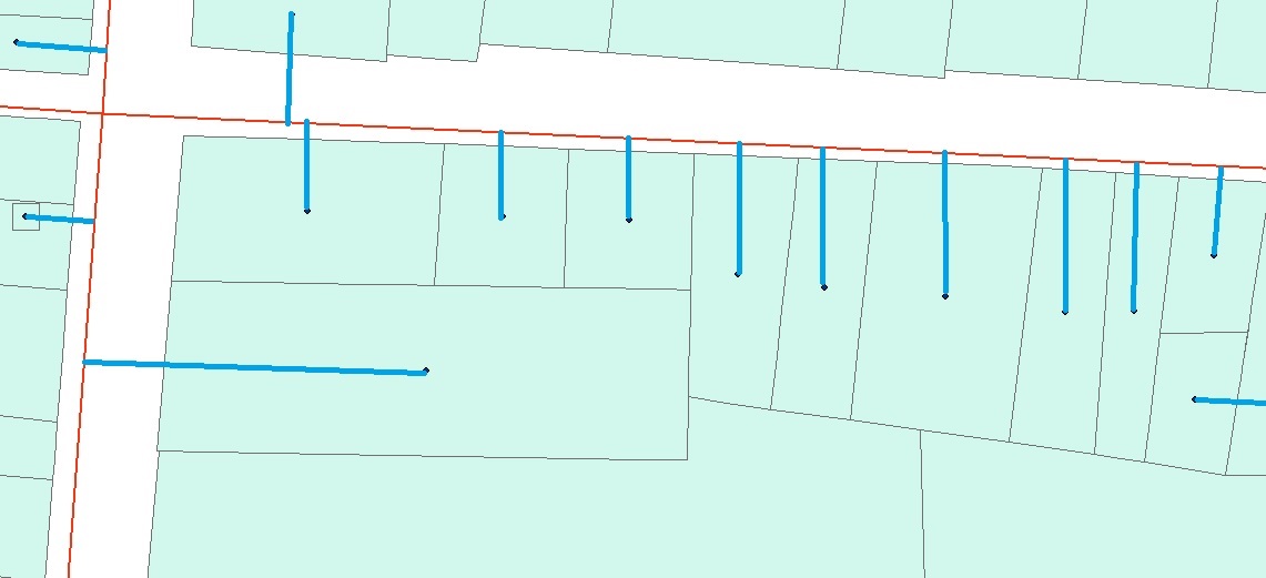
Solved! Go to Solution.
Accepted Solutions
- Mark as New
- Bookmark
- Subscribe
- Mute
- Subscribe to RSS Feed
- Permalink
This is possible with Python and Basic license, although untested for large datasets (I did run this against 1000+ points and it was fine).
First step is to dissolve all roads into a single feature, although you could loop through them with added code.
>>> points = "points_select" # points layer
... sr = arcpy.Describe(points).spatialReference # get CRS
... lines = "roads_select" # roads feature class containing single, merged feature for all roads
... out_lines = [] # output list
... line_geom = [i[0] for i in arcpy.da.SearchCursor(lines,'SHAPE@',spatial_reference=sr)] # the road feature
... with arcpy.da.SearchCursor(points,'SHAPE@') as cursor: # loop through points
... for row in cursor:
... end = line_geom[0].queryPointAndDistance(row[0])[0].centroid # get nearest point on line
... start = row[0].centroid
... out_lines.append(arcpy.Polyline(arcpy.Array([start,end]),sr)) # connect the dots and add to line list
... arcpy.CopyFeatures_management(out_lines,r'in_memory\out_lines') # write line list to disk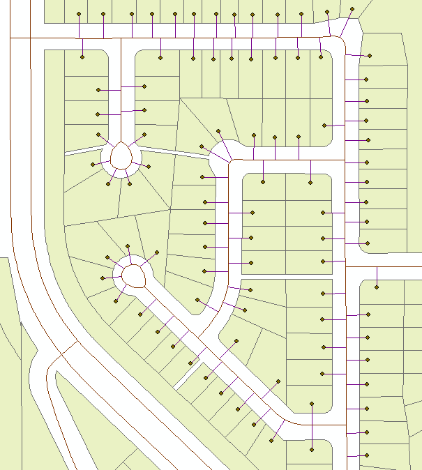
- Mark as New
- Bookmark
- Subscribe
- Mute
- Subscribe to RSS Feed
- Permalink
If memory serves
Near—Help | ArcGIS for Desktop followed by
XY To Line—Help | ArcGIS for Desktop
once you have your from and to, xy coordinates
... cavaet... you have the advanced license for ArcMap
- Mark as New
- Bookmark
- Subscribe
- Mute
- Subscribe to RSS Feed
- Permalink
This is possible with Python and Basic license, although untested for large datasets (I did run this against 1000+ points and it was fine).
First step is to dissolve all roads into a single feature, although you could loop through them with added code.
>>> points = "points_select" # points layer
... sr = arcpy.Describe(points).spatialReference # get CRS
... lines = "roads_select" # roads feature class containing single, merged feature for all roads
... out_lines = [] # output list
... line_geom = [i[0] for i in arcpy.da.SearchCursor(lines,'SHAPE@',spatial_reference=sr)] # the road feature
... with arcpy.da.SearchCursor(points,'SHAPE@') as cursor: # loop through points
... for row in cursor:
... end = line_geom[0].queryPointAndDistance(row[0])[0].centroid # get nearest point on line
... start = row[0].centroid
... out_lines.append(arcpy.Polyline(arcpy.Array([start,end]),sr)) # connect the dots and add to line list
... arcpy.CopyFeatures_management(out_lines,r'in_memory\out_lines') # write line list to disk