- Home
- :
- All Communities
- :
- Developers
- :
- Python
- :
- Python Blog
- :
- Free advanced tools ... Feature to Point ...
Free advanced tools ... Feature to Point ...
- Subscribe to RSS Feed
- Mark as New
- Mark as Read
- Bookmark
- Subscribe
- Printer Friendly Page
Free basic functionality.
Once again, functionality that is normally restricted to the Standard or Advanced ArcGIS Pro license.
Previously
- Feature Extent to Poly Features
- Free Tools : Frequency and Statistics
Help topics
- Convex hull in Minimum bounding geometry
Implementation
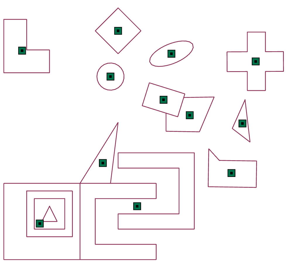
The implementation here is basically the default. Using the average or weighted average of the points making up the feature. Soooo basically some kind of average, like you can get the points yourself using ...FeatureClassToNumPyArray… with the 'explode_to_points' option. Voila! the points and their coordinates, ergo, the averages in some form (weighted or simple)
Output example
I tossed in a bounding container so you could see the points.
- Specify the input featureclass (polygon, polyline or multipoint),
- the output featureclass,
- select feature to point from the tool selection and
--------------------------------------------------------------------------------------------------------------------------------------------------------
The variant shown here is showing the full shape as input. A tweak, enables you to separate out multipart shapes if you want, or more simply use the ...Multipart to Singlepart... tool if you have a crushing need to carry over the attributes... It will save you a Join and arcpy has to do something occasionally.
The conversion uses the numpy based Geo class that I describe in the 8 part series on geometry.
You could add the geometry attributes to the result if needed ...Add Geometry Attributes …
WARNING
I have code that checks the validity of the file paths. If you input or output paths contain spaces or other flotsam, then the tool will not produce any results. Why? Too many questions where file paths are the problem. I won't 'enable' the current practice 
Download
You can copy the contents of the folder on my GitHub pages. No fancy install, just create a folder, throw the stuff in, load the toolbox and give it a try.
Got any geometry related or analysis tools you need implemented? let me know
You must be a registered user to add a comment. If you've already registered, sign in. Otherwise, register and sign in.