- Home
- :
- All Communities
- :
- Industries
- :
- Science
- :
- Ocean Science
- :
- Ocean Science Blog
- :
- Ocean Content Update
Ocean Content Update
- Subscribe to RSS Feed
- Mark as New
- Mark as Read
- Bookmark
- Subscribe
- Printer Friendly Page
Just in time for the Esri Ocean Forum, here is an update on some of the content we have been curating for the ocean community.
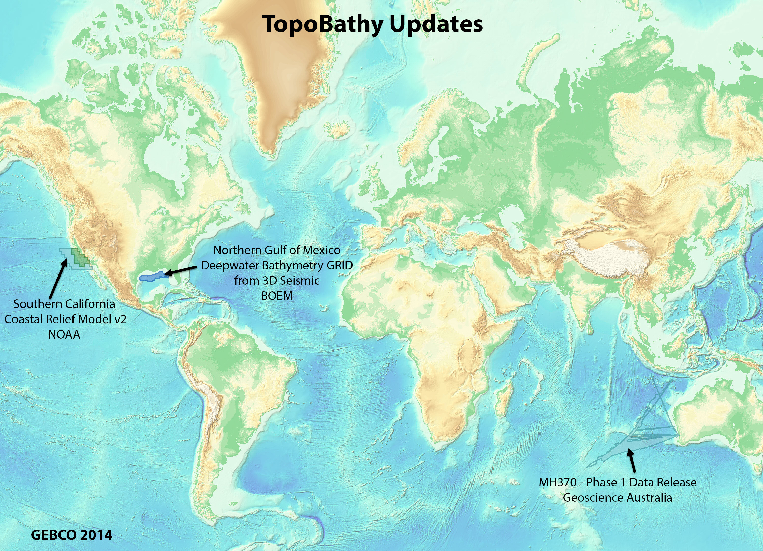
TopoBathy - The most recent release of TopoBathy had significant improvements in the ocean. Updates include: GEBCO 2014, BOEM Northern Gulf of Mexico Deepwater Bathymetry GRID from 3D Seismic, NOAA Coastal Relief Models for Southern California, and MH370 (missing Malaysia flight) Phase 1 Data from Geoscience Australia. Check out this blog for more comprehensive information on the recent TopoBathy release.
 HYCOM – A global modeled oceanographic dataset has been updated for the ocean community. The Hybrid Coordinate Ocean Model (HYCOM) provides a 30-day hind-cast and 7-day forecast (in three-hour time intervals) for use in marine operational planning. This living dataset contains multiple variables including temperature, salinity and velocity at depth levels ranging from the surface of the ocean to 5,000m water depth. It can be used to help determine if it is safe to deploy equipment, conduct operations, or plan a route in the ocean space. Sea surface height is also available through HYCOM.
HYCOM functionality has been extended through the HYCOM App that helps you visualize and compare the different modeled variables.

HYCOM has been in beta for two releases while we gather feedback from our users about how they use HYCOM data. If you have feedback on how you use HYCOM or how these layers can be improved please submit your feedback here.
This layer is part of a larger collection of ocean layers that you can use to perform a variety of mapping analysis tasks. For more information, see the Ocean Layers group on ArcGIS Online.
Don’t forget to check out the existing valuable Ocean content from the Living Atlas of the World. Nominate your authoritative data to the Living Atlas!
Keep the conversation going with the Ocean Community, ask questions and interact through Ocean Sciences on GeoNet.
Join us for the Esri Ocean Forum, an annual event for the Ocean GIS Community.
You must be a registered user to add a comment. If you've already registered, sign in. Otherwise, register and sign in.