Turn on suggestions
Auto-suggest helps you quickly narrow down your search results by suggesting possible matches as you type.
Cancel
- Home
- :
- All Communities
- :
- Industries
- :
- Science
- :
- Ocean Science
- :
- Ocean Science Blog
- :
- Higher-resolution EMUs!
Higher-resolution EMUs!
Subscribe
1094
0
09-14-2017 12:01 PM
- Subscribe to RSS Feed
- Mark as New
- Mark as Read
- Bookmark
- Subscribe
- Printer Friendly Page
09-14-2017
12:01 PM
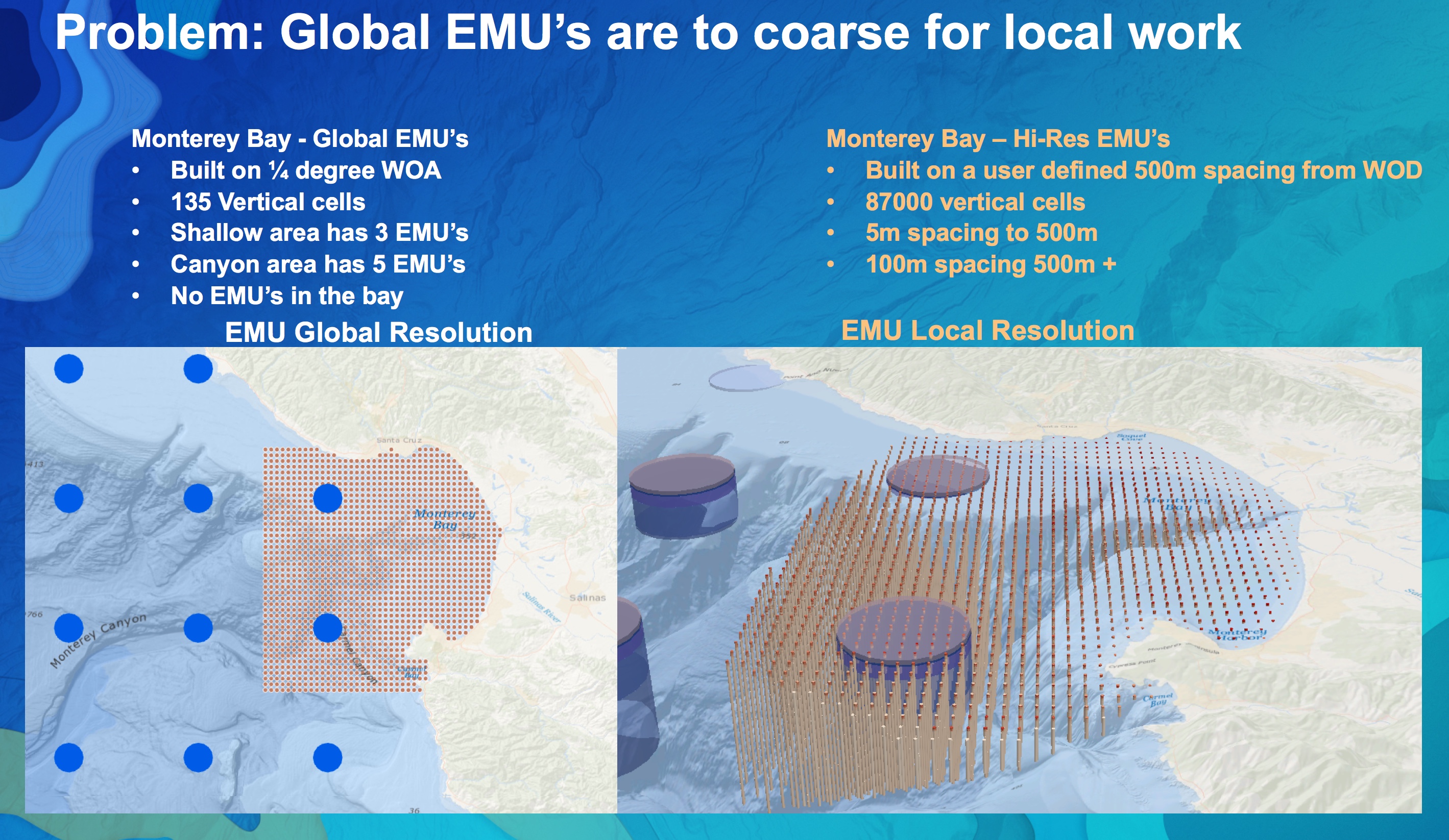
Stay tuned for more info from the Esri team on new workflows to produce local, higher-resolution 3D meshes and ultimately EMUs from NOAA data or your own data. Watch this space and the Esri Ocean GIS Forum recaps for more! We also have a growing list of exciting use cases of the EMUs for a range of scientific and resource management applications (NOAA Animal Telemetry Network, the Chesapeake Bay Program, the Orange County Sanitation District, the University of South Florida and Woods Hole as part of GEO’s Marine Biodiversity Observation Network, SCCWRP, and more).
Labels
You must be a registered user to add a comment. If you've already registered, sign in. Otherwise, register and sign in.
About the Author
Dawn was appointed Chief Scientist of Esri in October 2011 after 17 years as a professor of geography and oceanography at Oregon State University. As Esri Chief Scientist, she reports directly to Esri CEO Jack Dangermond with a mission to strengthen the scientific foundation for Esri software and services, while representing Esri to the international scientific community. Dawn maintains an affiliated faculty appointment at Oregon State. Follow her on all social media @deepseadawn. Direct email is [email protected]. More info. also at http://esriurl.com/scicomm and http://dusk.geo.orst.edu.