- Home
- :
- All Communities
- :
- User Groups
- :
- .NET and the Esri JavaScript API
- :
- Questions
- :
- Query Layer: JS 4x - GetElementById
- Subscribe to RSS Feed
- Mark Topic as New
- Mark Topic as Read
- Float this Topic for Current User
- Bookmark
- Subscribe
- Mute
- Printer Friendly Page
- Mark as New
- Bookmark
- Subscribe
- Mute
- Subscribe to RSS Feed
- Permalink
Hello all,
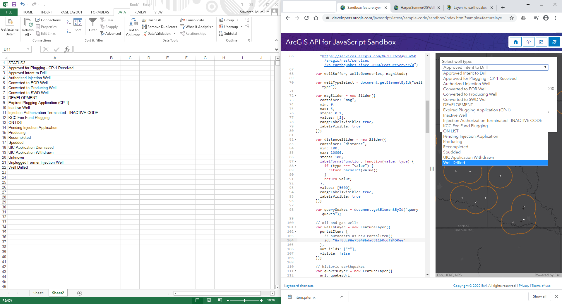
In this script, can someone please point out where the well-type options for the select tag is getting populated from? I have tried to incorporate this for my own code but I can't seem to get it working.
ArcGIS API for JavaScript Sandbox
Thank you
Solved! Go to Solution.
Accepted Solutions
- Mark as New
- Bookmark
- Subscribe
- Mute
- Subscribe to RSS Feed
- Permalink
Hi Sravanthi Murali,
// return an array of unique values in
// the STATUS2 field of the wells layer
From the comments in the JavaScript code you point to (ArcGIS API for JavaScript Sandbox) I can see that the well-type options for the select tag is populated with unique values from the STATUS2 field of the wells layer, i.e. the portal item with the id: "8af8dc98e75049bda6811b0cdf9450ee":
https://www.arcgis.com/home/item.html?id=8af8dc98e75049bda6811b0cdf9450ee
This Feature Layer (owned and published by the jsapi_team) points to this Layer https://services.arcgis.com/V6ZHFr6zdgNZuVG0/arcgis/rest/services/HarperSumnerOGWells/FeatureServer/...
You can, for example, query this layer for wells where STATUS2 = 'KCC Fee Fund Plugging'. This will return 23 wells.
Execute this query to see these 23 wells:
Hope this helps to get your own code running 🙂
P.S. If you think this answer is correct, please feel free to mark it as such, as this will earn me a whopping 250 points on GeoNet...
BR,
Egge-Jan
- Mark as New
- Bookmark
- Subscribe
- Mute
- Subscribe to RSS Feed
- Permalink
Hello Egge-Jan,
Thank you! I did look into this in detail and it is from the STATUS2 field. Please see screenshot below.
There are no domain or subtypes in the schema of the HarperSummerOGWells layer  I checked in ArcGIS Desktop.