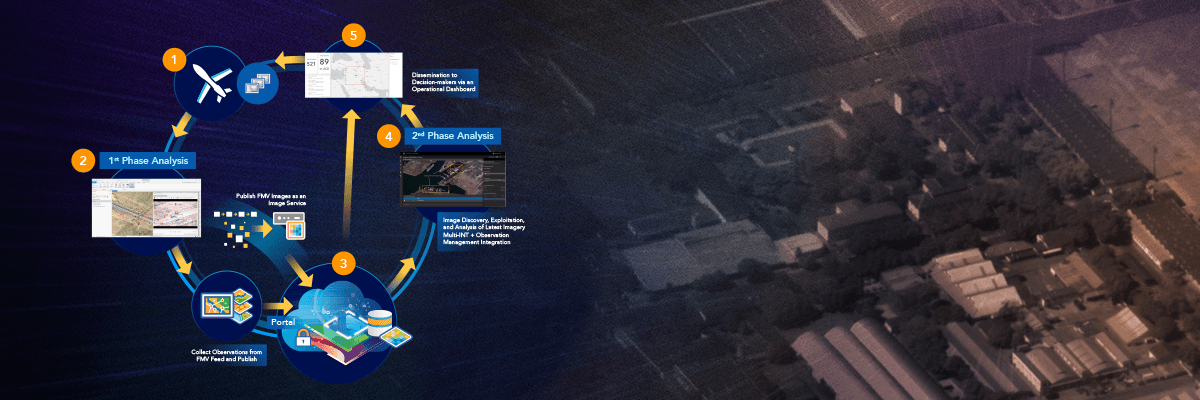
Structured observation management (SOM) is a framework for organizing and sharing GEOINT information—normalizing how to capture and record observations from sensors and sources obtained from an image, intelligence report, or other means by an analyst.
In this webinar, learn how to use ArcGIS as a structured observation management system including workflows for
- Establishing a web-based workflow for locating, identifying, and capturing observations.
- Configuring an enterprise database so that observations can be shared across the organization.
- Sharing data metrics as key information products for stakeholders.
Read more about the September 2020 release of ArcGIS Excalibur.
You can find all of the webinars in our National Government Webinar Series here.
Please continue to connect with the Esri National Government Team.
Find us on Twitter
Connect with our Esri presenters on LinkedIn:
Chris Lee
Ben Conklin
Kurt Schwoppe
Kyle Talbot