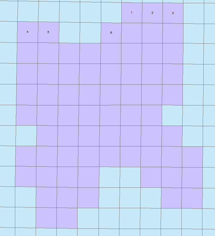
I have a feature class with 40 acre plots and want to create an incremental id for each 40 acre area based on its location. I tried using the sort and calculate unique value geoprocessing script but the 40s are not in a perfect grid (forth row down on the eastern portion) so they don't increment correctly. Does anyone have any experience with this type of dilemma? I attached a screenshot of what I am trying to accomplish (I entered the IDs in manually). I appreciate any help. Thanks!
