Turn on suggestions
Auto-suggest helps you quickly narrow down your search results by suggesting possible matches as you type.
Cancel
- Home
- :
- All Communities
- :
- Products
- :
- Mapping
- :
- Mapping Questions
- :
- Your Suggestions are highly apprciated
Options
- Subscribe to RSS Feed
- Mark Topic as New
- Mark Topic as Read
- Float this Topic for Current User
- Bookmark
- Subscribe
- Mute
- Printer Friendly Page
Your Suggestions are highly apprciated
Subscribe
2771
4
08-05-2021 05:02 AM
08-05-2021
05:02 AM
- Mark as New
- Bookmark
- Subscribe
- Mute
- Subscribe to RSS Feed
- Permalink
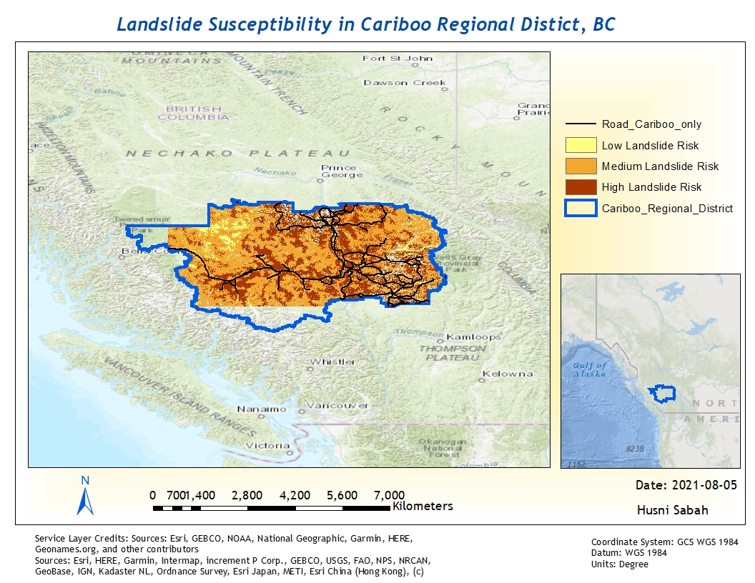
This project is part of a program that I am taking. the map depicts areas of different levels of landslide susceptibility in Cariboo Regional District in British Columbia. I downloaded images Band 4, Band 5 and DEM from NASA so it will cover the boundaries. I ran a number of spatial analysis tools such as mosaic to rasters, rasters to dataset, extraction with mask, NDVI, Slope, from "fill to streams to feature", reclassify and weighted overlay. There are two different projections.. I will like to improve. First, why some areas are white? Why there some are white fuzziness?
I appreciate your feedback
4 Replies
08-05-2021
10:28 AM
- Mark as New
- Bookmark
- Subscribe
- Mute
- Subscribe to RSS Feed
- Permalink
Thanks for the information.
08-05-2021
12:42 PM
- Mark as New
- Bookmark
- Subscribe
- Mute
- Subscribe to RSS Feed
- Permalink
When you train your satellite image, you need to make sure that most of the satellite image pixels have been trained - that is allocated land class categories. The areas that come out white are un-allocated pixels, those which have not been given a category when training was done. The more un-allocated pixel area, the more white spaces.
If you enlarge your image beyond its limits - that is beyond its spatial resolution allowance, the pixels disintegrate and your image will be fuzzy.
Good Luck
If you enlarge your image beyond its limits - that is beyond its spatial resolution allowance, the pixels disintegrate and your image will be fuzzy.
Good Luck
08-06-2021
01:52 PM
- Mark as New
- Bookmark
- Subscribe
- Mute
- Subscribe to RSS Feed
- Permalink
Thanks for this hint