- Home
- :
- All Communities
- :
- Products
- :
- Mapping
- :
- Mapping Questions
- :
- Visualizing Route Maps
- Subscribe to RSS Feed
- Mark Topic as New
- Mark Topic as Read
- Float this Topic for Current User
- Bookmark
- Subscribe
- Mute
- Printer Friendly Page
- Mark as New
- Bookmark
- Subscribe
- Mute
- Subscribe to RSS Feed
- Permalink
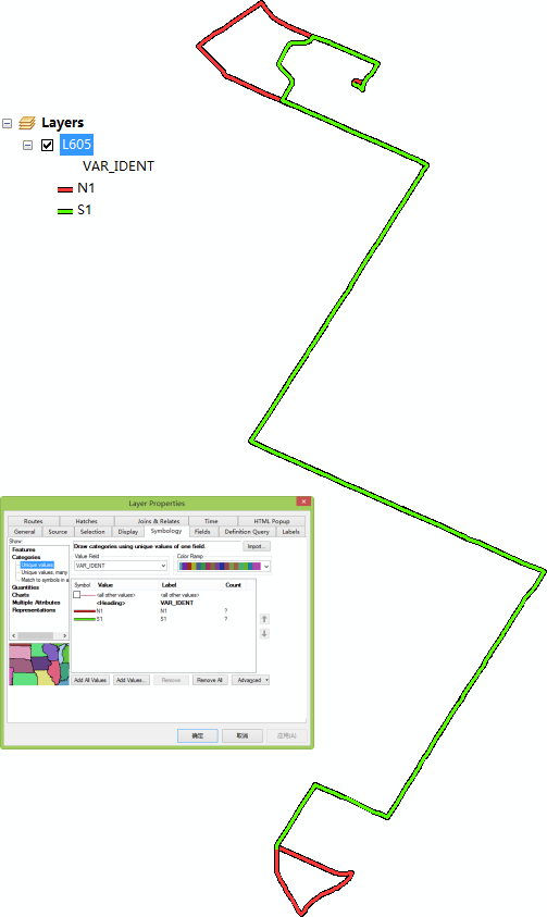
Hi, I'm tring to make a transit map using arcgis desktop.
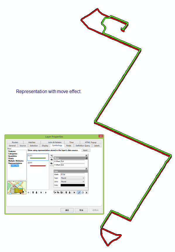
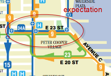
However, I have troubles with the map visualization. How to separate the two trips overlap on the same street? I'm tring to use the representation with move effect, but the results show that the direction of the move affects entire feature. My expectation is the two or more trip collineation display separately.
The attachment is the original shapefile.
Solved! Go to Solution.
Accepted Solutions
- Mark as New
- Bookmark
- Subscribe
- Mute
- Subscribe to RSS Feed
- Permalink
I do not know what version arcmap you have so I am sending a descriptive picture that encapsulates what I did .... If this is what you were after.
- Mark as New
- Bookmark
- Subscribe
- Mute
- Subscribe to RSS Feed
- Permalink
Thank you, Ted. That's what really I want.
- Mark as New
- Bookmark
- Subscribe
- Mute
- Subscribe to RSS Feed
- Permalink
The attachment has been updated, and the L620 issue is followed. Thanks!
- Mark as New
- Bookmark
- Subscribe
- Mute
- Subscribe to RSS Feed
- Permalink
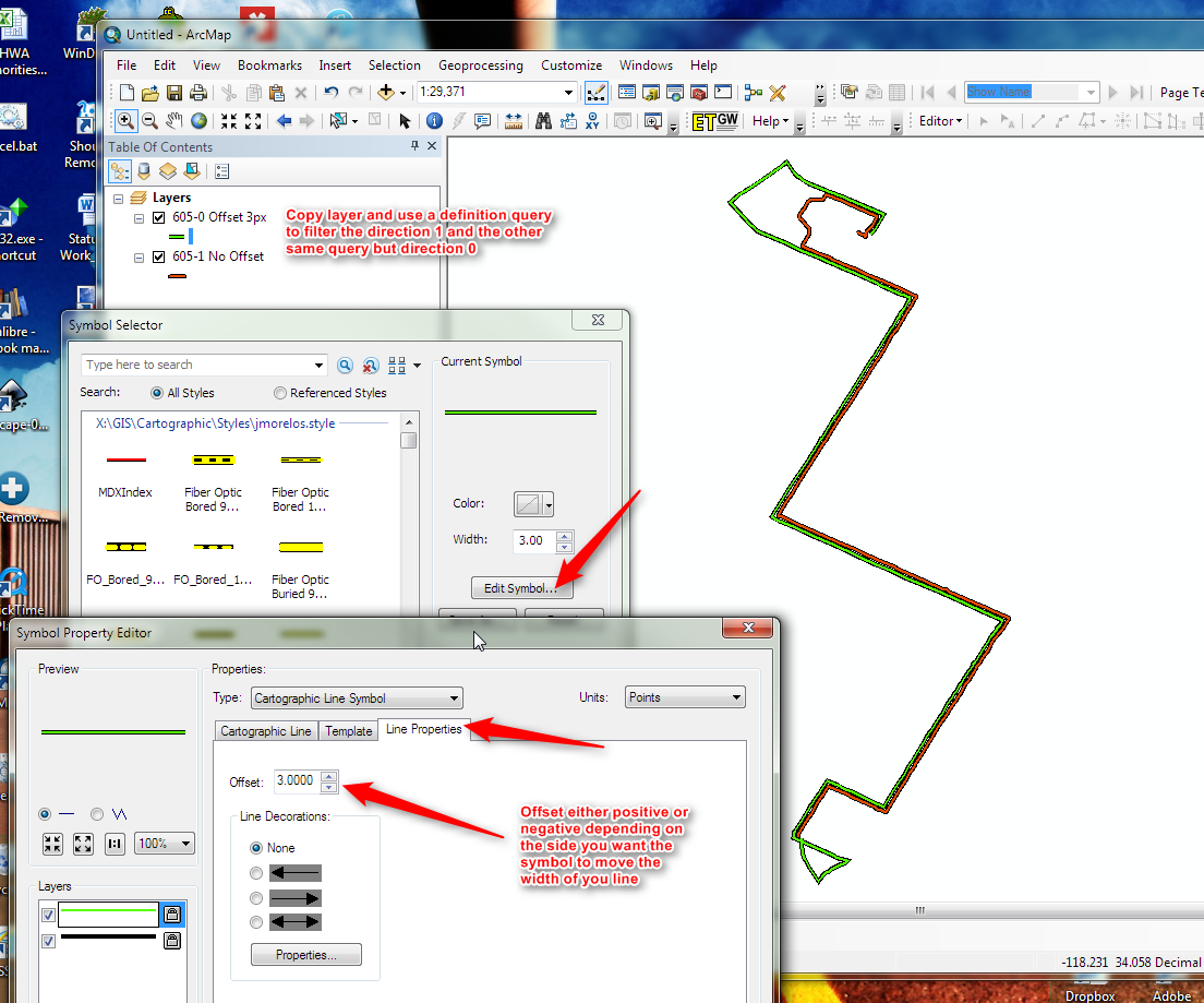
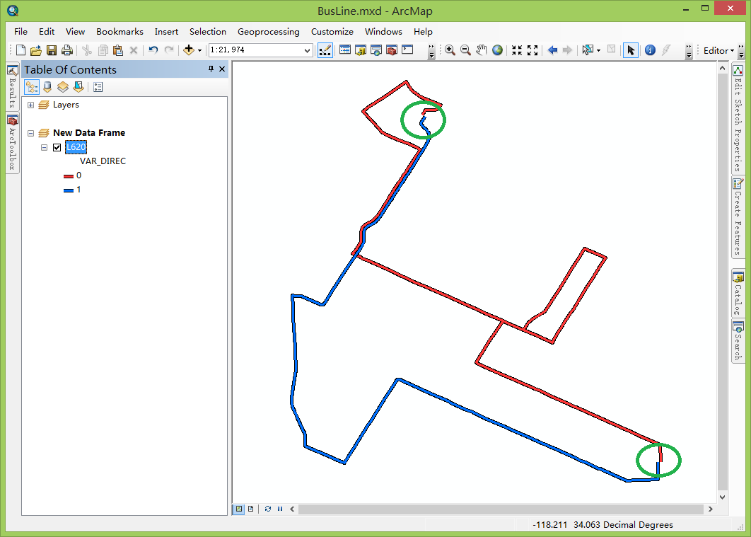
I use the method on another trip, it shows that the offset is affect on entire feature. Thus, the endpoint of two route doesn't connect. How to solve it?
P.S. the version of ArcGIS Desktop is 10.4
- Mark as New
- Bookmark
- Subscribe
- Mute
- Subscribe to RSS Feed
- Permalink
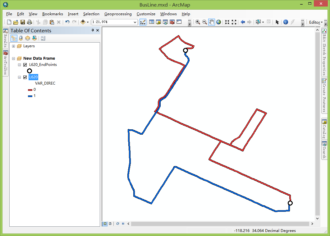
Are those locations terminal points where the routes switch around? You could use a point to represent those locations and symbolize accordingly to mask the apparent offset
- Mark as New
- Bookmark
- Subscribe
- Mute
- Subscribe to RSS Feed
- Permalink
Thank you for your advice, I'm trying to do so.
- Mark as New
- Bookmark
- Subscribe
- Mute
- Subscribe to RSS Feed
- Permalink
It seems much better! 
- Mark as New
- Bookmark
- Subscribe
- Mute
- Subscribe to RSS Feed
- Permalink
nice!
- Mark as New
- Bookmark
- Subscribe
- Mute
- Subscribe to RSS Feed
- Permalink
If you find you will be doing many route maps, an advanced technique you might want to consider is employing Representations. By using Representations, you have more cartographic control on the display of the data. For example, one can offset overlapping lines so they are side-by-side. Even better, unlike some other techniques to visualize data, Representations do not affect the underlying data, just the display of it. However, it is not totally without drawbacks. A big drawback is the time spent learning how to do Representations and then setting up the Representation symbology. If you find you will be revising the same data many times, it can be well worth the investment.
What are representations?—Help | ArcGIS for Desktop
Chris Donohue, GISP