- Home
- :
- All Communities
- :
- Products
- :
- Mapping
- :
- Mapping Questions
- :
- Using icons (pictures) in arcmap
- Subscribe to RSS Feed
- Mark Topic as New
- Mark Topic as Read
- Float this Topic for Current User
- Bookmark
- Subscribe
- Mute
- Printer Friendly Page
- Mark as New
- Bookmark
- Subscribe
- Mute
- Subscribe to RSS Feed
- Permalink
Hi guys,
I'm trying to use some icons (pictures) but i haven't been successful yet.
This is where i got the icons: Offices Google Maps icons | Map Icons Collection
I want to build a 1 meter by 2 meter tourism map of a specific area of Lisbon using these icons to ilustrate where are the restaurants/bars/banks/supermarkets/etc...
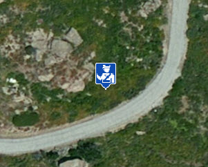
What happens when i add an icon in the arcmap is this:![]()
They have this white area around them but i would really like to take it away. I tried to get some help from some photoshop geeks but whatever the solution, when i upload them to arcmap they just don't change and still have the white edge..
thanks in advance
Solved! Go to Solution.
Accepted Solutions
- Mark as New
- Bookmark
- Subscribe
- Mute
- Subscribe to RSS Feed
- Permalink
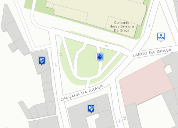
Also in version 10.1 the symbols are displayed without the white square:

Be aware that all layer beneath the points will be rasterized. For more information on that, please read the help topic on "About map printing", especially the part on "Printed map appears blocky or pixelated - Rasterization" in Troubleshooting map printing.
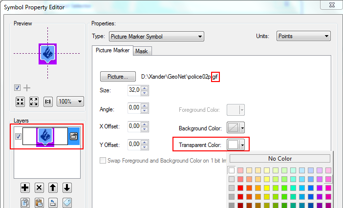
You can also define an equal color for the background and select that color as transparent color (not possible for PNG, but you can do this for GIF, BMP, etc).

This might be a little rough with the symbols you're using since they have a semi-transparent shade surrounding the picture.
- Mark as New
- Bookmark
- Subscribe
- Mute
- Subscribe to RSS Feed
- Permalink
Hi Claudio, to get a transparent background, you will first need to use PNG format. Also, you will need to use a photo editing software to make sure the white is actually transparent. I have not had much luck using free image tools like MS Paint but I think some other applications work OK.
- Mark as New
- Bookmark
- Subscribe
- Mute
- Subscribe to RSS Feed
- Permalink
Hi Leonard.
I'm using PNG format.Regarding the transparency, i had some photoshop geeks trying to solve the problem but they weren't successful. It seams to me that the problem is from arcmap.
- Mark as New
- Bookmark
- Subscribe
- Mute
- Subscribe to RSS Feed
- Permalink
Hey,
Try using paint.net's magic wand tool. If you want, you can attach the image file you want to make transparent and I'll try to make it transparent for you
- Mark as New
- Bookmark
- Subscribe
- Mute
- Subscribe to RSS Feed
- Permalink
Hey Chuck,
Here are the icons:
Police map marker POI icon | Map Icons Collection
As i said...i had some photoshop geeks trying to solve the problem but they weren't successful. It seams to me that the problem is from arcmap.
- Mark as New
- Bookmark
- Subscribe
- Mute
- Subscribe to RSS Feed
- Permalink
- Mark as New
- Bookmark
- Subscribe
- Mute
- Subscribe to RSS Feed
- Permalink
Also in version 10.1 the symbols are displayed without the white square:

Be aware that all layer beneath the points will be rasterized. For more information on that, please read the help topic on "About map printing", especially the part on "Printed map appears blocky or pixelated - Rasterization" in Troubleshooting map printing.
You can also define an equal color for the background and select that color as transparent color (not possible for PNG, but you can do this for GIF, BMP, etc).

This might be a little rough with the symbols you're using since they have a semi-transparent shade surrounding the picture.
