Turn on suggestions
Auto-suggest helps you quickly narrow down your search results by suggesting possible matches as you type.
Cancel
- Home
- :
- All Communities
- :
- Products
- :
- Mapping
- :
- Mapping Questions
- :
- Re: Spatial Index Grid is invalid
Options
- Subscribe to RSS Feed
- Mark Topic as New
- Mark Topic as Read
- Float this Topic for Current User
- Bookmark
- Subscribe
- Mute
- Printer Friendly Page
12-12-2013
10:59 AM
- Mark as New
- Bookmark
- Subscribe
- Mute
- Subscribe to RSS Feed
- Permalink
I'm overlaying the schematic over an existing CAD schematic. My Geometric network is giving me the attached error message.
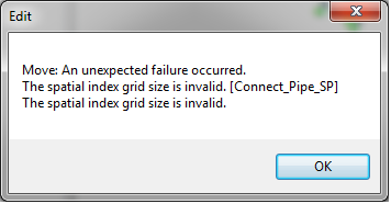
"Edit
Move: An unexpected failure occured.
The spatial index grid size is invalid. [Connect_Pipe_SP]
The spatial index grid size is invalid"
The error is carried into my schematic and the schematic cannot be saved. I switched from a geographic Coordinate system to projected Coordinate system (State Plane) and made sure everything is using the same. Does anyone know how to resolve this error? Not sure how to edit the Spatial Grid in a Dataset....
Thanks.
Solved! Go to Solution.
1 Solution
Accepted Solutions
12-16-2013
10:41 AM
- Mark as New
- Bookmark
- Subscribe
- Mute
- Subscribe to RSS Feed
- Permalink
Difficult to answer without a version number as things have changed a bit.
Anyway, on the schematic side with 10.x, you can do the following:
1. In Catalog, right click the schematic dataset in the database
2. Click Show/Hide Schematic Classes
3. For each ???link??? (edge) schematic class, right-click and choose Properties
4. Click the Indexes tab and click the Delete button at bottom
5. Click Apply
2 Replies
12-16-2013
10:41 AM
- Mark as New
- Bookmark
- Subscribe
- Mute
- Subscribe to RSS Feed
- Permalink
Difficult to answer without a version number as things have changed a bit.
Anyway, on the schematic side with 10.x, you can do the following:
1. In Catalog, right click the schematic dataset in the database
2. Click Show/Hide Schematic Classes
3. For each ???link??? (edge) schematic class, right-click and choose Properties
4. Click the Indexes tab and click the Delete button at bottom
5. Click Apply
Anyway, on the schematic side with 10.x, you can do the following:
1. In Catalog, right click the schematic dataset in the database
2. Click Show/Hide Schematic Classes
3. For each ???link??? (edge) schematic class, right-click and choose Properties
4. Click the Indexes tab and click the Delete button at bottom
5. Click Apply
12-17-2013
05:20 AM
- Mark as New
- Bookmark
- Subscribe
- Mute
- Subscribe to RSS Feed
- Permalink
Thanks, I have re-built my network and schematics and luckily the message is not coming up anymore. Nevertheless, this is very useful in case of future issues....Thanks....