- Home
- :
- All Communities
- :
- Products
- :
- Mapping
- :
- Mapping Questions
- :
- Raster with Streched Symbology not exporting corre...
- Subscribe to RSS Feed
- Mark Topic as New
- Mark Topic as Read
- Float this Topic for Current User
- Bookmark
- Subscribe
- Mute
- Printer Friendly Page
Raster with Streched Symbology not exporting correctly using DDP
- Mark as New
- Bookmark
- Subscribe
- Mute
- Subscribe to RSS Feed
- Permalink
Hi guys,
I have this ddp with a ground elevation grid with a stretched symbology. When I try to do some test exports, not all page comes out right with the imagery. Sometimes the grid is all red or all blue. I have some snapshots below of good (left) and bad (right) result of the ddp exporting,

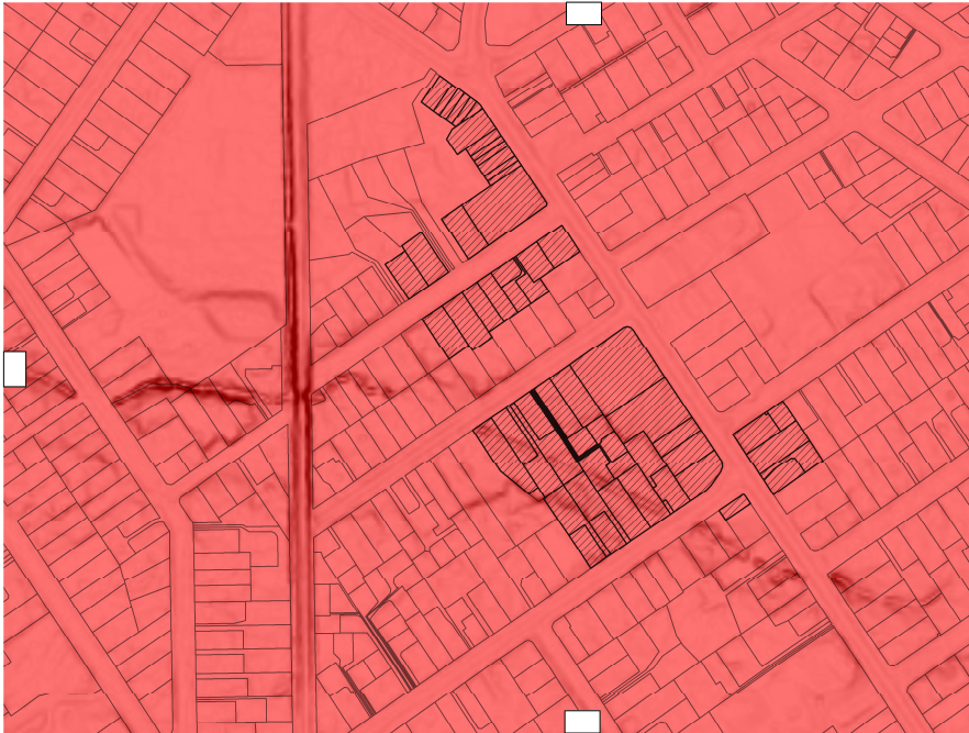
Aside from the stretched symbology, I have further settings for my raster as below,

So basically, my raster value max-min range change for each visible in the current page extent. And I apply the same dynamic behaviour to my raster legend entry. Now the issue is I cannot seems to make them export correctly if by batch, it works for single export.
Is there a limitation on the ddp exports if dealing with rasters setup the way I did.
Regards,
Chris
- Mark as New
- Bookmark
- Subscribe
- Mute
- Subscribe to RSS Feed
- Permalink
OK, basically I had to do a work around on this problem rather than finding out why ddp exports go crazy with my stretched raster symbology, I just export it thru python script as below,
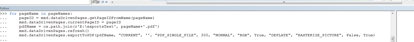
Works fine based on my sample exports.