Turn on suggestions
Auto-suggest helps you quickly narrow down your search results by suggesting possible matches as you type.
Cancel
- Home
- :
- All Communities
- :
- Products
- :
- Mapping
- :
- Mapping Questions
- :
- Increase visible range of vector tile basemap
Options
- Subscribe to RSS Feed
- Mark Topic as New
- Mark Topic as Read
- Float this Topic for Current User
- Bookmark
- Subscribe
- Mute
- Printer Friendly Page
Increase visible range of vector tile basemap
Subscribe
1848
1
05-10-2023 04:25 AM
05-10-2023
04:25 AM
- Mark as New
- Bookmark
- Subscribe
- Mute
- Subscribe to RSS Feed
- Permalink
Hi community,
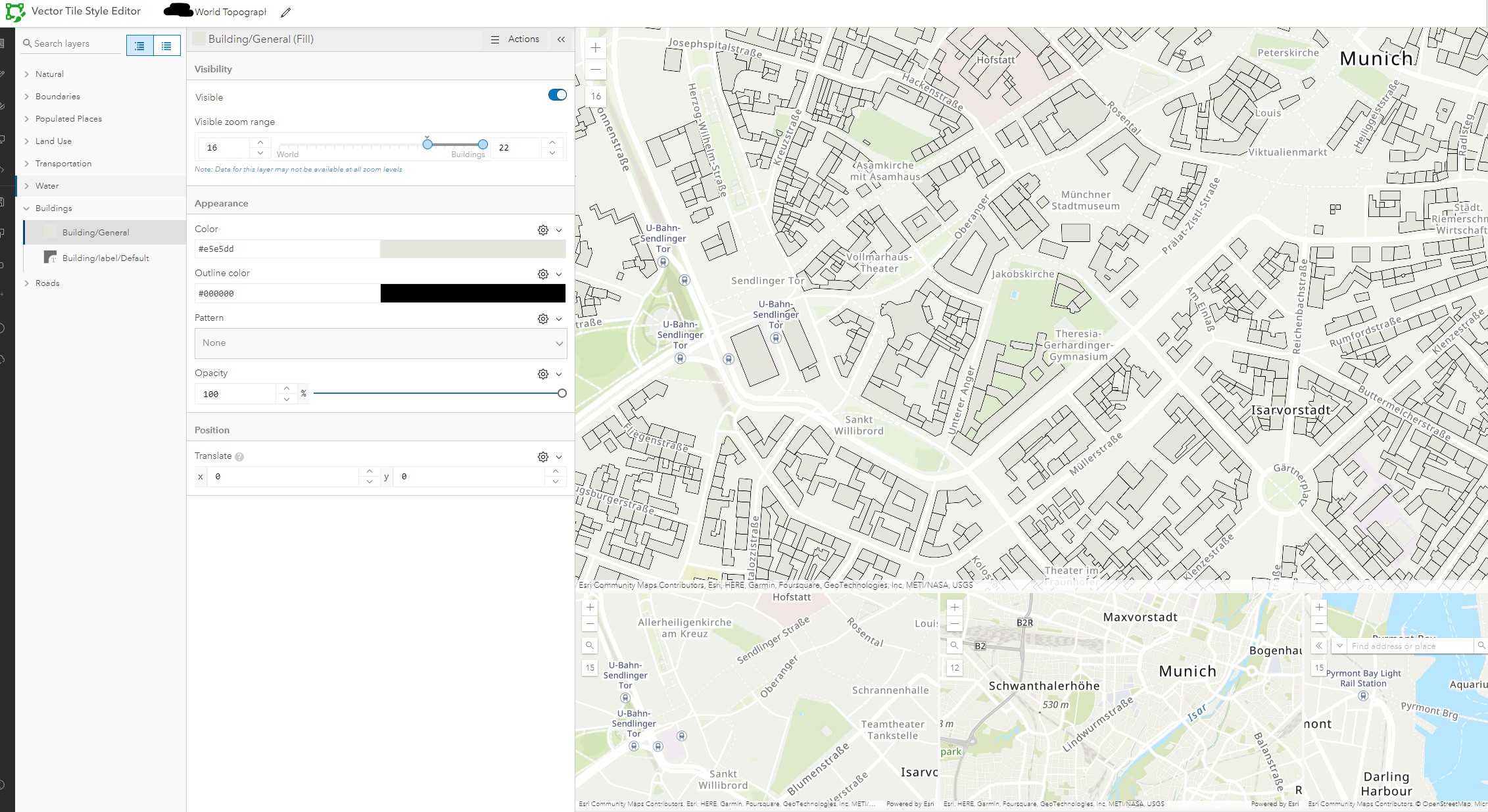
I am using the Vector Tile Style Editor to adjust the World Topographic Map (with Countours and Hillshade). I want to highlight buildings and need them to be visible on a broader range. However, I can set the visible zoom range only between 16 and 22. There is a Note: "Data for this layer may not be available at all zoom levels". Screenshot attached. Is there a way to make the data available at other zoom levels (e.g. 13)?
(I found changing the "minzoom" of Building entry in JSON would help, but that was not the case.)
1 Reply
09-19-2024
06:42 AM
- Mark as New
- Bookmark
- Subscribe
- Mute
- Subscribe to RSS Feed
- Permalink
Hi have you found a solution?