- Home
- :
- All Communities
- :
- Products
- :
- Mapping
- :
- Mapping Questions
- :
- Re: Aerial image quality - Data View vs Layout Vie...
- Subscribe to RSS Feed
- Mark Topic as New
- Mark Topic as Read
- Float this Topic for Current User
- Bookmark
- Subscribe
- Mute
- Printer Friendly Page
Aerial image quality - Data View vs Layout View
- Mark as New
- Bookmark
- Subscribe
- Mute
- Subscribe to RSS Feed
- Permalink
I've got an interesting conundrum...
We recently upgraded from 10.0 to 10.3.1 and my issue has only been happening since the udpate.
When I'm in Data View, my aerial imagery source is super clear, it's very tight resolution imagery.
When I'm in Layout View, the aerial imagery deterioroates and pixellates BIG time.
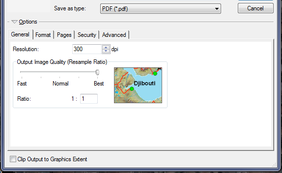
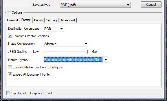
It doesn't matter if I export it as PDF, PNG, JPG, WITH or without image compression (I've tried all the different settings), it just keeps giving me grainy images...
Any thoughts?
- Mark as New
- Bookmark
- Subscribe
- Mute
- Subscribe to RSS Feed
- Permalink
don't rasterize... does that change things?
- Mark as New
- Bookmark
- Subscribe
- Mute
- Subscribe to RSS Feed
- Permalink
It does not. the aerial imagery background (the local version) still exports grainy...
- Mark as New
- Bookmark
- Subscribe
- Mute
- Subscribe to RSS Feed
- Permalink
perhaps calculate statistics for the local image.... according to this thread
Raster image problems when exporting from ArcMap
I did a keyword search on geonet using .... imagery quality export ... limited to 1 year, there are other hits
- Mark as New
- Bookmark
- Subscribe
- Mute
- Subscribe to RSS Feed
- Permalink
Local image is a LYR aerial image file that points to Image Server, which is hosted by the IT GIS group which I have no control over .... 
- Mark as New
- Bookmark
- Subscribe
- Mute
- Subscribe to RSS Feed
- Permalink
Were they from ESRI basemap or did you get them from private company that provide you the aerial imagery ?
Did you change the image to bilinear ?
- Mark as New
- Bookmark
- Subscribe
- Mute
- Subscribe to RSS Feed
- Permalink
The ESRI World Imagery basemap is the one that DOESN'T give me any issues. The local one is the one that does.
- Mark as New
- Bookmark
- Subscribe
- Mute
- Subscribe to RSS Feed
- Permalink
Did you recalculate the statistics as suggested?
- Mark as New
- Bookmark
- Subscribe
- Mute
- Subscribe to RSS Feed
- Permalink
How did they provide you these aerial photos to you or your employer ?
When you get these always review them before you use it .
- Mark as New
- Bookmark
- Subscribe
- Mute
- Subscribe to RSS Feed
- Permalink
Also check this out.
17332 - Maps print or export blocky, chunky, low quality, or raster banded from ArcMap
Think Location