- Home
- :
- All Communities
- :
- Products
- :
- Mapping
- :
- Map Projections Questions
- :
- Re: XY data projecttion problem
- Subscribe to RSS Feed
- Mark Topic as New
- Mark Topic as Read
- Float this Topic for Current User
- Bookmark
- Subscribe
- Mute
- Printer Friendly Page
XY data projecttion problem
- Mark as New
- Bookmark
- Subscribe
- Mute
- Subscribe to RSS Feed
- Permalink
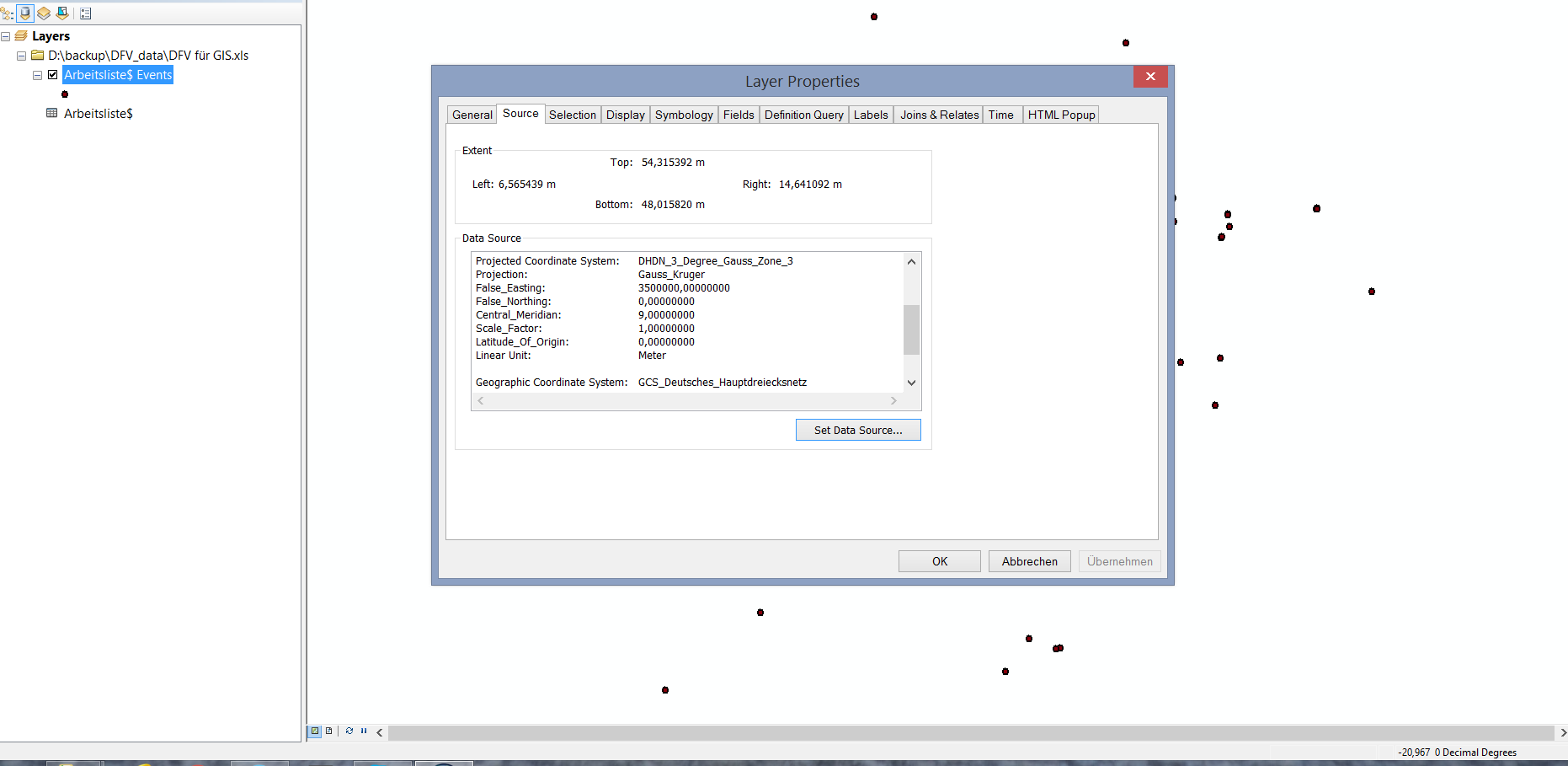
Hello everyone, I was making point data from xls/csv file. But i want to project my data into a Projected coordinate system, not in GCS. As this data is from Germany, so I was trying to make it into DHDN Gauskruger 3 zone 3, but unfortunately this is not working and the dataframe unit is showing decimal, see the attached image bottom right corner. I tried with ESPG 1989 33N also but its same. Any idea?
Regards
muqit
- Mark as New
- Bookmark
- Subscribe
- Mute
- Subscribe to RSS Feed
- Permalink
You have to Define Projection first... telling it what it is, not what you want it to be.
Once it is defined, you can use the Project tool
- Mark as New
- Bookmark
- Subscribe
- Mute
- Subscribe to RSS Feed
- Permalink
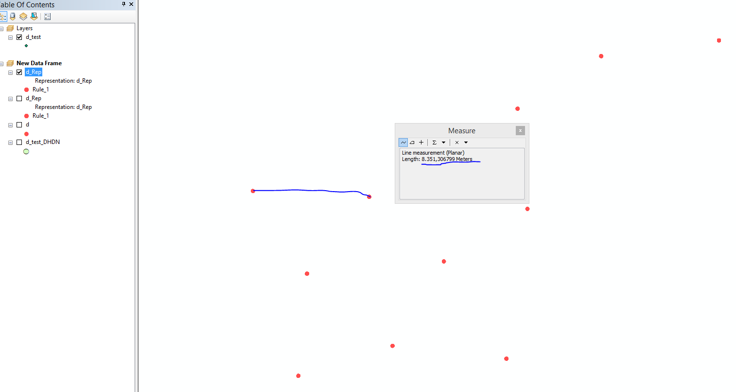
Hello Dan, I am facing trouble to make the disperse locations of similar lat/long values. My projection unit is in meter, I put 1 meter as parameter, but the points are creating at distant locations like 10km or 12 kilometer away, please see the image. I need to view the point markers just beside the actual point.
- Mark as New
- Bookmark
- Subscribe
- Mute
- Subscribe to RSS Feed
- Permalink
What's your original x,y data like? May be you have lon,lat data, but you difine it as projected coordinate (I see you have 0 degree latitude in your map) ?
- Mark as New
- Bookmark
- Subscribe
- Mute
- Subscribe to RSS Feed
- Permalink
Hello Wu, thanks, but i have solved that projection issue. But I cannot create the disperse markers correctly , now points (markers) are creating distant place, like 12 km away from actual place. Any solution?
- Mark as New
- Bookmark
- Subscribe
- Mute
- Subscribe to RSS Feed
- Permalink
Do you know the original long/lat's coordinate system? Maybe the data's GCS is not Deutsches Haupt... . can it be WGS84? There is several hundred meters of diffrence between them. Ask the data provider or try other GCS, and maybe it's not nessasery to change it to projected coordinate.
- Mark as New
- Bookmark
- Subscribe
- Mute
- Subscribe to RSS Feed
- Permalink
But that's why we think you have an incorrect original coordinate system
- Mark as New
- Bookmark
- Subscribe
- Mute
- Subscribe to RSS Feed
- Permalink
May you post some of x,y data?
- Mark as New
- Bookmark
- Subscribe
- Mute
- Subscribe to RSS Feed
- Permalink
Exactly as Dan & Wu says.
Judging by the extent values in your original post, your input points were in some form of GCS (lat/long), but they have been defined as the german grid metres.
This is a mistake. Bring the points in a define them correctly first, then project.
- Mark as New
- Bookmark
- Subscribe
- Mute
- Subscribe to RSS Feed
- Permalink
Hello Neil, thanks, but i have solved that projection issue. But I cannot create the disperse markers correctly , now points (markers) are creating distant place, like 12 km away from actual place. Any solution?
Regards