- Home
- :
- All Communities
- :
- Industries
- :
- Transportation
- :
- Logistics
- :
- Logistics Questions
- :
- Buffer using Excel long/lat and Radii Field Option
- Subscribe to RSS Feed
- Mark Topic as New
- Mark Topic as Read
- Float this Topic for Current User
- Bookmark
- Subscribe
- Mute
- Printer Friendly Page
Buffer using Excel long/lat and Radii Field Option
- Mark as New
- Bookmark
- Subscribe
- Mute
- Subscribe to RSS Feed
- Permalink
Hello geospatial community,
I have an excel document with long-lat coordinates, which contain radii information, however, I can't seem to get the buffer tool to work properly using the 'field' option. My buffered output is much to small. For instance, the point represented in this image has a radius of 292.933 or 0.05 miles.
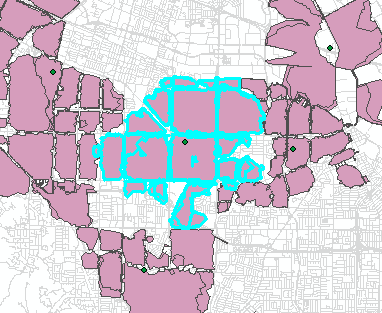
The buffer of this layer is as follows:
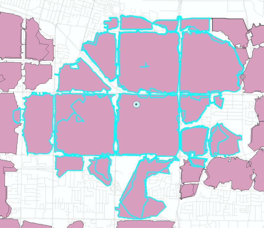
Visually, I just don't see how that small buffer could represent the entire area of the polygon highlighted in blue. I must be doing something wrong but I just don't know what it is.
I tried following the information found here: How To: Create buffers with different radii for point features using linear units
The excel table in Arcmap is as follows:
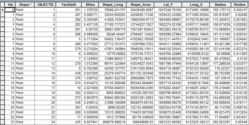
The Radius field is in feet, the Rmiles field is in miles. The radius was derived from the following excel formula
[ =SQRT(H2/PI()) ] where H2 is the Shape_Area.
The purpose is to take polygons which do not overlap, generated through network analyst, and normalize them into circles for input into a geospatial modal.
If anyone is able to point out where I am going wrong please let me know. I have been racking my brain on this one.