- Home
- :
- All Communities
- :
- Products
- :
- Imagery and Remote Sensing
- :
- Imagery Questions
- :
- Re: Convert an Orthomosaic to vector
- Subscribe to RSS Feed
- Mark Topic as New
- Mark Topic as Read
- Float this Topic for Current User
- Bookmark
- Subscribe
- Mute
- Printer Friendly Page
Convert an Orthomosaic to vector
- Mark as New
- Bookmark
- Subscribe
- Mute
- Subscribe to RSS Feed
- Permalink
- Report Inappropriate Content
Greeting
I am Msc student in surveying engineering, I have generated an orthomosaic.tiff (its size 4.5GB) and DTM.tiff (its size 2.5GB) using Pix4D software, I need to making a vectorization to dwg or dxf in order to produce a linemap, I have tried many time to do such conversion using:
AcrToolbox->conversion tools->from raster to ployline, OR raster to polygon.
Unfortunately after a few hours of conversion nothing will display and converted file is empty.
Could you please clarify the procedure if this type of conversion is possible.
- Mark as New
- Bookmark
- Subscribe
- Mute
- Subscribe to RSS Feed
- Permalink
- Report Inappropriate Content
The main term to search for is "edge detection" and I've already provided links to convolution filters as a start. What have you tried so far?
- Mark as New
- Bookmark
- Subscribe
- Mute
- Subscribe to RSS Feed
- Permalink
- Report Inappropriate Content
This link might be of use , What is editing?—Help | ArcGIS for Desktop The section on creating lines and polygons is appropriate, since you haven't given any of Darren's suggestions a try.
- Mark as New
- Bookmark
- Subscribe
- Mute
- Subscribe to RSS Feed
- Permalink
- Report Inappropriate Content
Dear Dan
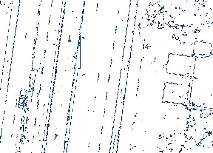
I have done all steps that was Dareen said such as filtering, segmentation, classification, cleaning up, ...etc, also I have generated CAD format vector file (as you see in the screen shot), as you see there are many unlike features need to be eliminated! unfortunately I could't be able to eliminating, therefor I tried to perform filtering again, still I have a problem converting from RGB to Grayscale.
- Mark as New
- Bookmark
- Subscribe
- Mute
- Subscribe to RSS Feed
- Permalink
- Report Inappropriate Content
I don't think the problem is the colour, you are still left with a large number of artifacts in the data. It appears that an automated process is producing results less than satisfactory for your purposes. Is there a reason that you have to pursue this route rather than taking a more human-interaction one?
- Mark as New
- Bookmark
- Subscribe
- Mute
- Subscribe to RSS Feed
- Permalink
- Report Inappropriate Content
Dear Dan
Thank you for pursuing me in this issue, my supervisor suggested to perform linemap using automatic feature extraction instead of manually digitizing, because he believed that manually digitizing could't be able to digitize exact pixel which represents an edge, I think if I solved RGB to Grayscale problem output result would be more satisfactory. last link not solved may problem.
- Mark as New
- Bookmark
- Subscribe
- Mute
- Subscribe to RSS Feed
- Permalink
- Report Inappropriate Content
You may wish to show your initial findings. My suspicion is that there is too much emphasis being placed at the pixel level and the fact that the automated process is unable to pull out the features that you need. It appears that the focus is on the wrong scale. Do be aware that image processing techniques are not solutions to problems... they are tools... sometimes tools perform better in certain environments than others. I would be less concerned at how well it performs at the pixel level but focus on the observation that it doesn't do well in extracting the linear features you need from THAT particular type or source of data. All is not lost... you still have to write it up.
I would be nice if someone else chimed in with any suggestions on how to improve the results...forget the color issue for now.
- Mark as New
- Bookmark
- Subscribe
- Mute
- Subscribe to RSS Feed
- Permalink
- Report Inappropriate Content
Dear Darren
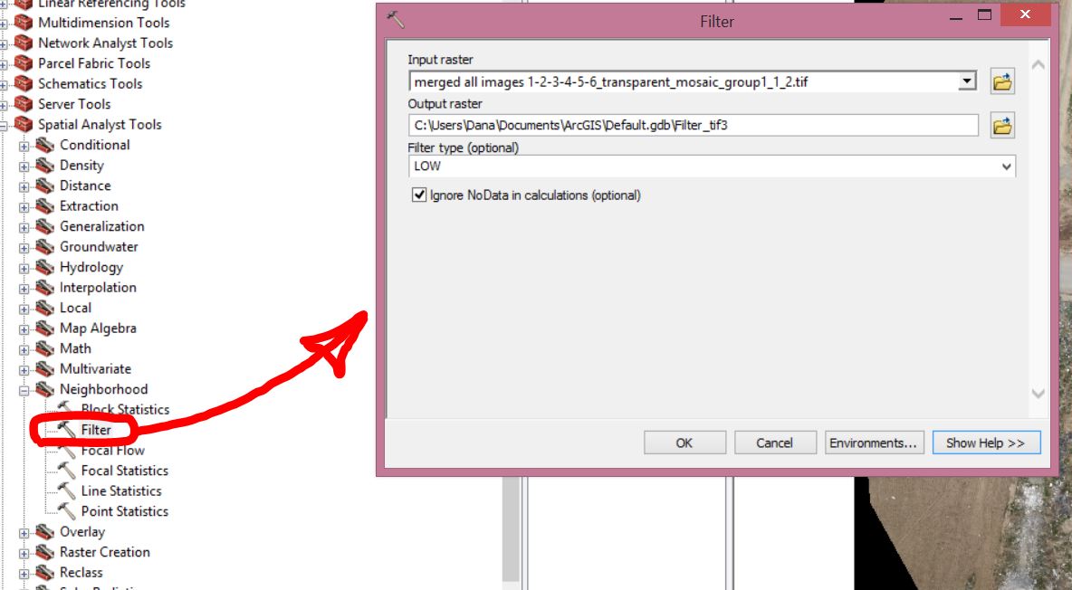
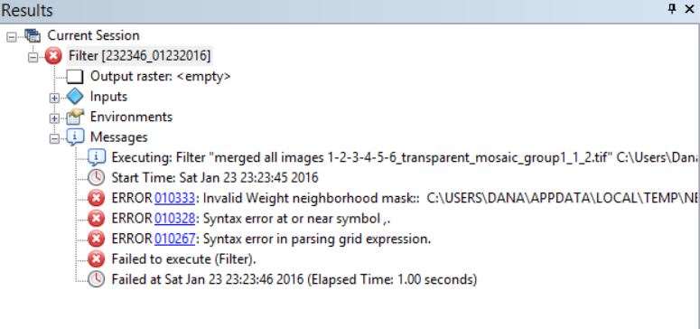
I as a civil engineer GIS field is new and too much hard/complex for me, therefore applogize if disturbed you, I have tried many time to do the Low-Pass filter, unfortunately all trials are failed (as you see in screenshots), could you please clarify briefly how can I do smoothing (low-pass)->edge detecting (Laplacian).
- Mark as New
- Bookmark
- Subscribe
- Mute
- Subscribe to RSS Feed
- Permalink
- Report Inappropriate Content
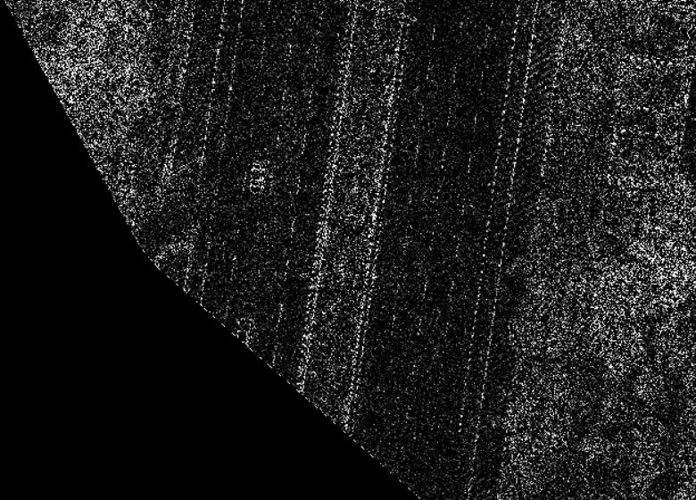
Dear Dareen
I have performed high-pass filter successfully (as you see in screenshot), after high-pass I have performed raster to polyline/polygon conversion unfortunately no line clear in the output, therefore, could you please instruct me how can I perform edge detection in Arc Map or python? as I understanded from internet searching about edge detection is mostly using python, actually I don't have any knowledge about python.
- Mark as New
- Bookmark
- Subscribe
- Mute
- Subscribe to RSS Feed
- Permalink
- Report Inappropriate Content
Rojgar
I think we need to start with the basics. What do you want to see in this output vector file? If you're seeking elevation (terrain) contours, that can be easily done using the DSM but not the orthomosaic. (note you may have to correct the DSM for absolute elevation; most DSMs output from Pix4D will not be at the correct Z value unless you added ground control).
Converting the orthomosaic to vectors does not make any sense to me.
Can you post a screenshot or upload an example of what you are seeking as a linemap? It doesn't have to go with this image, any example will do
Thanks
Cody B.
- Mark as New
- Bookmark
- Subscribe
- Mute
- Subscribe to RSS Feed
- Permalink
- Report Inappropriate Content
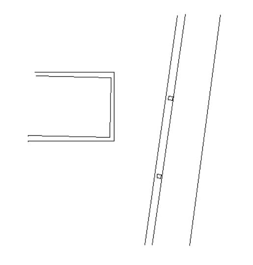
Cody
What I am looking to display on the line map is ONLY edges/corners of features like manmade features (House, road, manhole, yard, ...etc as you see in the screen shoot