Turn on suggestions
Auto-suggest helps you quickly narrow down your search results by suggesting possible matches as you type.
Cancel
- Home
- :
- All Communities
- :
- Products
- :
- Imagery and Remote Sensing
- :
- Imagery Questions
- :
- Raster dataset rendering
Options
- Subscribe to RSS Feed
- Mark Topic as New
- Mark Topic as Read
- Float this Topic for Current User
- Bookmark
- Subscribe
- Mute
- Printer Friendly Page
Raster dataset rendering
Subscribe
463
0
03-15-2019 12:18 PM
03-15-2019
12:18 PM
- Mark as New
- Bookmark
- Subscribe
- Mute
- Subscribe to RSS Feed
- Permalink
- Report Inappropriate Content
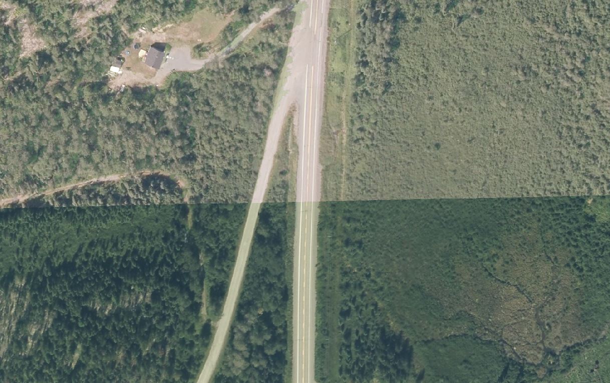
Hi everyone,
I used "Mosaic to new raster" tool and two rasters (jp2 format) as input to create a new geodatabase based raster. When I add the resulting raster to ArcMap there is a difference in the color of the image along the limite of the two rasters that served as input to the tool. I would like to know if it is possible to homogenize the display of this new raster.
Thanks
0 Replies