- Home
- :
- All Communities
- :
- Products
- :
- Imagery and Remote Sensing
- :
- Imagery Questions
- :
- Mosaic Dataset drawing error
- Subscribe to RSS Feed
- Mark Topic as New
- Mark Topic as Read
- Float this Topic for Current User
- Bookmark
- Subscribe
- Mute
- Printer Friendly Page
Mosaic Dataset drawing error
- Mark as New
- Bookmark
- Subscribe
- Mute
- Subscribe to RSS Feed
- Permalink
- Report Inappropriate Content
Started gettting ArcMap drawing errors with Mosaic Datasets after we upgraded to 10.6.1 (from 10.4.1).
Usually happens when user clicks Previous Extent 3-4 times in quick succession and is at a level that is displaying overview. Does not happen when user is zoomed in far enough they are viewing original image.
I have Overviews built, Pyramids not built, Statistics are calculated. Is there something else I need to set or run?
- Mark as New
- Bookmark
- Subscribe
- Mute
- Subscribe to RSS Feed
- Permalink
- Report Inappropriate Content
Mike,
I would recommend checking the MaxPS value for the primary imagery. I would make sure that this value is set to a value that is equal to the highest MinPS value for the level 1 overviews, so that the system isn't trying to draw the primary imagery at levels where the service overviews are being drawn.
Best wishes,
Andrew.
- Mark as New
- Bookmark
- Subscribe
- Mute
- Subscribe to RSS Feed
- Permalink
- Report Inappropriate Content
Check the values, all the MaxPS for primary are same as MinPS for lvl 1 overviews.
- Mark as New
- Bookmark
- Subscribe
- Mute
- Subscribe to RSS Feed
- Permalink
- Report Inappropriate Content
Mike,
In that case I'm afraid that I don't have any other suggestions as to what might be happening with this mosaic.
Andrew.
- Mark as New
- Bookmark
- Subscribe
- Mute
- Subscribe to RSS Feed
- Permalink
- Report Inappropriate Content
I would try to delete the overviews and rebuild them.
It takes a little time (depend on the data size) but might solve the problem.
Have fun
- Mark as New
- Bookmark
- Subscribe
- Mute
- Subscribe to RSS Feed
- Permalink
- Report Inappropriate Content
Mike,
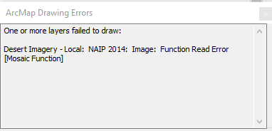
Were you able to get this issue resolved? We're testing ArcGIS 10.6.1 now and are running into the same problem. Any mosaic dataset we try, no matter if it was created back in 10.3.1 or brand new in 10.6.1, no matter if it's in a file geodatabase or our enterprise geodatabase, it causes this error. It seems to be when a user tries to move the display (or otherwise click, which stops drawing) while ArcMap is still drawing the raster. Usually changing extents very quickly will cause this to pop up and disappear in rapid succession.
It's usually:
"[Layer Name]: Image: Function Read Error [Mosaic Function]".
Sometimes it's:
"[Layer Name]: Image: Function Read Error [RasterInfo Function]".
Those are the only two error messages I've seen. Refreshing or moving the map display again will cause it to go away, but an empty "ArcMap Drawing Errors" window remains open. Overviews can help the raster draw faster, which reduces the chance of the error, but it still occurs if you can click fast enough.
This is the only thread on this issue I've found, so hoping you can tell what your experience was and whether you were able to find a solution.
Thanks!
John
- Mark as New
- Bookmark
- Subscribe
- Mute
- Subscribe to RSS Feed
- Permalink
- Report Inappropriate Content
John - I was never able to find a solution for this. If user pans/zooms too fast still get the draw errors. Maybe 10.7 will have a fix?
- Mark as New
- Bookmark
- Subscribe
- Mute
- Subscribe to RSS Feed
- Permalink
- Report Inappropriate Content
Thanks, Mike! I appreciate the information and glad we're not the only ones experiencing this!
- Mark as New
- Bookmark
- Subscribe
- Mute
- Subscribe to RSS Feed
- Permalink
- Report Inappropriate Content
Have you reported this to tech support?
I would highly recommend it if you can duplicate the issues easily in fGDB and EGDB. That way the issue can be investigated.
- Mark as New
- Bookmark
- Subscribe
- Mute
- Subscribe to RSS Feed
- Permalink
- Report Inappropriate Content
Thanks. We just really investigated what was happening today, but we plan on submitting a support ticket Monday probably, especially since I haven't seen it in any official Esri bug documentation. I was surprised not to see more discussion on it since I presume it affects everyone on 10.6.1 who uses mosaic datasets (and likes to click around the map quickly...).