- Home
- :
- All Communities
- :
- Products
- :
- Imagery and Remote Sensing
- :
- Imagery Questions
- :
- Landsat 8 Pan-sharpening and clipping in ArcGIS 10
- Subscribe to RSS Feed
- Mark Topic as New
- Mark Topic as Read
- Float this Topic for Current User
- Bookmark
- Subscribe
- Mute
- Printer Friendly Page
Landsat 8 Pan-sharpening and clipping in ArcGIS 10
- Mark as New
- Bookmark
- Subscribe
- Mute
- Subscribe to RSS Feed
- Permalink
- Report Inappropriate Content
I am currently working with Landsat 8 imagery and an having a hard time pan-sharpening the imagery to get a better resolution. Then option under properties>pan-sharpening to choose an infrared image as the 4th band is greyed out. I am not sure if I am going about this right. Should I create an new mosaic dataset first, then a natural color image and follow that with the pan-sharpening? Any tutorials on this would help.
Second question is, when I clip the raster image from the study area boundary, the color of the pixels changes. How do I prevent this discoloration and maintain the natural color of the pixels? My analysis is dependent upon the pixels maintaining their natural color. Any help would be appreciated.
Solved! Go to Solution.
Accepted Solutions
- Mark as New
- Bookmark
- Subscribe
- Mute
- Subscribe to RSS Feed
- Permalink
- Report Inappropriate Content
Norman
1) re: clip and color changes, yes your understanding is correct. try that, and if you're still seeing a color change, then we have to figure out what's wrong. You are correct in expecting that you should be able to see exactly the same, before and after... HOWEVER, I'd put this on hold until you consider other advice - I'm not sure you should use "clip" on anything before perhaps a final, classified raster... ( If you "clip" you end up with an exported version of the imagery and will typically lose connection to the metadata, and that metadata is critical for doing classification).
2) I'm glad you're on 10.3.1! That is the good news... The bad news is, I think you should start over re: workflow. There's no need to copy pixels into a GDB - it just duplicates data and may break the link to original metadata. When you have time to read, I'd encourage you to learn more about the Mosaic Dataset and understand alternatives by reviewing our “Image Management Guidebook” = http://esriurl.com/6007 but that is not a very direct answer to this question... What I would recommend is
- for working with an individual image, you can use the Raster Product (expand the little satellite icon in Catalog) - you'll see the Pan Sharpened output is prebuilt for you
- (A second #1. I love auto formatting) If you're working with multiple images, create a mosaic dataset, then when you "Add Rasters" be sure to use the Landsat 8 Raster Type. That will add function chains to derive the pan sharpened product automatically.
- You can also use the supervised classification tools directly on the mosaic dataset (but NOTE pan sharpened imagery is NOT appropriate for classification...)
- note all of your work will be done "on the fly" (without duplicating disk space) so when you get a good classified result, you can either export it, or just save the MXD to return to the output products you create.
- I think I had a fourth recommendation but need to run to another meeting - my apologies - I will revise this or add a follow up post as possible...
Cody B.
- Mark as New
- Bookmark
- Subscribe
- Mute
- Subscribe to RSS Feed
- Permalink
- Report Inappropriate Content
I suggest you to use a professional program to manage remote sensing data and satellite images.
You can try erdas imagine, Envi, Geomatica, erdas ermapper or the good avenza geographic imager extension for adobe photoshop.
At least you need to upgrade your arcgis at the v10.2.2 or 10.3 version. these new version are contains now a decent tools to analyze satellite images.
- Mark as New
- Bookmark
- Subscribe
- Mute
- Subscribe to RSS Feed
- Permalink
- Report Inappropriate Content
Nicola,
I am sorry about not clarifying the version. I am using ArcMap 10.3.1.
Norman Nash
- Mark as New
- Bookmark
- Subscribe
- Mute
- Subscribe to RSS Feed
- Permalink
- Report Inappropriate Content
Norman - several questions to clarify what you're attempting to do, but you can do pan sharpening in ArcGIS.
First, your subject says ArcGIS 10 - does this mean you are using 10.0?
Second, are you using the image analysis window (IAW) to reference the image, and moving to a Mosaic Dataset (MD) is your alternative, or are you using a MD and just not getting the raster function to work properly? Note with a later version of ArcGIS and a mosaic dataset using the Landsat 8 raster type, pan sharpening may be applied automatically - but for now I'll assume upgrading to a current version is not possible. In 10.0, you can use the IAW to pan sharpen as described in this help topic: ArcGIS Desktop
Note that topic describes exporting to save the image, but you can also simply save the map in MXD format, and any time you need to access the pan sharpened image, reload that MXD. (otherwise, exporting will take up disk space - and with L8, that's a pretty big file!)
If you're using an MD and want to get pan sharpening working in a raster function chain (e.g. you have multiple scenes?), let me know and I can expand on this. This topic may be helpful http://resources.arcgis.com/en/help/main/10.1/index.html#/Exercise_7_Creating_a_pan_sharpened_natura...
...but note it refers to Landsat 7 (implies using the L7 raster type), and I'm guessing it won't work properly with Landsat 8 since the metadata changed - I'd have to work through a test to advise if those instructions would need to be modified for L8...
I'll reply separately re: histogram/color change after clipping.
Cody B.
- Mark as New
- Bookmark
- Subscribe
- Mute
- Subscribe to RSS Feed
- Permalink
- Report Inappropriate Content
Cody,
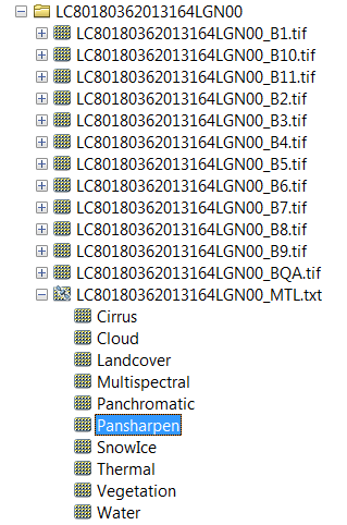
First, I am using ArcMap 10.3.1. Second, I downloaded the imagery from glovis and then used the "Raster to Geodatabase" tool to bring in the Bands 4, 3, 2 and 8. Then I used arc toolbox>raster processing> composite bands and added these which created the natural color image (just with bands 4, 3, 2). I am not sure if this is correct since I really do not have much experience doing RS. Then problem I am having is creating the mosaic dataset because when I go to import these bands, there is nothing (no .tiff files) under the geodatabase that was created using the raster to geodatabase tool. Do I need to use the raster to geodatabase tool for this or can this be done without that step.
The resource that you sent me is the one that I have been following but I do appreciate that.
As far as the histogram/color change after clipping, I will follow your instructions and get back to you on that. So if I am understanding you correctly, the natural color image before the clip should be set to "None" on the stretch, then use the clip and change the stretch to "NONE"?
Thanks,
Norman N.
P.S. The goal of this project is to use supervised classification of Landsat 8 imagery and compare the accuracy to supervised classification of GeoEye imagery. I am new to this but am working on a thesis and am learning as I go so you may get quite a lot of questions.
- Mark as New
- Bookmark
- Subscribe
- Mute
- Subscribe to RSS Feed
- Permalink
- Report Inappropriate Content
The natual color combination is 1, 2 and 3. the combination 4,3 and 2 is used to vegetation analysis and land use. BEfore apply the pan sharpening, add a stretch filtrer to correct the natural color.
Also you need to apply the stretch to the pan 8 band.
Than finally you can do the final pan sharpering to upgrade the 15 meters resolution to the RGB combination.
On youtube you can find usefull videos to apply the standard stretch to the RGB combination bands and to the pan band
I guess you are using standard landsat 7 or 8..
- Mark as New
- Bookmark
- Subscribe
- Mute
- Subscribe to RSS Feed
- Permalink
- Report Inappropriate Content
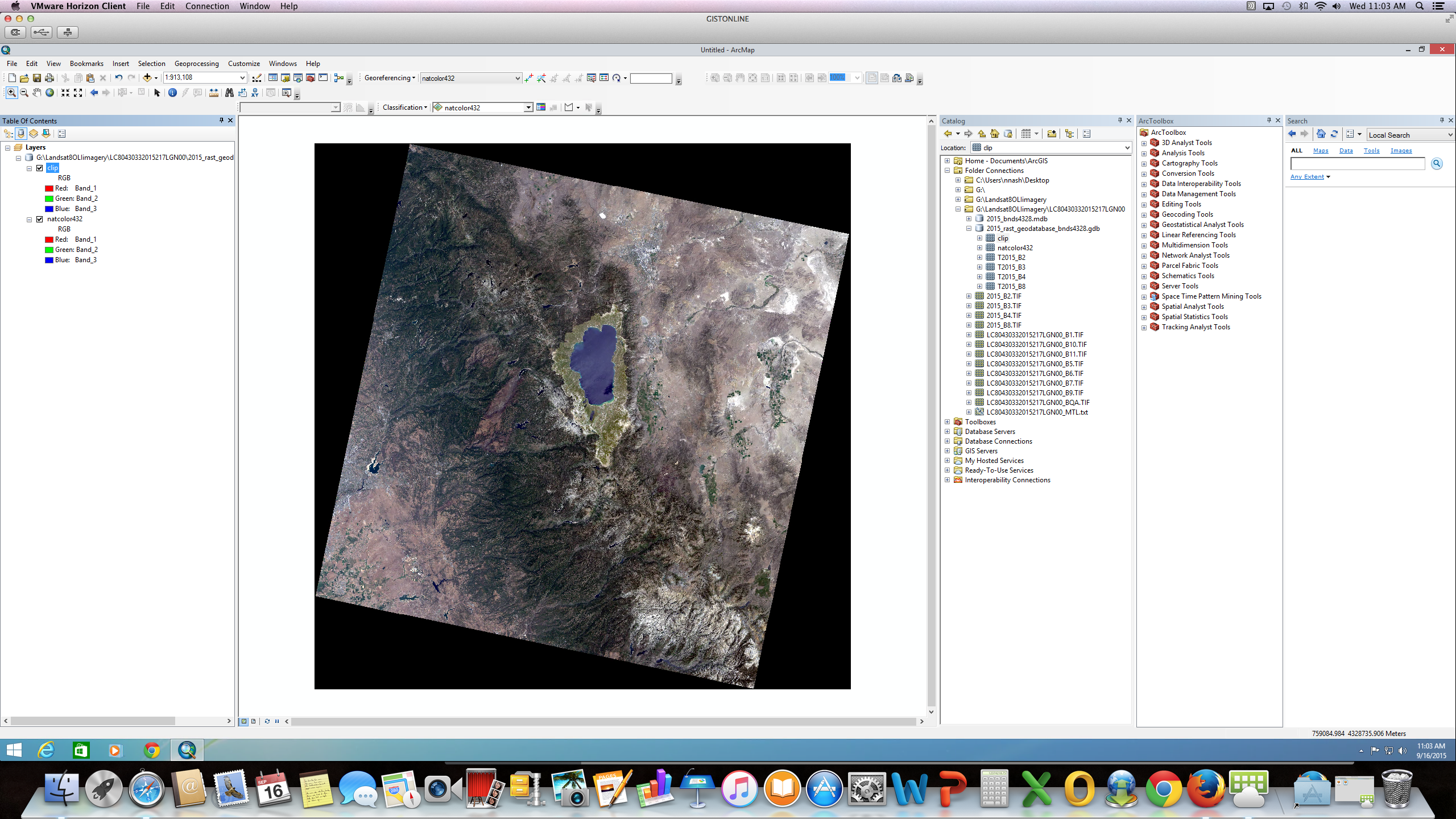
I was under the impression that Landsat 8 natural color was bands 4, 3, 2. Bands 1, 2, 3 would be coastal aerosol, Blue and Green respectively. Bands 4 (red), 5(NIR), 6/7(SWIR), 8(cirrus). So before I create a natural color image, I need to individually apply the standard stretch to all bands that I use? I have attached two screenshots. One natural color image using bands 4, 3, 2 from landsat 8 as well as one with the clip of the study region. You can see that the color has changed.
Thanks 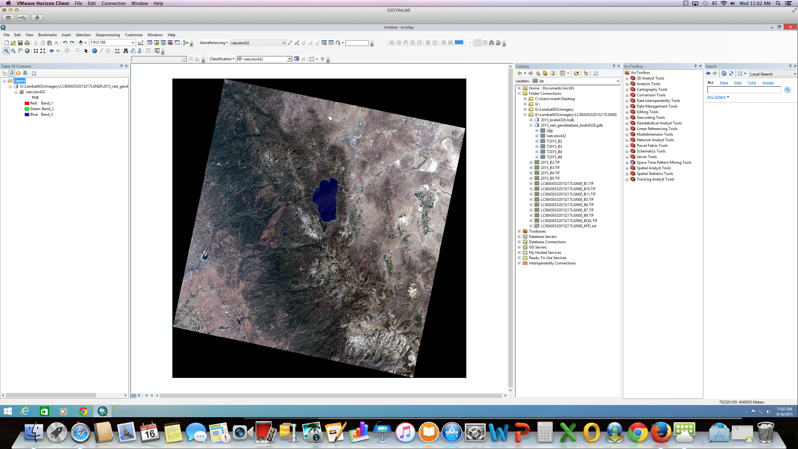
- Mark as New
- Bookmark
- Subscribe
- Mute
- Subscribe to RSS Feed
- Permalink
- Report Inappropriate Content
Norman
You are correct. The spectral bands for Landsat 7 and 8 are not the same. For L8, true color is 4/3/2 See this link What are the band designations for the Landsat satellites?
Cody B.
- Mark as New
- Bookmark
- Subscribe
- Mute
- Subscribe to RSS Feed
- Permalink
- Report Inappropriate Content
Cody,
Thank you for the reassurance. And thank you for pointing out the Image analysis window. It will be much easier to make progress using this rather than the toolbox. Like I said, I am new to this.
Much appreciation
Norman Nash
- Mark as New
- Bookmark
- Subscribe
- Mute
- Subscribe to RSS Feed
- Permalink
- Report Inappropriate Content
Cody,
By the way, did you see the screenshots on my reply to Nicola?