- Subscribe to RSS Feed
- Mark as New
- Mark as Read
- Bookmark
- Subscribe
- Printer Friendly Page
On June 23, 2018, 12 members of a junior soccer team and their coach became trapped inside a flooded cave in Thailand's Chiang Rai province. They'd ventured in after practice, in part to celebrate one team member's birthday. Sudden and heavy rainfall forced the group deeper into the flooding cave to seek high ground, which they found at a location known as Pattaya Beach. After going missing, the team's bicycles and other belongings were found at the entrance, and the ensuing rescue brought in some of the world's best divers and rescue personnel to the cave.
On July 2, the team was discovered alive at Pattaya Beach, however the logistics of evacuating the team seemed overwhelming. Tragically, one highly experienced diver lost his life returning from a support dive delivering oxygen tanks to staging areas for the rescue.
According to Wikipedia:
The rescue efforts included a total of over 10,000 people – including more than 100 divers, many rescue workers, representatives from about 100 government agencies, 900 police officers, and 2,000 soldiers – 10 police helicopters, seven police ambulances, more than 700 air canisters (of which more than 500 were in the cave at any one time and another 200 were in the queue to be refilled), and the removal of more than 1 billion liters of water (the equivalent of 400 Olympic-size swimming pools).
On July 8, four of the boys were rescued using scores of support divers and rescue personnel, and all twelve were out by July 12. See the Wikipedia article for all the details.
Cave maps
According to Wikipedia
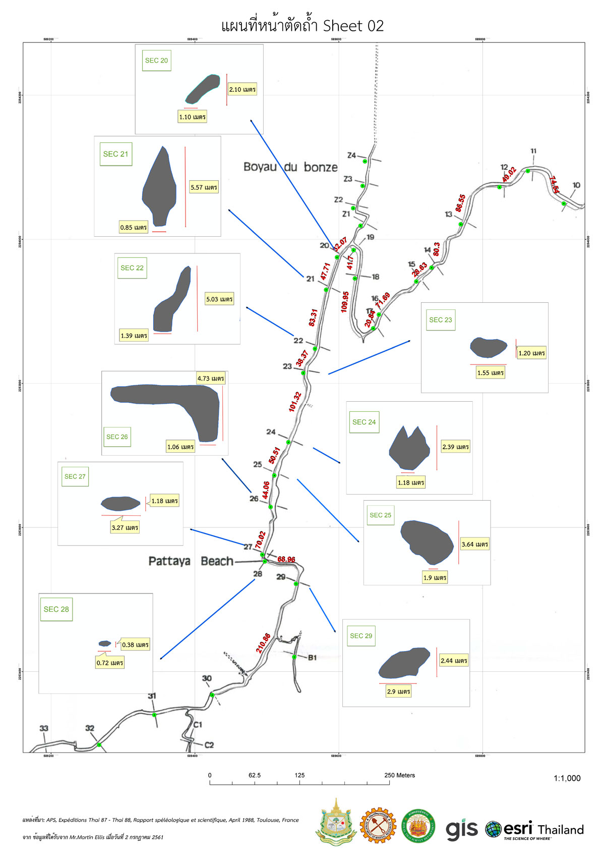
A team of French cavers made the first survey of Tham Luang's main cave in 1986 and 1987. Further surveys were done in 2014 and 2015 by the British cavers Vern Unsworth, Martin Ellis, Phil Collett, and Rob Harper.
Maps from these surveys helped guide the dive and rescue efforts. Shown below is one of the annotated maps prepared by Esri Thailand from the archived cave survey data and published maps that was used for logistics planning.
GIS Maps
Esri Thailand supported the efforts using GIS to create maps and perform analysis. Some of their work included:
- Creating a 3D representation of the cave (generated using archived survey data from British cavers).
- Developing 3D models to measure the depth to the cave from the surface terrain, identify low-slope areas for possible equipment deployment, and to examine the potential for surface drilling to enter the cave.
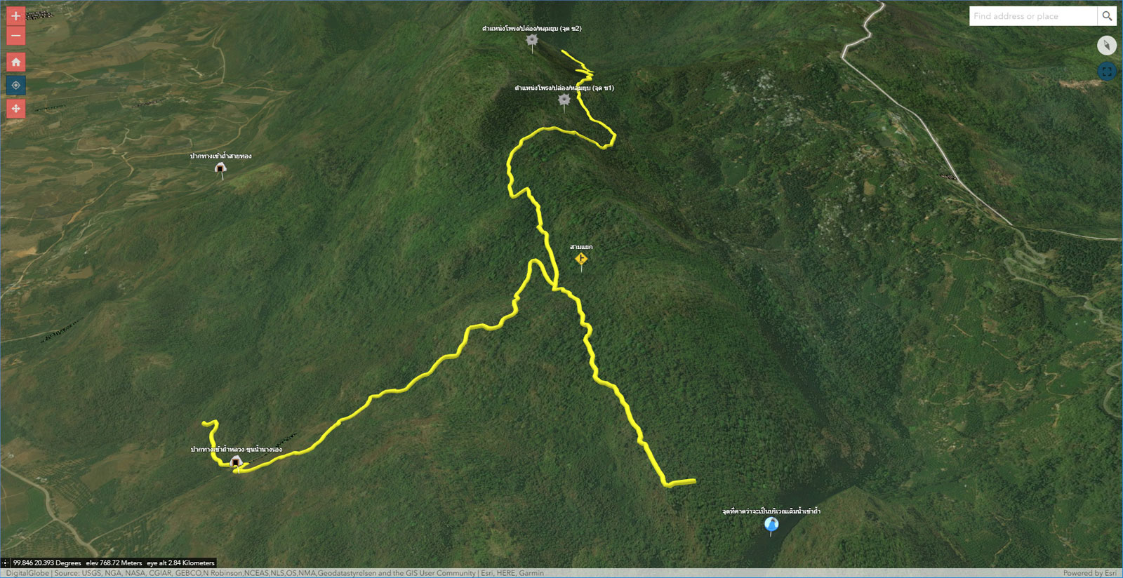
- Generating operational maps for rescue logistics.
- Generating reliable and accurate topographic data, such as DEMs, contours, and orthophotos.
- Using ArcGIS Hydro tools to determine candidate locations for surface water diversion away from the cave.
A Web AppBuilder 3D app used to display a scene showing the generalized cave outline draped on the surface. The entrance is to the lower left in this image.
A generalized 3D model of the cave was created, shown here in the Scene Viewer beneath a partially transparent surface, to evaluate potential drilling sites and visualize the cave in relation to surface topography.

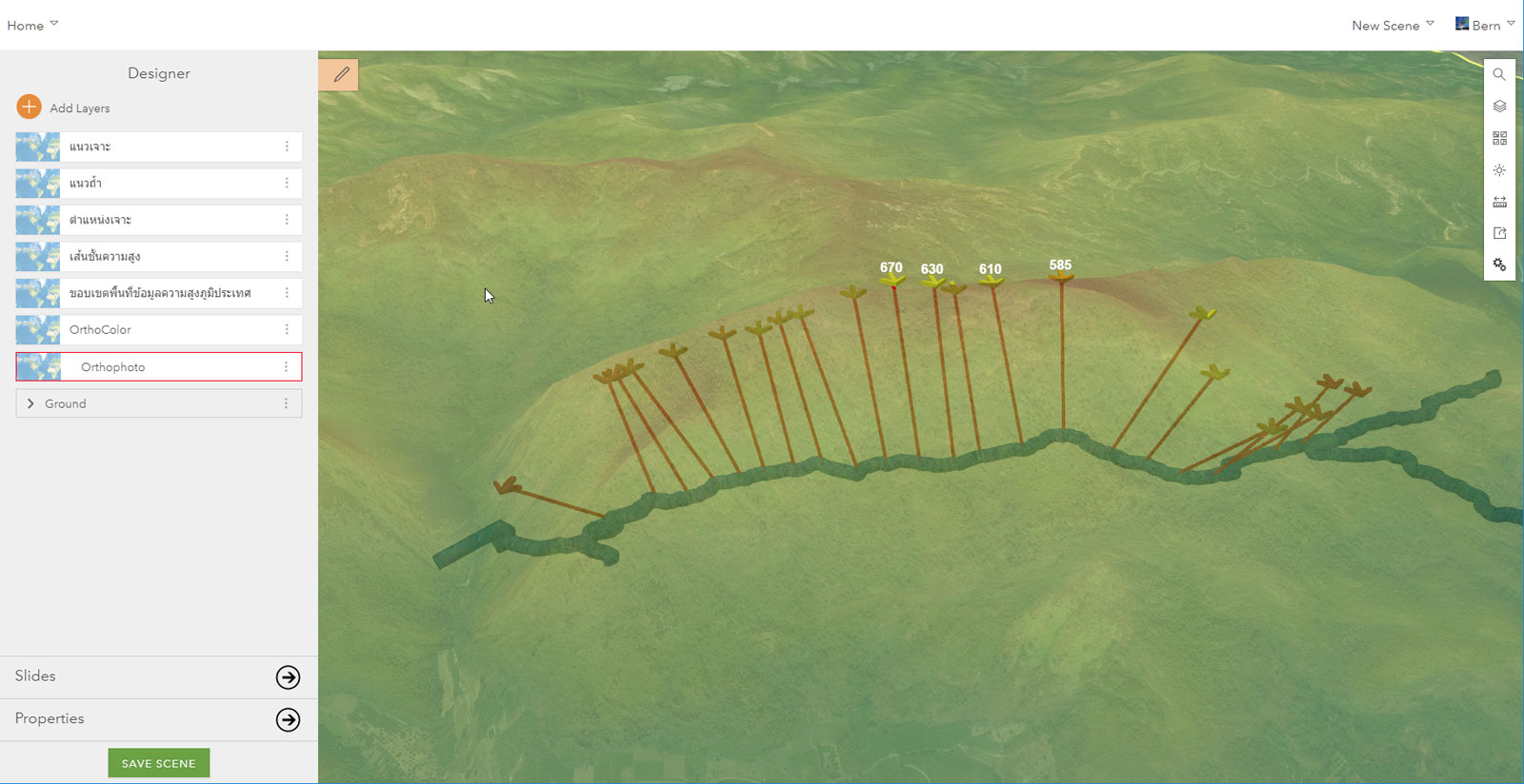
Another scene showing cross sections across the mountain range with elevations, and the cave (in black) beneath the surface.

Above is a map showing the cave with elevations, catchment areas, and rain intensity during one of the storm episodes.

Maps were used to show the results of resistivity surveys which were performed in various areas to pinpoint where cave passages were located underground. The survey was completed by the Royal Irrigation Department ground team, and interpreted by Department of Mineral Resources experts. The diagram above shows the survey results in combination with the cave lineplot and topographic maps. The resistivity model shows water-filled passages in dark blue, coinciding with modeled cave passages at 460-480 meters elevation.
All data courtesy Esri Thailand.
You must be a registered user to add a comment. If you've already registered, sign in. Otherwise, register and sign in.