- Home
- :
- All Communities
- :
- ArcGIS Topics
- :
- GIS Life
- :
- GIS Life Blog
- :
- Processing High-Resolution Optical Imagery
Processing High-Resolution Optical Imagery
- Subscribe to RSS Feed
- Mark as New
- Mark as Read
- Bookmark
- Subscribe
- Printer Friendly Page
In operation, people very commonly think that today powerful computers would help imagery specialists effectively to perform automation of color-balancing and spatial rectification for imagery processing (i.e., without intensively human involvements).
Obviously, it is wrong impression, Including the use of GPUs-based supercomputing workstation, or multi-core /processor CPU-based server machines (over load-balancing cluster or Cloud infrastructure)...
In fact, imagery specialists are still facing challenges ‘effectively and accurately’ to process high-resolution (0.31-2.5 m) optical imagery for larger coverage (from hundreds of thousands to millions KM2), which is critical to support operations and many applications (# 1 below).
From frontline experiences, in addition to technical challenges, there is major barrier to tell people the limitations of current computer solutions with any latest imagery-processing-related algorithms, no matter how powerful those solution packagess are…
Certainly, massively 'manual' adjustment in color and spatial accuracy are highly required, to meet high-standard operation requirements like features' enhancement in mosaic, in addition to color-balanced requirement (#2 & 3 below).
Due to spectral variations, there are still some issues like seamlines in some areas (# 4 below).
 |
|---|
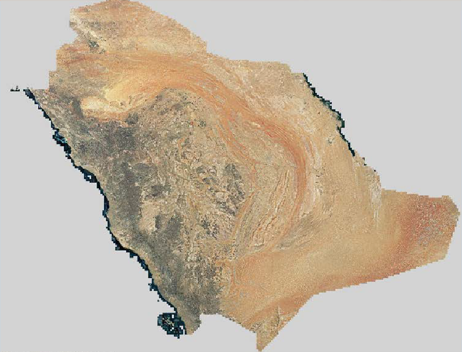
1. High resolution (0.5-m) satellite imagery mosaic covering the area of over-2-million KM2, which is well-balanced in color and spatially rectified |
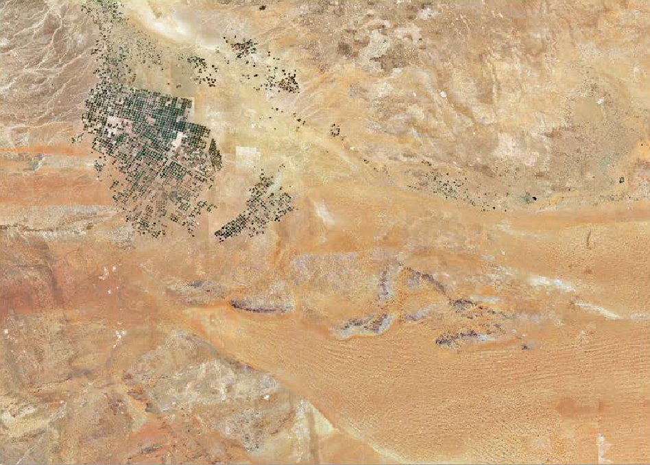 |
| 2. Overall, visible and near-infra remote sensing technology can be perfectly applied to the areas with limited variations to the landscape, which allows for nice color balancing in the entire region |
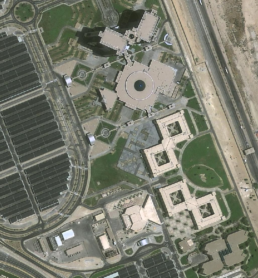 |
| 3. High-level and clear features for feature extraction, mapping, and cartography in well-balanced color mosaic |
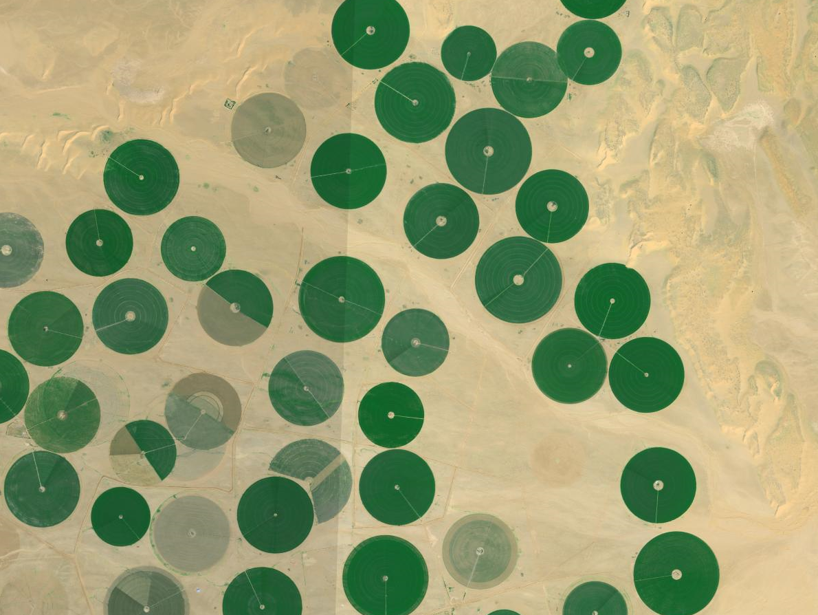 |
| 4. However, some seamlines are still visible among scenes in some areas (around 3-5% of scenes) , due to 'huge' spectral differences, including atmospheric conditions |
You must be a registered user to add a comment. If you've already registered, sign in. Otherwise, register and sign in.