- Home
- :
- All Communities
- :
- ArcGIS Topics
- :
- GIS Life
- :
- GIS Life Blog
- :
- Mostly Mapping Map of the Day - August 19, 2014
Mostly Mapping Map of the Day - August 19, 2014
- Subscribe to RSS Feed
- Mark as New
- Mark as Read
- Bookmark
- Subscribe
- Printer Friendly Page
Earlier this week the World Health Organization announced that the Ebola outbreak in West Africa has claimed more than 1,200 lives. The outbreak began last December, originating in Guinea and subsequently spreading to Liberia, Sierra Leone, and Nigeria. Threats that the spread could escalate increased as a holding facility in the West Point slum of Monrovia, Liberia, was ransacked, with patients fleeing and looters removing items stained with blood, vomit, and excrement—potentially spreading the disease further.
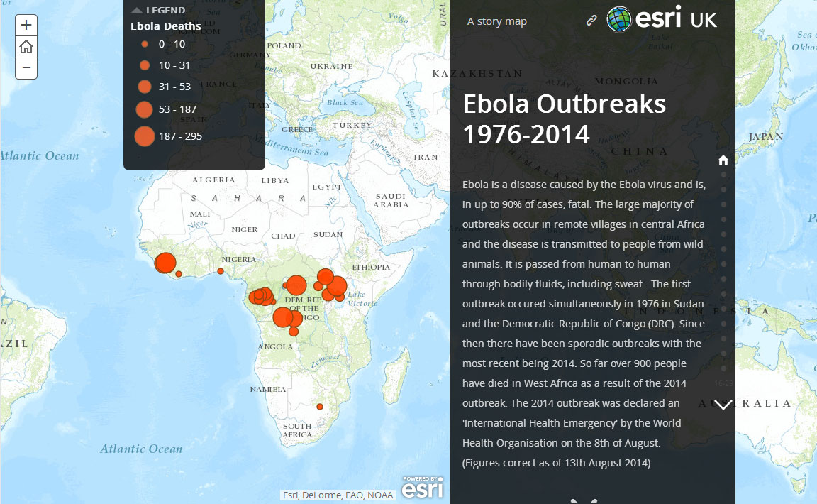
This of course is not the first outbreak of the disease, though it has the highest number of human cases by far. According to the Centers for Disease Control and Prevention (CDC) website the previously recorded high was 425 cases, reported during the 2000-2001 outbreak in Uganda.
Chronicling the outbreaks since 1976 is this Story Map from Esri UK. It uses a combination of maps, reports, and photos to add context to the timeline, and was authored using the Story Map Journal. This timely, informative, and sobering story makes it our Mostly Mapping map of the day.
You must be a registered user to add a comment. If you've already registered, sign in. Otherwise, register and sign in.