GIS Life Blog - Page 2

cancel
Showing results for 
Show  only  | Search instead for 
Did you mean: 

Latest Activity

(451 Posts)
by Anonymous User
Not applicable

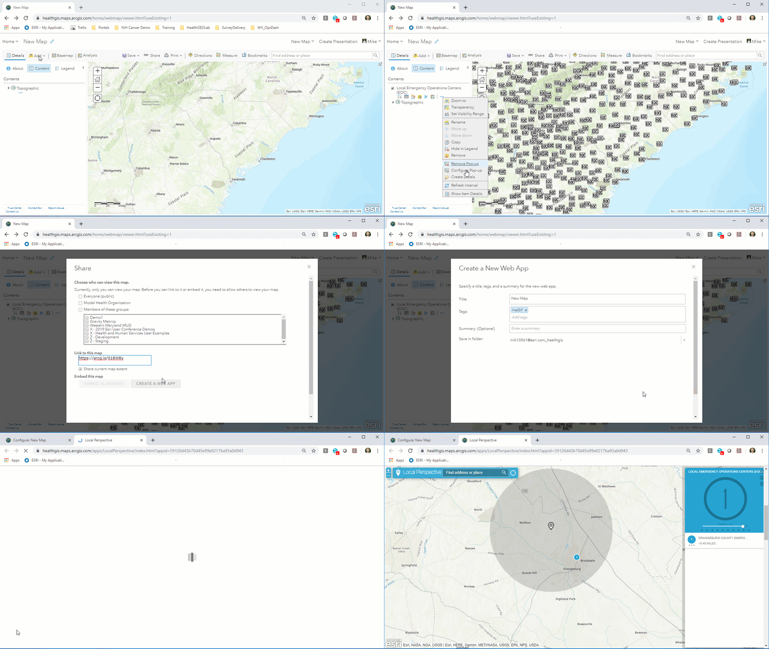
Where is the nearest early voting site by my house? Where is the nearest pharmacy to this clinic? Where is the nearest Pho restaurant by my dog's hair stylist? These are all questions that your community needs answered. Luckily in just 45 seconds, you can build an application that empowers the community to find the answer on their own, and looks 100% awesome on mobile. 

Rapidly create an application using pre-configured app templates. Just share the map as an app!

Using ArcGIS Configurable Apps, users can rapidly create applications for both browsers and mobile devices.

This is accomplished with the suite of ready-to-use app templates in ArcGIS Online. Just add points to a web map, save it, then share with an app template! It is really that simple: no development, no design. Just minor configurations that can be done in seconds.

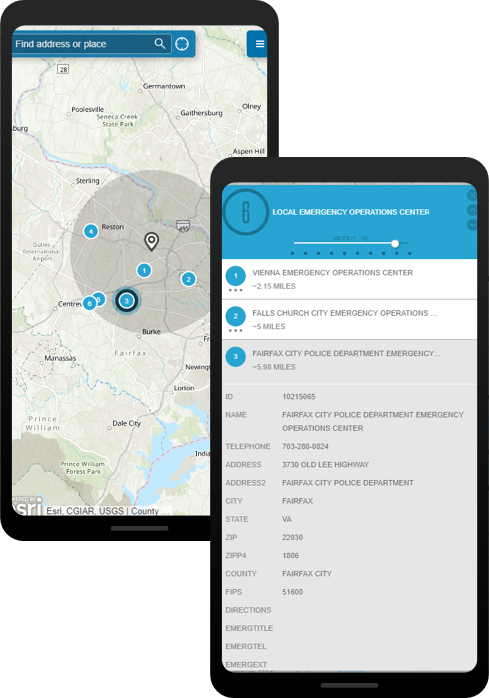
App templates look great on mobile too!

Looks and performs great on mobile devices

In this example, I'm using some Emergency Operations Centers from the Living Atlas; a massive library of geospatial content. However, this could just as easily be your organization's point layer of pharmacies, voting sites, homeless shelters, mobile clinics, drop off sites--anything your community needs to find! 

About In a GIF:

Every Friday, I take a few seconds of my day to demonstrate a cool feature of the ArcGIS platform, and share it with you all! The goal is to show how easy it is to create incredible products using tools available in the Esri environment.

We've all seen "look how easy this tool is to use" demos before, using curated data and copy-pasta code. So, to truly demonstrate going from zero-to-hero, In a GIF follows three simple rules:

 In a GIF Rules:

1) The .gif must be less than 45 seconds.

2) No cutting time from the .gif

3) No pre-prepared code allowed.

more
1 0 953
by Anonymous User
Not applicable

Blurry. Fuzzy. Non-clicky. Out of date. These are all of the qualities of the peach that I left in the fridge over the weekend at the Esri DC office. They are also the qualities of that screen-grab of an Excel chart you've just embedded on the front page of your website or StoryMap.

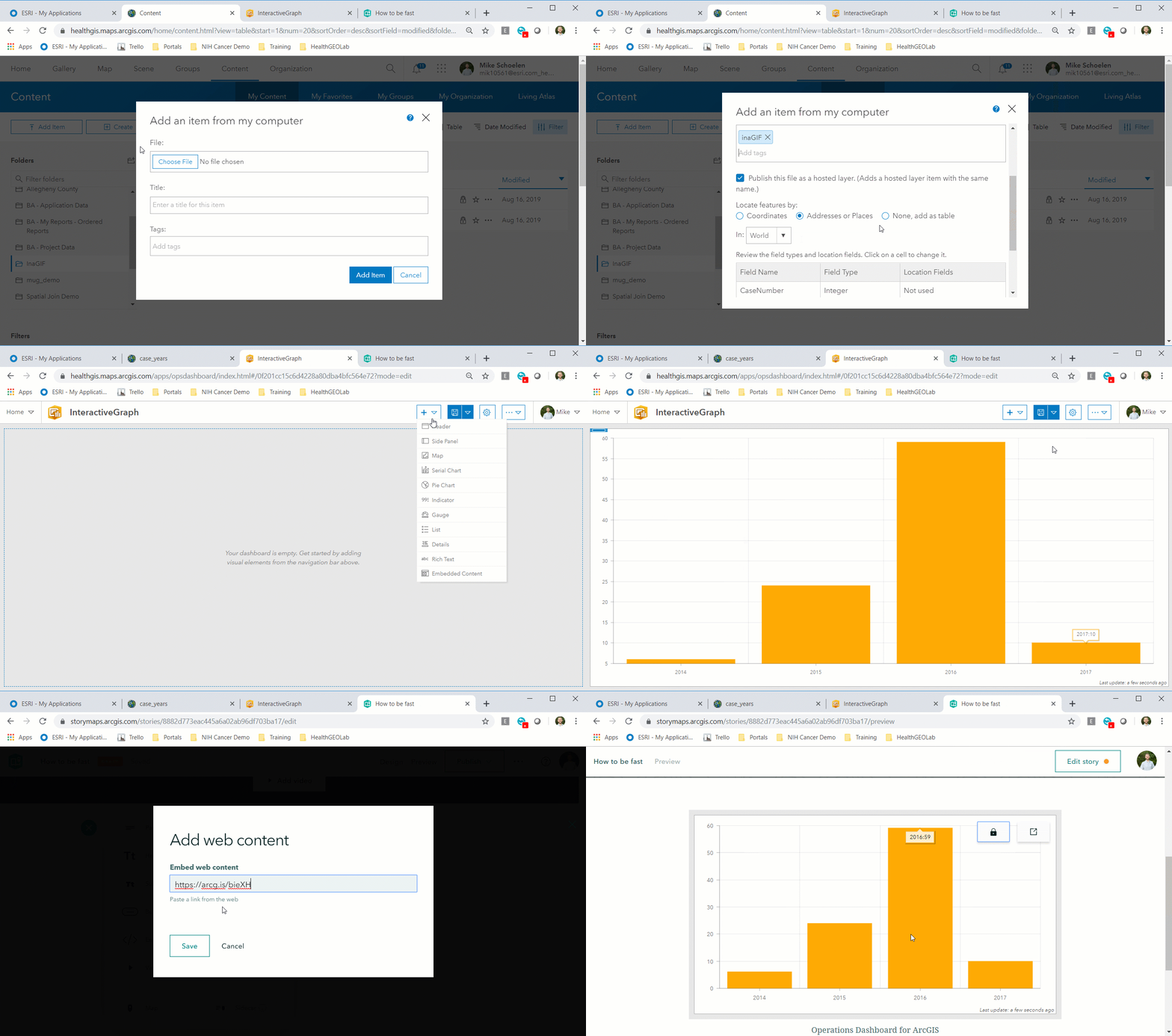
In just 45 seconds (yes, this one went a little longer because I wanted to show the final product), you can create an interactive graph that can be embedded directly into your website. As your data updates, so will the chart! This is accomplished by adding your CSV to ArcGIS Online as a hosted layer. Then, pull the hosted layer into Operations Dashboard via the Serial Chart widget, save it, share it, and embed! 

Operations Dashboard can be used to create an embeddable chart.

Did you know: Operations Dashboard is already included with your ArcGIS Online account. Just click the app launcher in your organization's home page.

Here is a sample of the CSV being pulled into ArcGIS Online. This could just have easily been a feature class!

CaseNumberYear
12014
22014
72015
82015
92015
402016
412016
422016

About In a GIF:

Every Friday, I take a few seconds of my day to demonstrate a cool feature of the ArcGIS platform, and share it with you all! The goal is to show how easy it is to create incredible products using tools available in the Esri environment.


We've all seen "look how easy this tool is to use" demos before, using curated data and copy-pasta code. So, to truly demonstrate going from zero-to-hero, In a GIF follows three simple rules:


 In a GIF Rules:

1) The .gif must be less than 45 seconds.

2) No cutting time from the .gif

3) No pre-prepared code allowed.

more
2 0 622
by Anonymous User
Not applicable

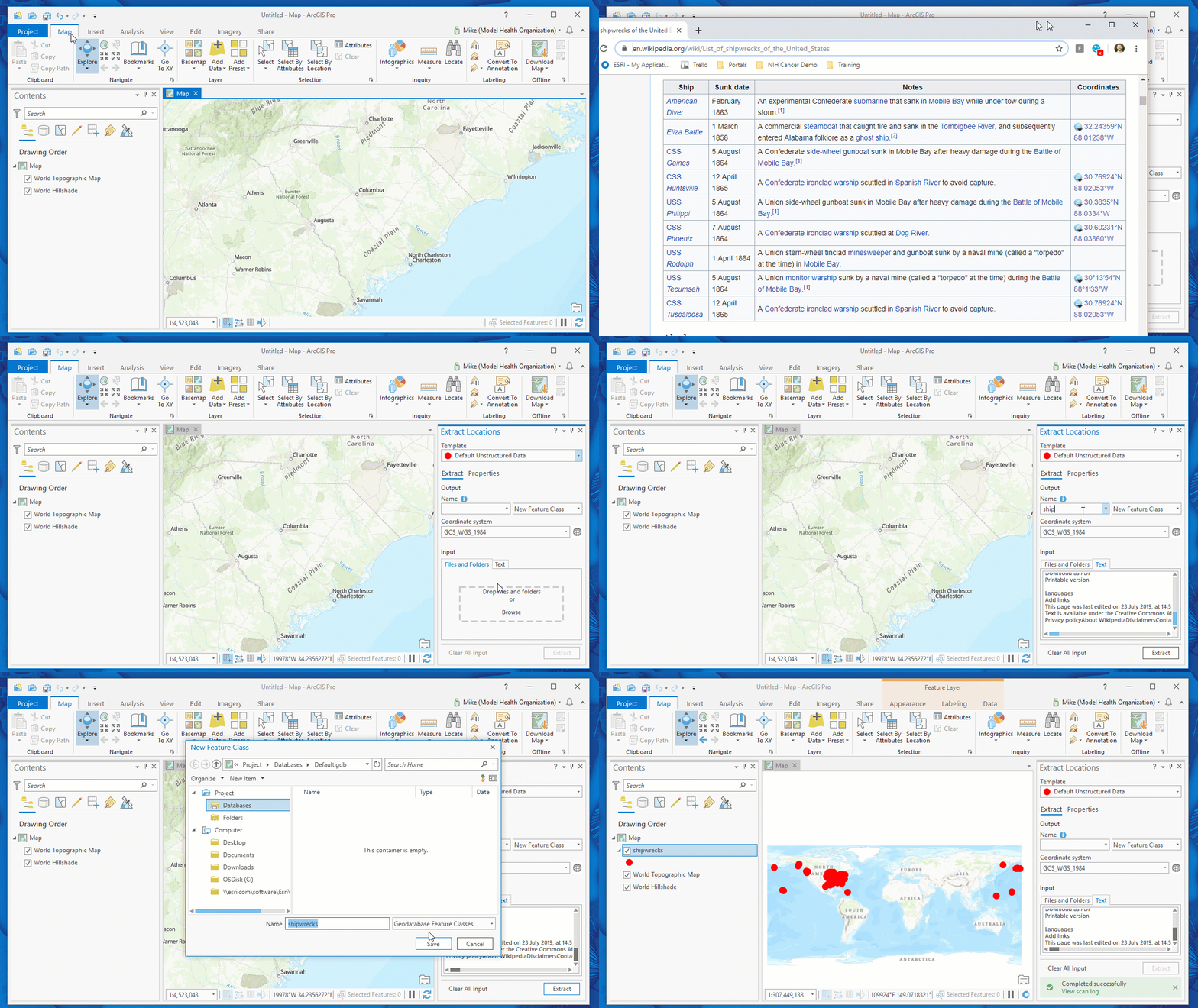
This week's .gif features LocateXT, a powerful text extraction tool accessible in ArcGIS Pro. This extension can be used to plot coordinates and placenames, extract attributes, and rapidly iterate through massive folders of documents. For more information, visit the product page.

LocateXT extracts the coordinates of every shipwreck in a wikipedia article and plots them on a map.

LocateXT can rapidly discover geodata in unstructured text, then convert it to points on a map.

Shout-out to Maren John for inspiring this application of pulling from a source like Wikipedia!

About In a GIF:

Every Friday, I take a few seconds of my day to demonstrate a cool feature of the ArcGIS platform, and share it with you all! The goal is to show how easy it is to create incredible products using tools available in the Esri environment.

We've all seen "look how easy this tool is to use" demos before, using curated data and copy-pasta code. So, to truly demonstrate going from zero-to-hero, In a GIF follows three simple rules:

 In a GIF Rules:

1) The .gif must be less than 45 seconds.

2) No cutting time from the .gif

3) No pre-prepared code allowed.

more
11 3 2,444
76 Subscribers