- Home
- :
- All Communities
- :
- Products
- :
- Data Management
- :
- Geodatabase Questions
- :
- Re: Topology Error 138
- Subscribe to RSS Feed
- Mark Topic as New
- Mark Topic as Read
- Float this Topic for Current User
- Bookmark
- Subscribe
- Mute
- Printer Friendly Page
- Mark as New
- Bookmark
- Subscribe
- Mute
- Subscribe to RSS Feed
- Permalink
Hey everybody!
I tried to create a topology for two line features and use the "Must Not Intersect With" rule. Once I create the topology and try to validate it, I receive the following error.
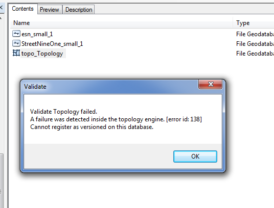
Anybody came across this yet and figured out how to solve it?
Thanks,
Tim
Solved! Go to Solution.
Accepted Solutions
- Mark as New
- Bookmark
- Subscribe
- Mute
- Subscribe to RSS Feed
- Permalink
You could write a script to change the current extent and then use Validate Topology—Help | ArcGIS Desktop
grab the full extent X/y, then break it into four extents. Zoom. Run the topology on current extent, move to next, etc.
- Mark as New
- Bookmark
- Subscribe
- Mute
- Subscribe to RSS Feed
- Permalink
I'm not sure that this will help, but there was another (not checked as resolved) thread https://community.esri.com/thread/164974
that at suggested trying a smaller geographic extent...have you tried that? Also, make sure they are in the same coordinate/reference system and extent.
I knwo now back in the 9.4 (turned into 10.1) days, we could not validate our topology no matter how we "broke it down", but I don't remember if gave a code or just crashed. That did have to do with the size of the data OR possibly the extent east/west (over the 180), even if we weren't validating over the line. We could do about 95% (different extents, different order, etc.) but the last portion would not work. That was fixed before the 10.1 release. We were using ArcSDE SQL.
Are te you using Enterprise SDE or a a fgdb or personal? Maybe you are hitting a limit? I think topology checking produces a lot of data behind the scenes.
- Mark as New
- Bookmark
- Subscribe
- Mute
- Subscribe to RSS Feed
- Permalink
Yes, I saw this discussion, but I hoped I wouldn't have to do the validation in smaller pieces.
I am using a fgdb for my topology.
- Mark as New
- Bookmark
- Subscribe
- Mute
- Subscribe to RSS Feed
- Permalink
You could write a script to change the current extent and then use Validate Topology—Help | ArcGIS Desktop
grab the full extent X/y, then break it into four extents. Zoom. Run the topology on current extent, move to next, etc.
- Mark as New
- Bookmark
- Subscribe
- Mute
- Subscribe to RSS Feed
- Permalink
This might be the only way. Thanks!